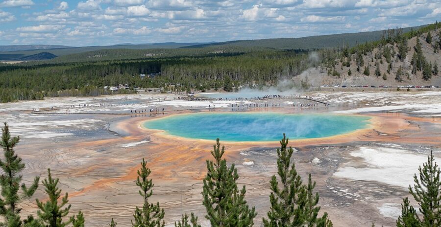
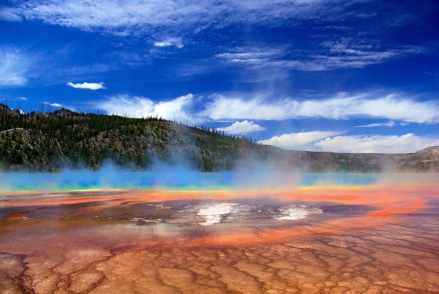
Grand Prismatic Spring looks its best from a hillside 105 feet (32 m) above it, on a warm, breezy afternoon when the steam blows sideways off the water. From the boardwalk at its edge you see a wall of vapor and an orange rim. From the overlook you see the whole thing: the blue eye, the yellow and orange rings, the runoff channels braided across the white ground.
That move, from the edge to the hill, is most of what photographing Yellowstone asks of you. Nearly every famous subject has a place where it works and a place where it doesn’t, and the difference is the direction you face and the hour you turn up. The Lower Falls are a morning subject, the northern valleys belong to the first and last hour, and Old Faithful runs on a clock the park publishes.
Contents12 parts
- The layout, and which way you face
- Grand Prismatic Spring and Midway Geyser Basin
- Old Faithful and the Upper Geyser Basin
- Firehole Lake Drive and Great Fountain Geyser
- Norris Geyser Basin
- Mammoth Hot Springs terraces
- The Grand Canyon of the Yellowstone, rim by rim
- Wildlife at dawn and dusk
- Yellowstone Lake, West Thumb and Tower Fall
- Seasons: what the calendar does to the pictures
- The rules that shape the shot
- Where to base yourself and how long to stay
The layout, and which way you face
The Grand Loop Road runs as a figure eight through the middle of the park, and nearly every subject below sits on it or a short spur off it. The geyser basins line the west side along the Firehole River. The Grand Canyon of the Yellowstone is in the middle, at Canyon Village. Hayden Valley lies between the canyon and Yellowstone Lake, and Lamar Valley is out in the northeast corner on the road to Cooke City.
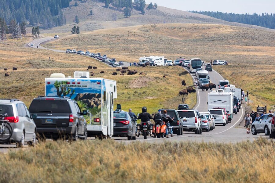
Distances look short on the map and aren’t: pullouts fill, bison walk down the center line, and one photograph becomes forty minutes. I would plan one region per day.
Light is the other planning tool. The canyon viewpoints look west or southwest toward the falls and want the morning sun behind them; the Grand Prismatic overlook looks north-northeast and works from late morning on. The thermal basins add steam, which thickens as the air cools and can swallow a hot spring whole on a cold morning.
Grand Prismatic Spring and Midway Geyser Basin
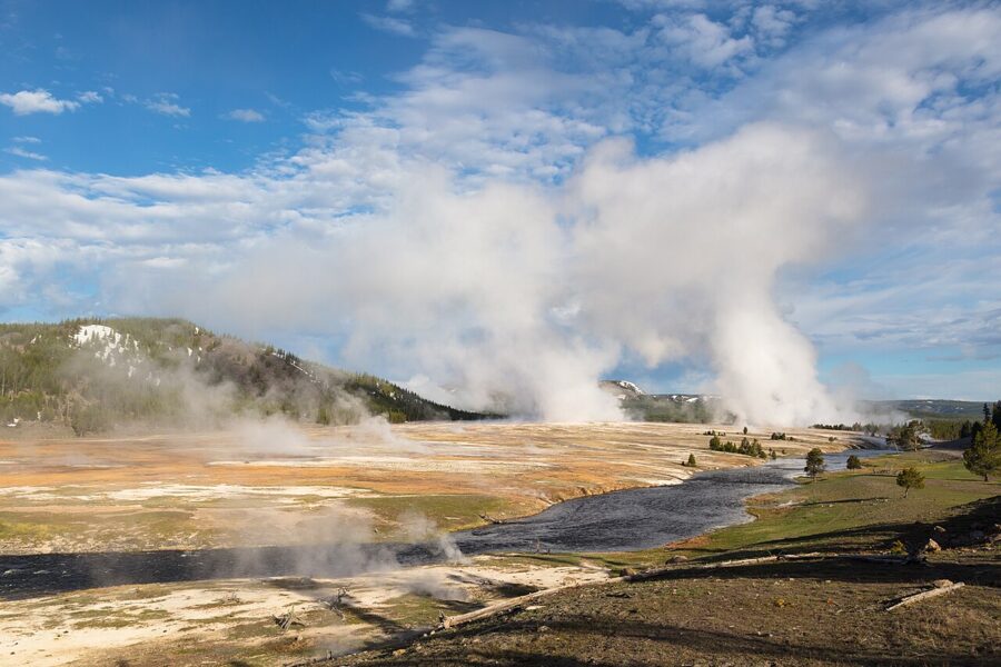
Grand Prismatic is the largest hot spring in the park and more than 121 feet (37 m) deep. The park’s figures for its width disagree: the current listing gives 200 to 330 feet across, older park exhibits about 370. Either way, it is too big to frame from the boardwalk beside it.
The colors are living things: mats of heat-loving microbes grow in bands set by the water temperature as it cools outward from the vent, so the rings run from blue at the center through yellow to orange and brown.
The overlook trail from Fairy Falls Trailhead
Park at the Fairy Falls Trailhead, 1 mile (1.6 km) south of the Midway Geyser Basin lot, and follow the trail along the Firehole River. The park describes the walk to the overlook as a gradual 0.6-mile climb of 105 feet, 1.2 miles round trip, and warns that parking at the trailhead is very limited. The trail and platform date from 2017, built after people trampled the hillside for the view; off-trail travel on those hills is now prohibited.
The platform looks down from the south-southwest. I would aim for late morning to mid-afternoon on a sunny day, when the sun is behind you or overhead and the air has warmed enough to thin the steam. A polarizer cuts the glare and deepens the blue, but turn it slowly: at full strength the orange rim looks painted. Around 24 mm takes in the spring and its runoff; a short telephoto picks out the channels.
Wind decides the rest. A light breeze from the south or west pushes the steam away from you and off the water; on a still, cold morning the spring is often nothing but a white cloud.
The boardwalk loop
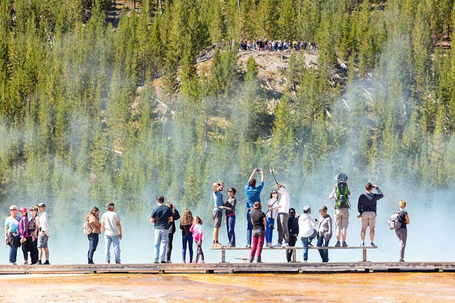
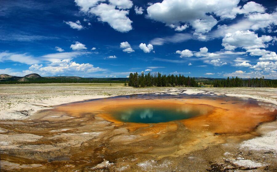
The Midway Geyser Basin boardwalk crosses the Firehole River and climbs past the steaming crater of Excelsior Geyser before it reaches the edge of Grand Prismatic. From the edge you photograph texture rather than the whole spring: the terraced orange mats, the runoff spilling into the river, the bright blue of Turquoise Pool and Opal Pool along the same loop.
Parking is the hard part: the Midway lot is small, and the park advises visiting busy areas early or late in summer. Do the overlook in the afternoon and the boardwalk in the evening, when the lot empties and low light rakes across the mats.
Old Faithful and the Upper Geyser Basin
Old Faithful has never erupted on the hour, whatever the postcards say. The park lists its interval as 94 or 68 minutes, depending on the length of the previous eruption, with a margin of plus or minus ten minutes. Eruptions last 1.5 to 5 minutes and reach 106 to 184 feet (30 to 55 m).
Reading the predictions
Rangers post predictions for six geysers, and you can find them on the free NPS app and on the park’s recorded phone line. These are the park’s published averages and margins:
| Geyser | Average interval | Margin |
|---|---|---|
| Old Faithful | 94 or 68 minutes | ±10 minutes |
| Castle | 13 hours 30 minutes | ±45 minutes |
| Daisy | 2 hours 45 minutes | ±30 minutes (longer if windy) |
| Grand | 6 hours 30 minutes | ±60 minutes |
| Riverside | 6 hours 30 minutes | ±30 minutes |
| Great Fountain | 11 hours 30 minutes | ±2 hours |
One catch for shoulder-season trips: predictions stop when the Old Faithful Visitor Education Center closes, typically early November to mid-December and mid-March to mid-April.
Where to stand for Old Faithful
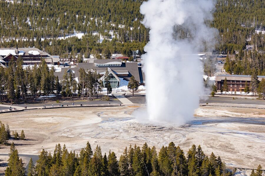
The benches arc around the south and east sides of the geyser, in front of the visitor center. For a sunset eruption, the east end of the arc puts the low sun behind the plume and turns the steam into a backlit cloud. Arrive twenty minutes before the window and pick your bench by where the sun will be, not where the crowd is.
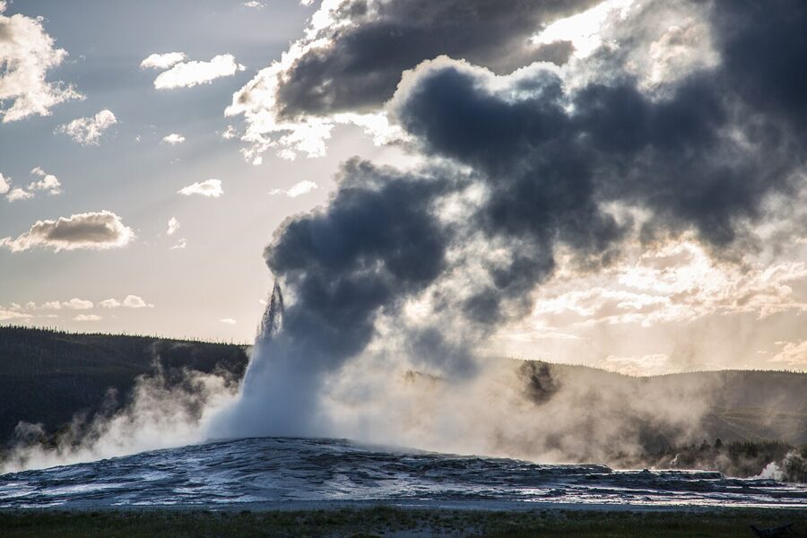
For the view most people never take, cross the Firehole River on the Geyser Hill boardwalk and climb the short, steep trail to Observation Point. It sits northeast of the geyser, so you look southwest over the plume to the Old Faithful Inn and the forest behind. Morning is the time: the sun comes from behind you and lights the front of the column.
Morning Glory Pool, Grand and Castle
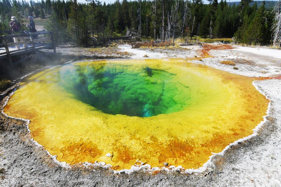
Keep walking north along the Firehole and the crowd thins with every geyser you pass. Castle Geyser rises from the massive sinter cone that gave it its name; Grand Geyser, another of the six predicted geysers, erupts in a series of bursts rather than one steady column. Morning Glory Pool marks the far end of the trail. Its colors have shifted over the decades as people threw coins and rubbish into it, which cooled the vent and let the orange bacteria creep inward.
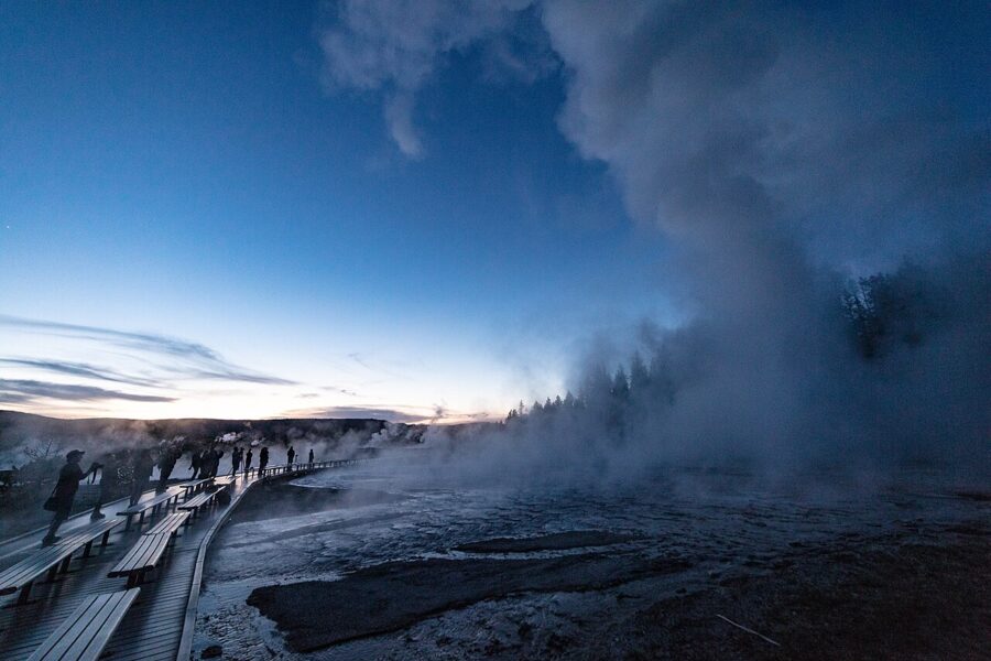
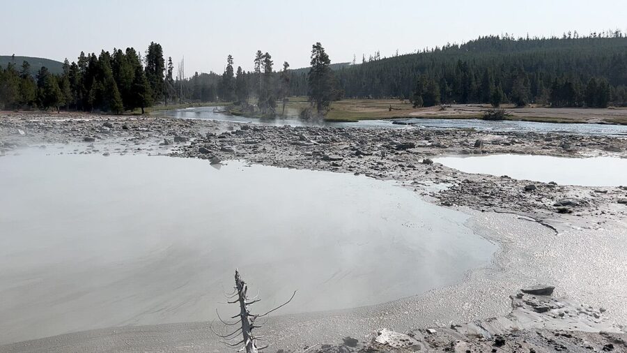
Biscuit Basin, the next stop north on the main road, has been closed since a hydrothermal explosion blew out part of the boardwalk there on July 23, 2024. As of the park’s July 2026 update the closure remains in place because the activity is still unpredictable, so check before you plan around the Mystic Falls Trail that starts there.
Firehole Lake Drive and Great Fountain Geyser
The park’s own advice for sunset is Firehole Lake Drive and the Fountain Paint Pot boardwalks, and I agree. Firehole Lake Drive is a one-way loop of about three miles off the Grand Loop Road, north of Midway, and Great Fountain Geyser sits close to the road with an open western sky behind it.
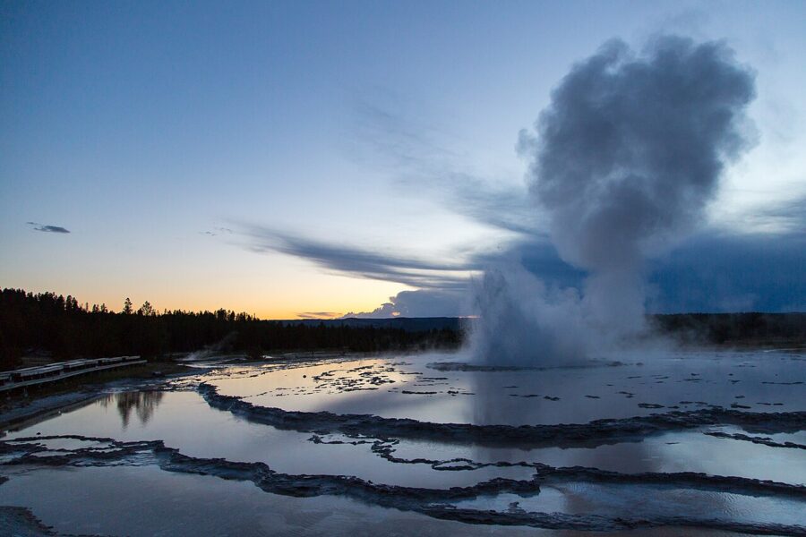
Great Fountain is the gamble. Its prediction window is plus or minus two hours, so you may sit through the whole golden hour and see nothing but the sunset in its flooded terraces. If the timing lines up, it is the best geyser photograph in the park.
Fountain Paint Pot, on the main road near where the drive rejoins it, gives you mud pots, fumaroles and Clepsydra Geyser on a short boardwalk loop. It’s a good fallback when Great Fountain isn’t due until after dark.
Norris Geyser Basin
Norris is the hottest and most changeable thermal area in the park, and it photographs differently from the Firehole basins. Porcelain Basin, the open bowl below the museum, is milky white and pale blue, with runoff channels stained orange and green. On a cool morning it fills with steam, and the low sun from the east shines through it.
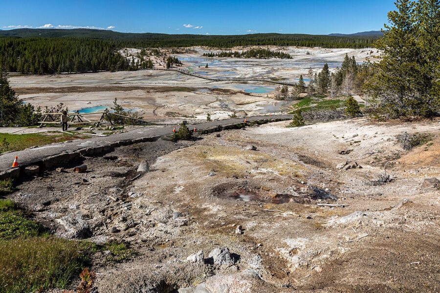
Steamboat Geyser, in the Back Basin, is the tallest active geyser in the world but keeps no schedule worth planning around. Treat a major eruption as luck.
Mammoth Hot Springs terraces
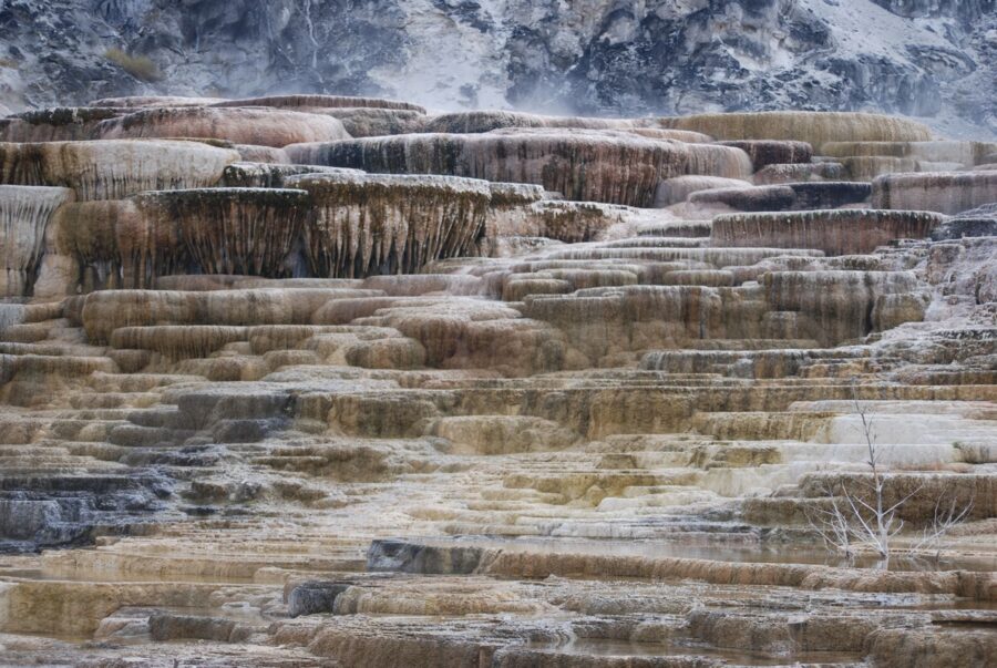
Mammoth is built from a different stone. Its terraces are travertine, calcium carbonate laid down by water that has passed through limestone, where the geyser basins farther south are made of silica sinter. The shapes change from year to year as springs switch on and off; Canary Spring, the brightest of them, owes its yellow to sulfur-loving filamentous bacteria and sometimes goes dormant for a while.
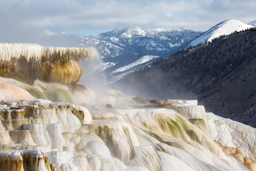
The terraces face east, down toward the village, so they take the morning sun. The Lower Terraces boardwalk climbs the hillside with stairs; the Upper Terrace area has its own parking and boardwalks with views of Canary Spring from above. In the park’s words, both the top of Canary Spring and Palette Spring can be reached by wheelchair when there’s no snow on the ground.
Mammoth’s other subject is elk, which graze the lawns around the old Fort Yellowstone buildings. The park warns that cow elk are especially protective of their calves from May to early July.
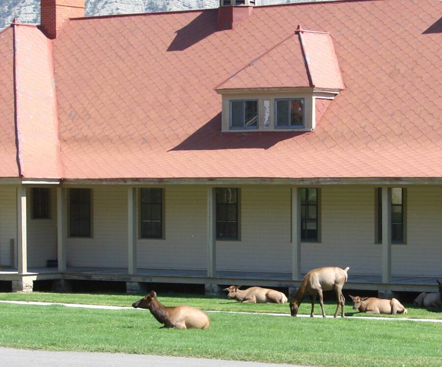
The Grand Canyon of the Yellowstone, rim by rim
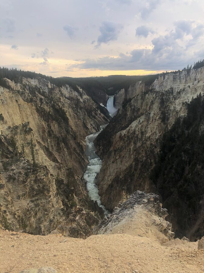
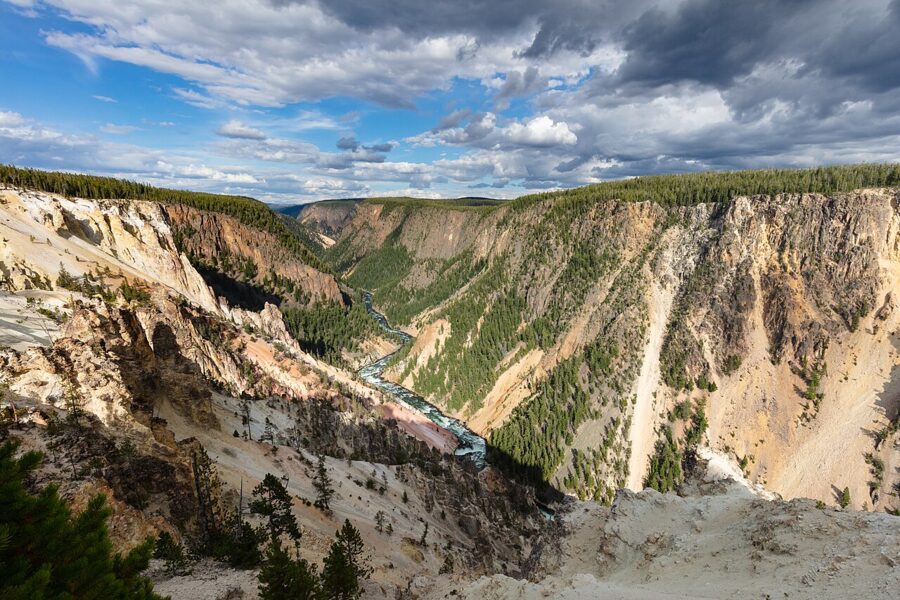
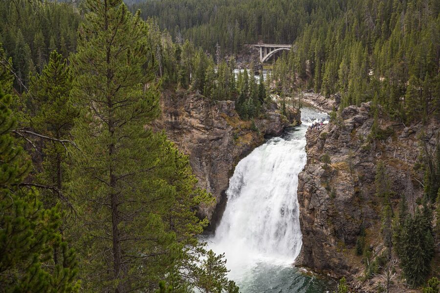
The canyon is about 20 miles (32 km) long, more than 1,000 feet (305 m) deep and between 1,500 and 4,000 feet across. Its walls are rhyolite that hot water altered and oxidized, and the iron in the rock gives the yellows, pinks and rusts. Two falls drop into it: the Upper Falls at 109 feet (33 m) and the Lower Falls at 308 feet (94 m).
Volume changes the picture: the park gives the flow as about 63,500 gallons per second at peak spring runoff, against 5,000 in autumn. June means a white curtain and heavy spray; September shows more of the green notch at the lip.
Almost every viewpoint sits east or northeast of the Lower Falls and looks back west or southwest at them, which makes the canyon a morning subject. With the sun behind you, light falls on the face of the water and the yellow walls; by late afternoon the falls are in shade under a bright sky. Off-trail travel is prohibited throughout the Canyon area.
North Rim: the brink, Lookout, Red Rock, Grand View, Inspiration
North Rim Drive starts about 1.5 miles from Canyon Village and strings together five viewpoints. The Brink of the Lower Falls comes first: a short, steep switchback trail ends on a platform right beside the lip, where you look straight down 308 feet of falling water. A fast shutter freezes the green water as it breaks over the edge.
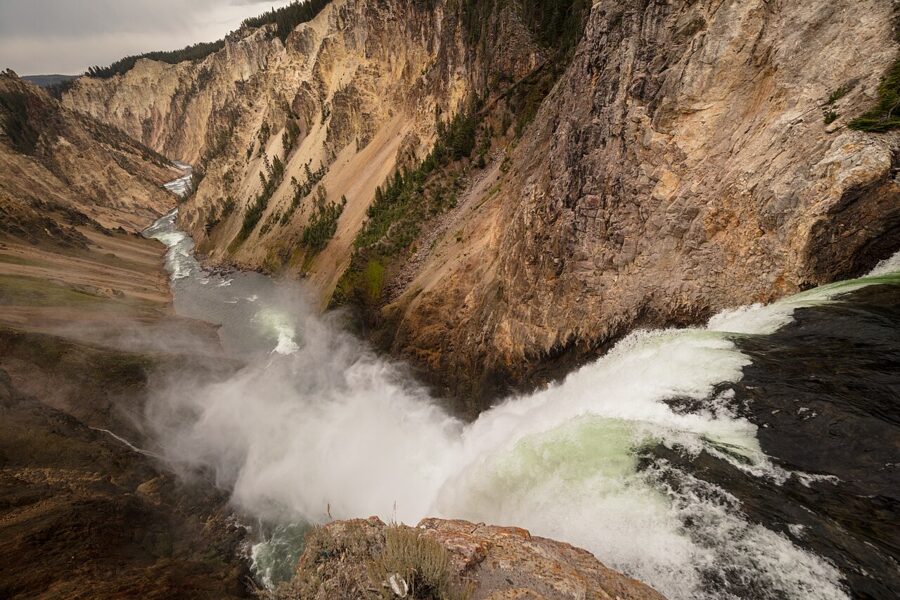
Lookout Point is the classic north-rim angle, with the falls framed by canyon walls on both sides. From the same parking area, a steep trail of switchbacks and stairs drops to Red Rock Point, much closer to the falls and a good deal lower. The climb back up is the price; if you have a 70-200 mm lens, the shot from Lookout already compresses the distance.
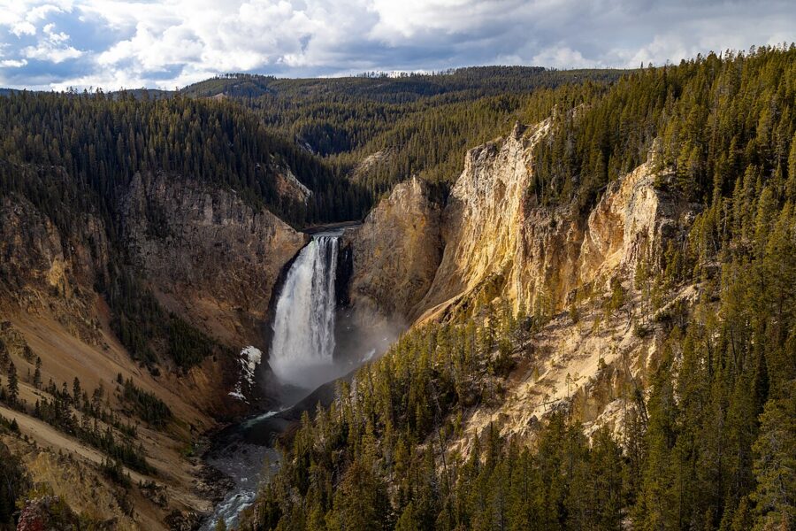
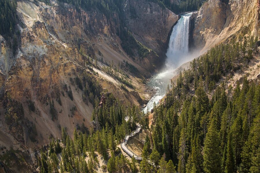
Grand View and Inspiration Point look along the canyon, where the walls are wider and more colorful and the falls shrink to a white stroke. These are the places for long-lens abstracts of the eroded walls. The park lists the rim path between the Lookout and Grand View lots as the longest accessible stretch.
South Rim: Upper Falls Viewpoint and Artist Point
South Rim Drive turns off about 2 miles from Canyon Village. The Upper Falls Viewpoints come first and are the only easy angle on the Upper Falls, which most people drive past. The road ends a mile on at the Artist Point parking area, and a short paved path leads to the overlook, accessible as far as the second viewing area.
Artist Point is the view everyone knows: the Lower Falls straight up the canyon, yellow walls closing in from both sides. It faces west-southwest, so the falls and near wall take direct light in the morning. It is also the most crowded viewpoint on either rim, so I would come at first light, when the canyon floor is still blue and the sun has just reached the top of the walls.
The Artist Point to Point Sublime trail continues east along the rim for those who want the canyon without the railings full. Much of it runs close to the cliff edge, so keep children close.
Wildlife at dawn and dusk
The rules come first because they decide your lens. The park requires you to stay at least 100 yards (91 m) from bears, wolves and cougars, and at least 25 yards (23 m) from every other animal, birds included. It is also illegal to stay near or approach wildlife at any distance that disturbs or displaces it. If an animal moves because of you, you are too close.
Do the arithmetic before you go. A 600 mm lens on a full-frame camera covers a strip about 18 feet (5.5 m) wide at 100 yards, so a grizzly fills roughly a third of the frame at the legal limit. At 25 yards a 400 mm lens covers less than 7 feet, enough for a bison’s head and shoulders. Anything shorter than 300 mm turns wolves into dots.
Bison have injured more people in Yellowstone than any other animal, and they can outrun you. When a bear is near the road, the park says to stay in or beside your car, which doubles as a blind. Use the pullouts; rangers close them when people park on the vegetation or block traffic.
Lamar Valley
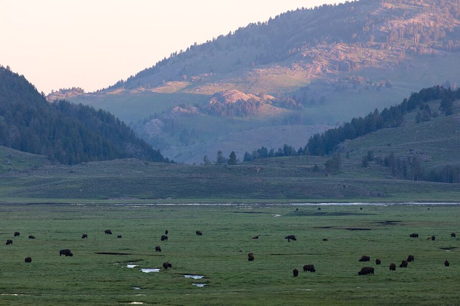
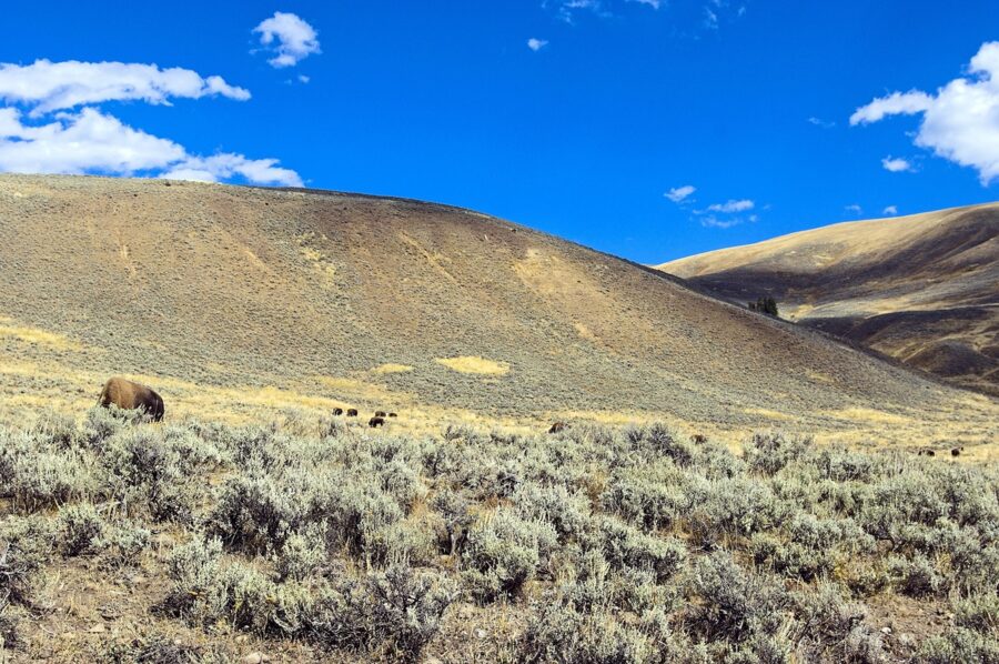
Lamar Valley, in the northeast on the road between Tower-Roosevelt and the Northeast Entrance, holds the most species in the park, wolves and grizzlies included. The valley runs northeast to southwest, which lines it up with the summer sunrise: the first sun skims along the floor and lights the animals from the side. Be there at dawn; by mid-morning the herds have bedded down and heat shimmer softens anything at long range.
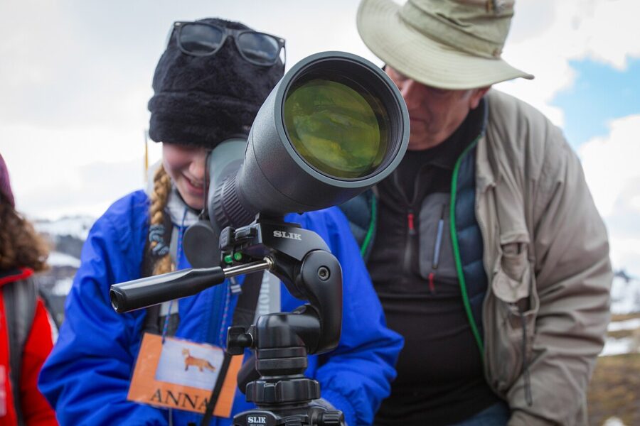
Wolves are usually far off, on a ridge or at a carcass across the river, which is why the regulars carry scopes. A small dark shape on a snowfield tells the story better than a cropped, soft close-up. In late spring the herds fill with rust-colored bison calves, the most cooperative subject in the valley.
Hayden Valley
Hayden Valley sits on the Yellowstone River between Canyon Village and Yellowstone Lake, and it is the easier valley to fit into a day. Bison are almost guaranteed, and their rut in August fills it with bellowing bulls and dust. Grizzly Overlook and the pullouts above the river give you long curves of water even with no animals in sight.
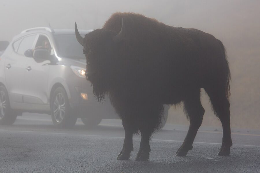
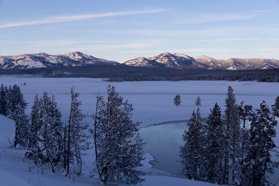
Which valley is better? For wolves and the widest range of animals, Lamar, without much argument. For bison, river scenery and an easy combination with the canyon, Hayden. If you only have one dawn, I would spend it in Lamar.
Yellowstone Lake, West Thumb and Tower Fall
For sunrise over water, the park points to the pullouts along the lake’s western shore, where the sun comes up over open water and the Absaroka Range. On a calm morning the surface goes glassy; wind ruins it fast, so get there before the light.
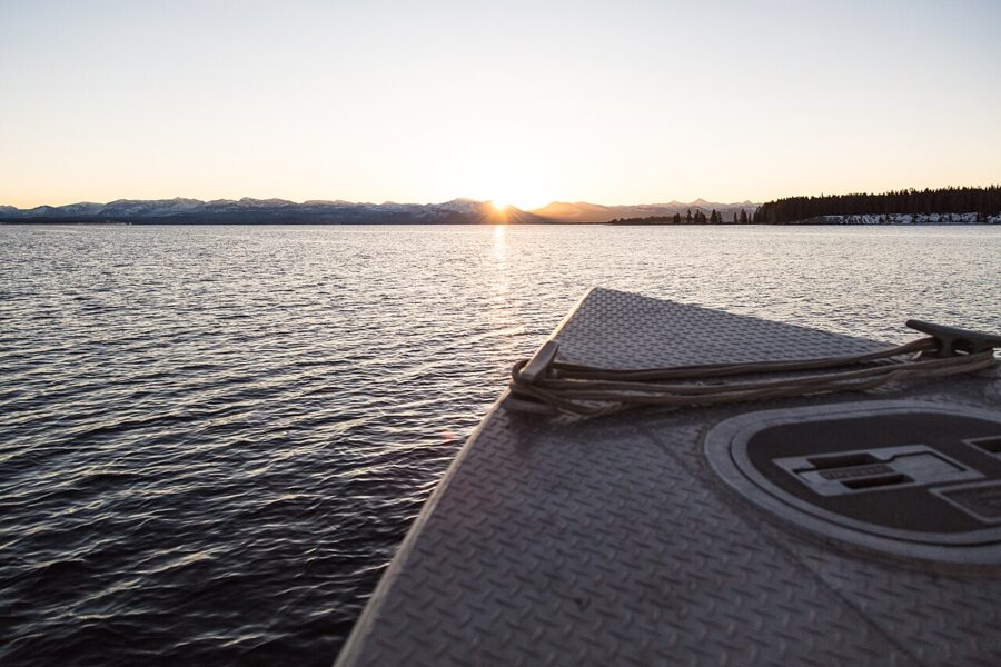
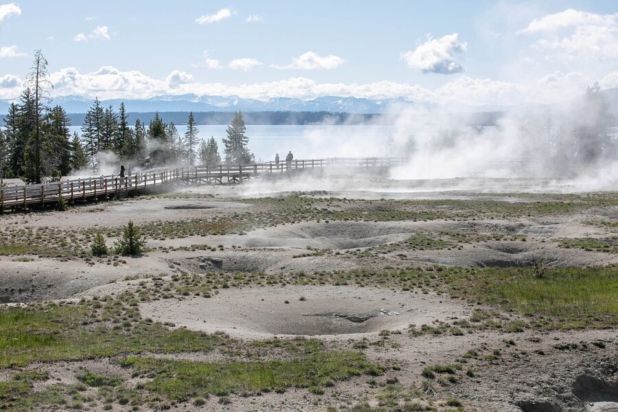
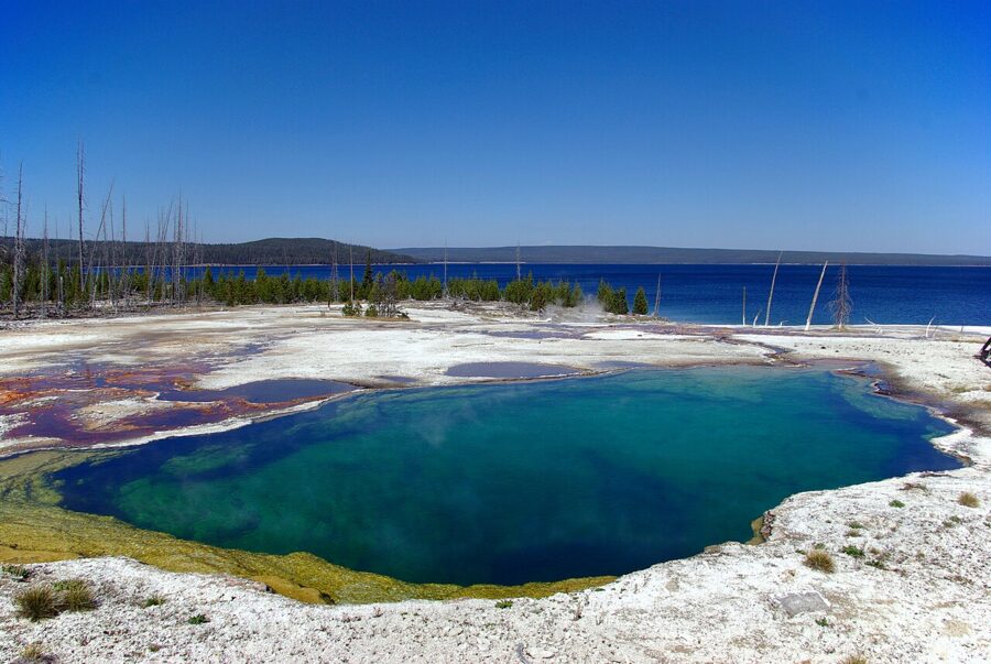
West Thumb Geyser Basin lies on the lakeshore itself, with hot pools a few steps from cold water. The boardwalk loop is short, and the low eastern horizon over the lake makes it a sunrise spot as well. Look for the Fishing Cone just offshore and the deep blue of Abyss Pool.
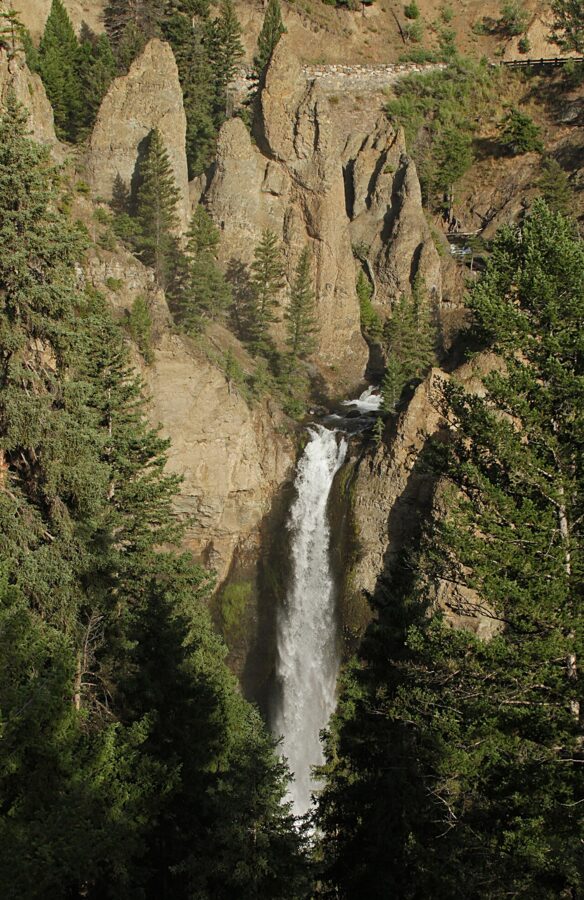
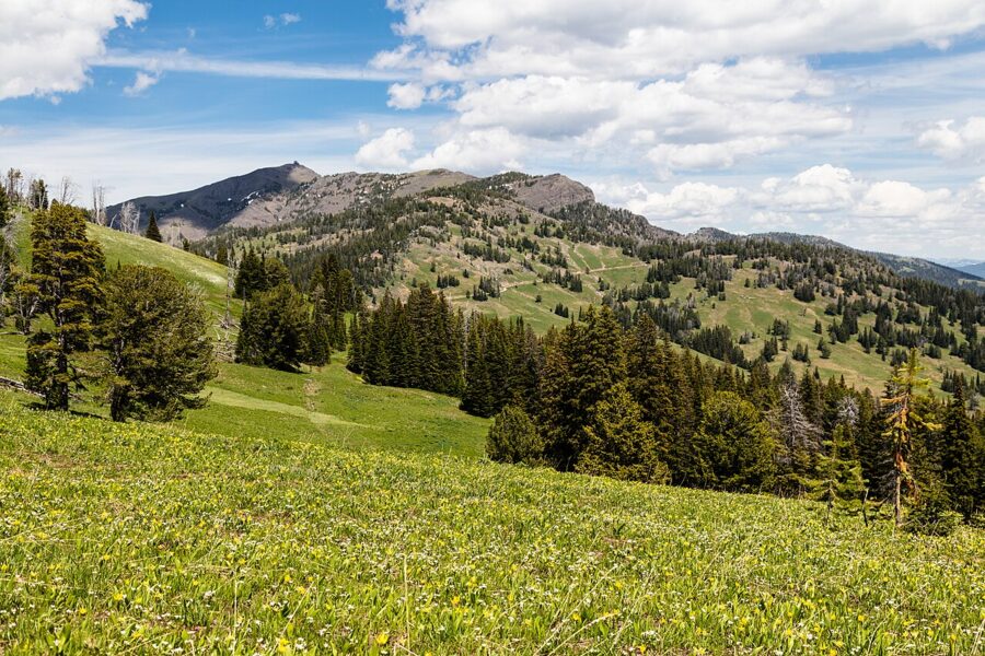
Tower Fall drops 132 feet between pinnacles of volcanic rock just off the road north of Dunraven Pass. The viewpoint is a few minutes from the parking area and looks across at the fall, so a bright overcast day evens out the deep shadow. Over Dunraven Pass, the park recommends July for wildflowers.
Is Dunraven Pass a frightening drive? It is a paved two-lane mountain road with long drops on the outside edge in places. Taken slowly in daylight it is an ordinary mountain pass, and it opens later and closes earlier than any other section of the loop.
Seasons: what the calendar does to the pictures
Road dates come first, because they decide what you can reach. These are the park’s projected dates for 2027 for regular vehicles, all subject to weather:
| Road | Open to cars (2027, projected) |
|---|---|
| North Entrance to Northeast Entrance (Mammoth, Lamar Valley) | All year |
| West Entrance to Madison, Madison to Old Faithful, Madison to Norris, Mammoth to Norris, Norris to Canyon | April 16 to October 31 |
| East Entrance to Fishing Bridge, Canyon to Bridge Bay (Hayden Valley) | May 7 to October 31 |
| South Entrance to West Thumb, West Thumb to Old Faithful, West Thumb to Lake Village, Tower-Roosevelt to Tower Fall | May 14 to October 31 |
| Canyon to Tower Fall (Dunraven Pass) | May 28 to October 11 |
As of late November 2026, every park road except Mammoth to the Northeast Entrance is closed to wheeled vehicles until the oversnow season opens on December 15.
Spring
Spring is wet, muddy and underrated. The falls run fullest in May and June, bison calves appear in the valleys, and the park notes that grizzlies are often seen around Canyon in spring and early summer. The basins steam hard on cold mornings, so save them for midday.
Summer
Summer brings the crowds and the full road network. Work the edges of the day and drive between regions at midday. The park notes the Milky Way is visible from April through October; for night work it suggests a flashlight, a companion and bear spray.
Autumn
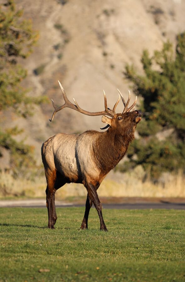
From September the crowds thin and the light softens. The park dates the elk rut from early September to mid-October, with bulls bugling at Mammoth, along the Madison River and in the meadows. Cold mornings bring fog to the rivers and heavy steam to the basins, and the aspens in the northern range turn gold.
The catch is closing dates. For 2027, Lake Yellowstone Hotel’s season runs to October 10 and the Old Faithful Inn’s to October 11; Dunraven Pass is projected to close October 11 and the other interior roads on October 31.
Winter
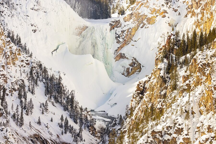
Winter is the season with the strongest pictures and the hardest access. From mid-December to mid-March, the interior roads are open only to snowcoaches and snowmobiles: commercially guided trips, or a permit under the park’s Non-Commercially Guided Snowmobile Access Program. For 2026 to 2027 the park lists oversnow travel from December 15, with the last groomed roads closing between March 7 and March 15.
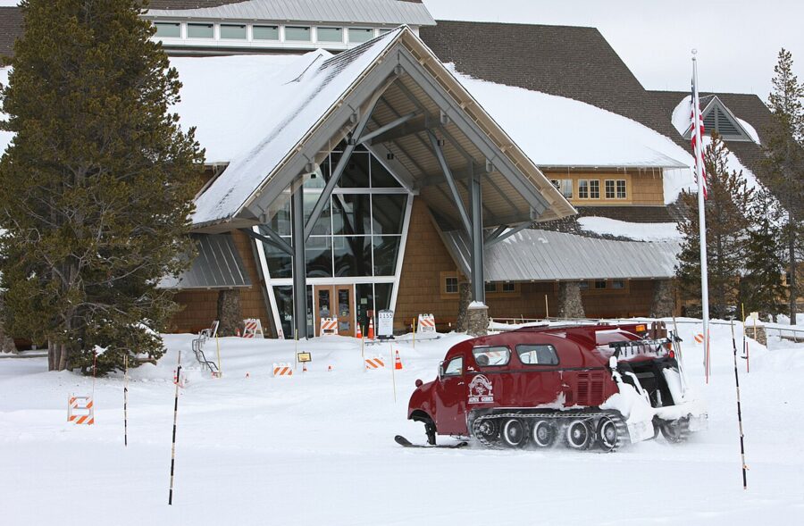
The one road you can drive is the northern one, from Gardiner past Mammoth and through Lamar Valley to Cooke City: terraces, elk and wolves, a strong trip in itself. Daytime temperatures run from zero to 20°F, and sub-zero nights are common.
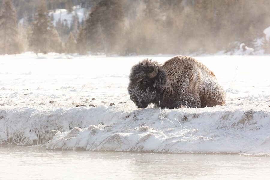
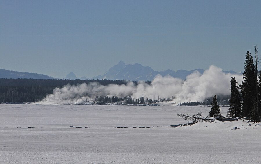
Steam is the main event in winter. It turns eruptions into towering clouds and freezes onto nearby trees, but it hides the colors of the hot springs almost completely. Boardwalks ice over, so the park advises traction aids; keep spare batteries in an inside pocket.
The rules that shape the shot
Stay on the boardwalks and marked trails in every thermal area. The ground beside them can be a thin crust over boiling water, and the park counts more than 20 people who have died from burns after entering or falling into hot springs. Toxic gases can also build up in some basins; if you feel ill, leave.
Tripods are allowed on boardwalks, but the park asks that the legs stay on the boards and leave room for people to pass. Off-trail travel is prohibited at Grand Prismatic, including the hills above it, and in the Canyon area.
Drones are out: the park prohibits the launching, landing or operation of unmanned aircraft anywhere in Yellowstone. Some commercial filming and photography needs a permit.
Entrance fees, as of the park’s fee page updated in June 2026:
- Private vehicle, 7 days: $35
- Motorcycle, 7 days: $30
- On foot or by bicycle, per person aged 16 and over, 7 days: $20
- Yellowstone annual pass (US citizens and residents): $70
- America the Beautiful annual pass: $80 for US residents, $250 for nonresidents
- Non-US residents aged 16 and over also pay a $100 per-person fee on top of the standard entrance fee, unless they enter on an annual or America the Beautiful pass
No vehicle reservation or timed entry is needed to enter Yellowstone.
Where to base yourself and how long to stay
Three full days is the least I would give the park with a camera: one for the geyser basins, one for the canyon and Hayden Valley, one for a Lamar dawn and Mammoth. Five lets you go back where the light failed you the first time.
Where you sleep decides which dawns you can catch:
- Old Faithful: the Old Faithful Inn (2027 season April 30 to October 11) and, in winter, the Old Faithful Snow Lodge (December 16, 2026 to March 7, 2027). The base for the geyser basins and Grand Prismatic.
- Canyon Village: Canyon Lodge (2027 season May 14 to October 31). The canyon at first light, and Hayden Valley a short drive south.
- Lake Village: Lake Yellowstone Hotel (2027 season May 14 to October 10). Sunrise on the lake and Hayden Valley.
- Mammoth Hot Springs: the Mammoth Hot Springs Hotel, open in winter as well. The terraces, the elk and the drive to Lamar.
- West Yellowstone, Gardiner, Cooke City and Silver Gate: the gateway towns. West Yellowstone suits the geyser basins; Gardiner suits Mammoth; Cooke City and Silver Gate put you at the head of Lamar Valley before dawn.
Cell reception is limited across most of the park, so download the NPS app’s offline content, offline maps and a sun calculator for your dates before you arrive.
Then go back to where this started. Walk up to the Grand Prismatic overlook on your first afternoon, look at the direction of the wind and the steam, and decide whether this is the day. If it isn’t, the spring will still be there tomorrow, and the platform faces the same way.