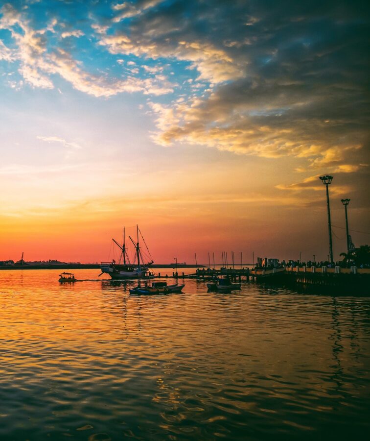
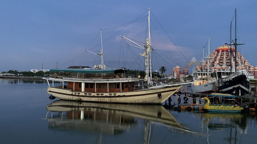
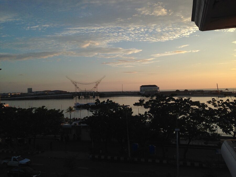
Losari Beach faces west across the Makassar Strait, which is why the evening in Makassar happens on one seawall. From about five o’clock the promenade fills with families, banana-grilling carts and raised phones, and the sun goes down behind a moored schooner or the orange domes of a mosque built on reclaimed land. A kilometer and a half up the same shore stands a fort the kings of Gowa began in 1545, and three kilometers beyond that the old wooden cargo boats still tie up at Paotere.
Most people use Makassar, the capital of South Sulawesi in eastern Indonesia, as an airport on the way to Toraja. I would give the city two days and add a third for the limestone country of Maros, about an hour north, where boats run up a river between karst towers at Rammang-Rammang and a cave wall holds the oldest dated painted scene found anywhere. A week on Sulawesi covers all of that and three or four days in the Toraja highlands.
Contents10 parts
A port city that faced the sea
Makassar grew out of two linked kingdoms, Gowa and Tallo, whose rulers turned their harbor into the great free port of the eastern archipelago in the early 1600s. Gowa’s court took up Islam in 1605. Portuguese, English, Danish and Chinese merchants kept agents here and bought the Moluccan cloves and nutmeg that the Dutch East India Company (VOC) wanted for itself.
The Company’s answer was war. From 1666 a VOC fleet under Cornelis Speelman, allied with the Bugis prince Arung Palakka of Bone, fought Sultan Hasanuddin of Gowa. The Treaty of Bongaya in November 1667 handed the Dutch the fort at Ujung Pandang, and Gowa’s own stronghold of Somba Opu fell in 1669. Hasanuddin is now a national hero, and the airport carries his name.
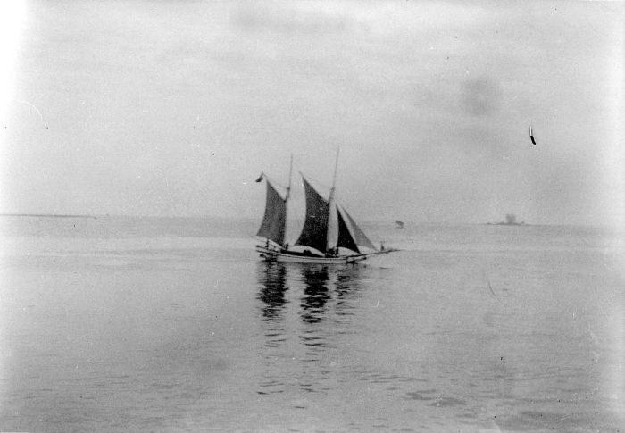
The sailors kept sailing. For well over a century, Makassar’s praus rode the northwest monsoon to Arnhem Land in northern Australia to gather trepang, the sea cucumber sold on to China, and Makassarese words survive in Yolngu languages there today. The last prau left in 1907, after the colonial government stopped issuing licenses.
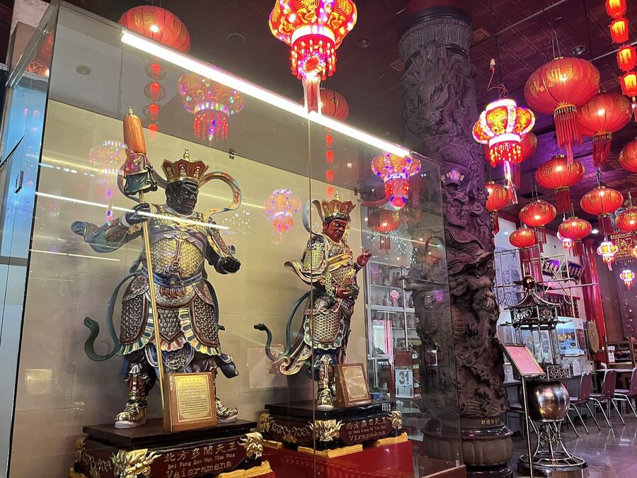
From 1971 to 1999 the city was officially called Ujung Pandang, after the fort’s old name. It is the largest city on Sulawesi, with about 1.4 million people at the 2020 census, mostly Makassarese and Bugis, along with Torajan and Chinese Indonesian communities. The Chinatown streets around Jalan Sulawesi, a few blocks north of the fort, are worth a slow walk for their temples and old shophouses.
Fort Rotterdam
What you are looking at
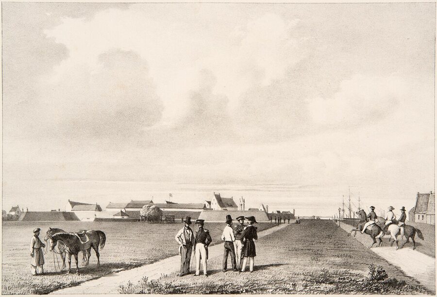
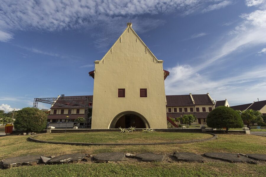
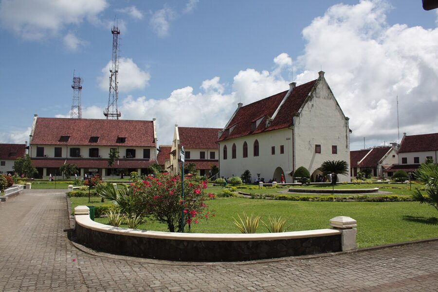
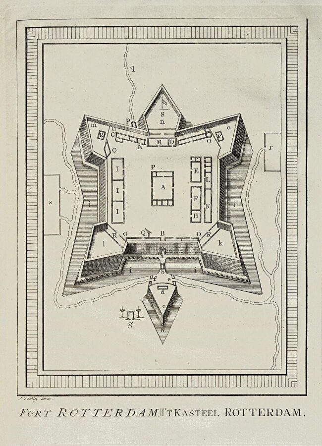
The fort began in 1545 as an earth-walled stronghold of Gowa’s ninth king, called Ujung Pandang. In 1634 Sultan Alauddin had it refaced in stone quarried from the karst hills of Maros. After Bongaya, Speelman rebuilt it in the Dutch manner, finished by 1673, and the Company named it Rotterdam.
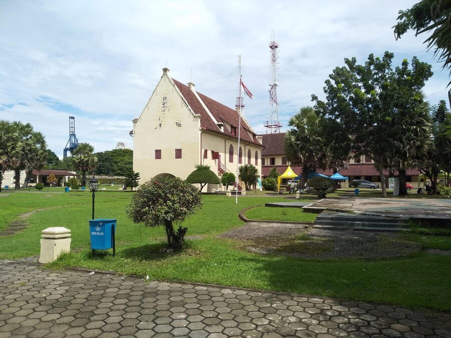
Its outline is often compared to a turtle crawling toward the sea, and locals still call it Benteng Panyyua, the turtle fort. You need a plan or a drone to see that shape, and flying a drone over a national heritage site needs the site office’s permission first. On the ground you get a walled lawn ringed by steep-roofed Dutch blocks, one of the best-preserved Dutch forts in Indonesia.
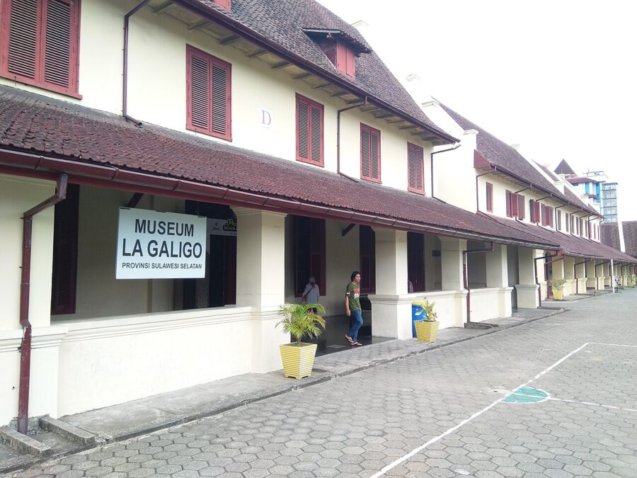
Two of the buildings hold the Museum La Galigo, named after the Bugis epic I La Galigo, with boat models, wedding costume, palm-leaf manuscripts in the Lontara script and objects from the Gowa court.
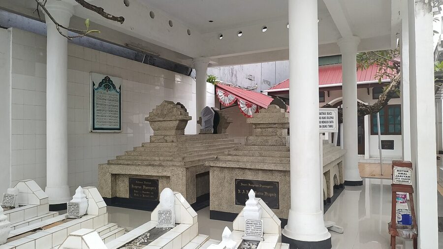
Prince Diponegoro, the Javanese noble who led the war against the Dutch from 1825 to 1830, was held in the fort from 1833 until his death in 1855, in a cramped cell in the Bacan bastion. His grave is a short ride away, on Jalan Diponegoro.
When to go and where to stand
The entrance is on the west side, on Jalan Ujung Pandang, facing the harbor. Come at opening time for an empty lawn and soft light; by mid-afternoon school groups and wedding shoots arrive and the pale plaster throws back hard glare. Late afternoon puts warm side light on the west-facing walls, and you can walk straight from the gate to Losari for sunset.
Hours and tickets
As of June 2026 the grounds were free and open daily from 8 a.m. until 5 or 6 p.m., so arrive by mid-afternoon. The museum charged foreign visitors Rp10,000 (about 60 cents), one ticket for both museum buildings. In July 2026 the Minister of Culture inspected the fort ahead of a planned restoration, so expect some buildings to be closed or under scaffolding in the coming years.
Losari Beach at sunset
The seawall and the platforms
Losari is a promenade, not a swimming beach: a concrete seawall along Jalan Penghibur running south from near the fort for about a kilometer and a half. Its paved platforms carry giant letters spelling out Pantai Losari and the names of South Sulawesi’s peoples, and each one has a queue for group photos at dusk. For a swim, go to the islands offshore or to Akkarena, the sandy beach further south.
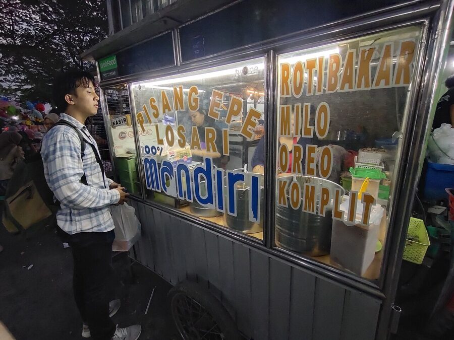
Losari’s other fame is pisang epe. Carts along the seawall press bananas flat between two wooden boards, grill them over charcoal and pour on palm sugar syrup, sometimes with durian or grated cheese. It is the standard thing to hold while you wait for the sun.
Two mosques on the water
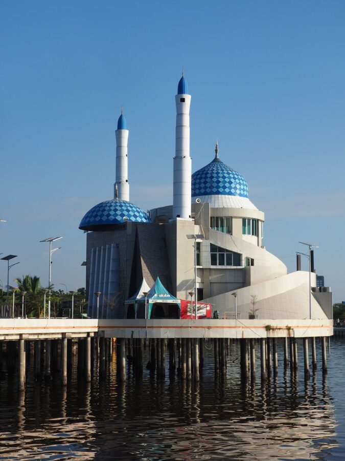
At the south end of the promenade, the Amirul Mukminin mosque stands on piles over the water, with twin minarets and blue domes, and everyone calls it the floating mosque. Its lights come on at dusk and double in the water on a calm evening. Shoot it from the seawall to the north, with the minarets against the last of the color.
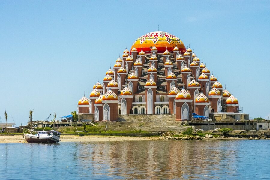
Beyond it, on the reclaimed Center Point of Indonesia headland, rises the 99 Domes Mosque, Masjid 99 Kubah Asmaul Husna, its domes standing for the 99 names of God. The architect Ridwan Kamil designed it with the local architect Mursyid Mustafa; work began in 2017, and it was open for prayer by the early 2020s. It is an active mosque, so visit outside prayer times, cover shoulders and knees, and bring a headscarf if you are a woman going inside.
Where the sun goes down
Makassar sits about five degrees south of the equator, so the sun sets close to due west at the March and September equinoxes and swings about 23 degrees south of west by late December and north of west by late June. From the seawall opposite the headland, the 99 Domes lies almost due west, which puts the equinox sun close behind its domes. Around December it drops to the left of the mosque; around June it sets to the right, over open water toward Lae-Lae island. Check a sun calculator for your date before you pick a spot.
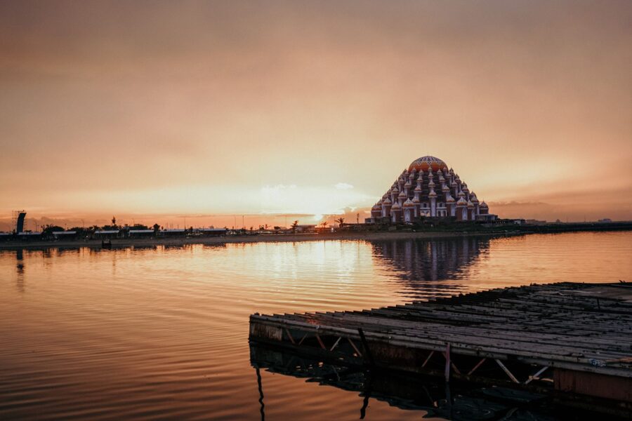
The best color often comes ten to twenty minutes after sunset, when the sky over the strait turns pink and both mosques light up. In the wet season, roughly December to March, afternoon storms build over the water and either give you towering clouds or wash the evening out. Dry-season evenings are more reliable but often hazy, which turns the sun into a flat orange disc.
Boats to the islands
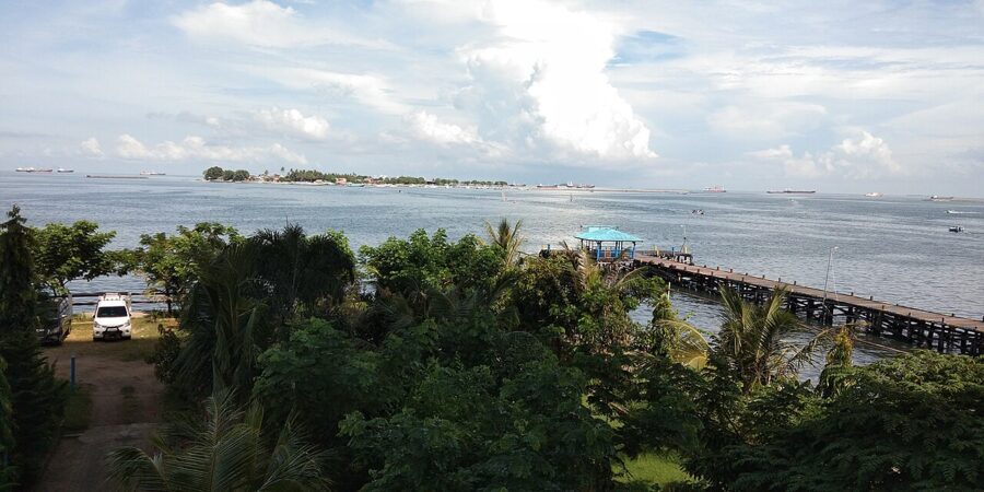
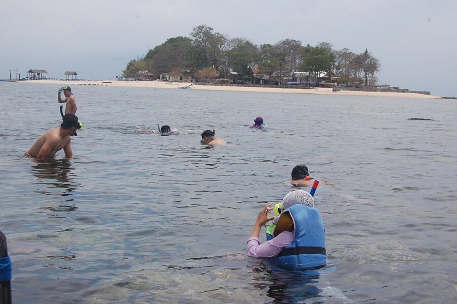
The low coral islands of the Spermonde archipelago lie just offshore. Samalona, a small wooded island ringed by reef, and Kodingareng Keke, a bare sand cay further out, are the usual day trips, by boats chartered from the Kayu Bangkoa pier near the fort. Fares are per boat and negotiated, so a group pays less each.
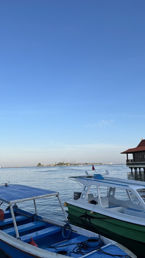
Go in the dry season, when the sea is calmer, and ask for life jackets before you set off. Bring shoes for the coral rubble, and do not stand on live coral.
Paotere harbor and the pinisi
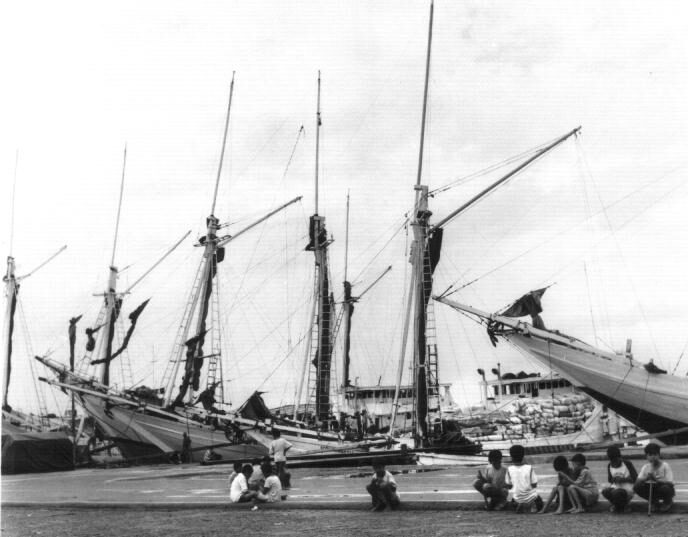
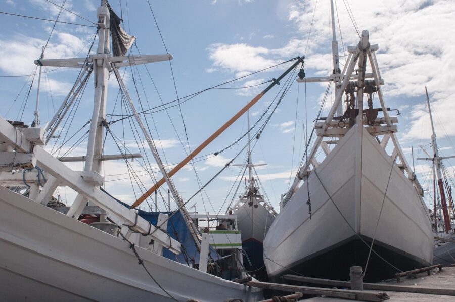
Paotere, about three kilometers north of the fort in the Ujung Tanah district, is the old harbor of the wooden-boat trade. Pinisi and smaller lambo moor bow-in along the quay, their bowsprits reaching over it, loading and unloading cargo for the islands. Most now run on engines and rarely carry sail, but the hulls are the shape the Bugis and Makassarese have built for centuries.
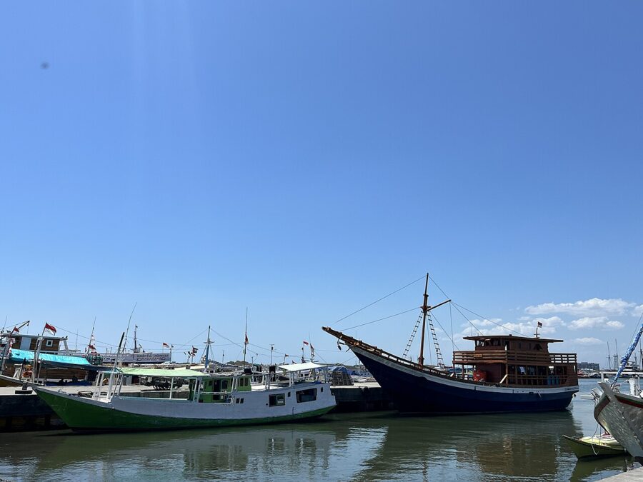
In 2017 UNESCO added the art of pinisi boatbuilding in South Sulawesi to its list of intangible cultural heritage. The boats are built by hand on the beaches of Tana Beru and Bira in Bulukumba, on the south coast. Paotere is where you see them at work.
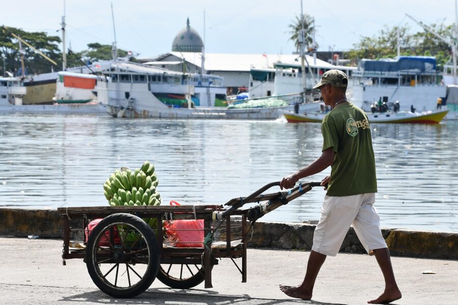
Go early. The fish market at the harbor’s edge is busiest in the first hours of daylight, the low light models the hulls, and the heat has not yet flattened everything. Ask before photographing people, keep off the gangplanks while crews are loading, and expect the smell of fish and diesel to follow you home.
Rammang-Rammang karst
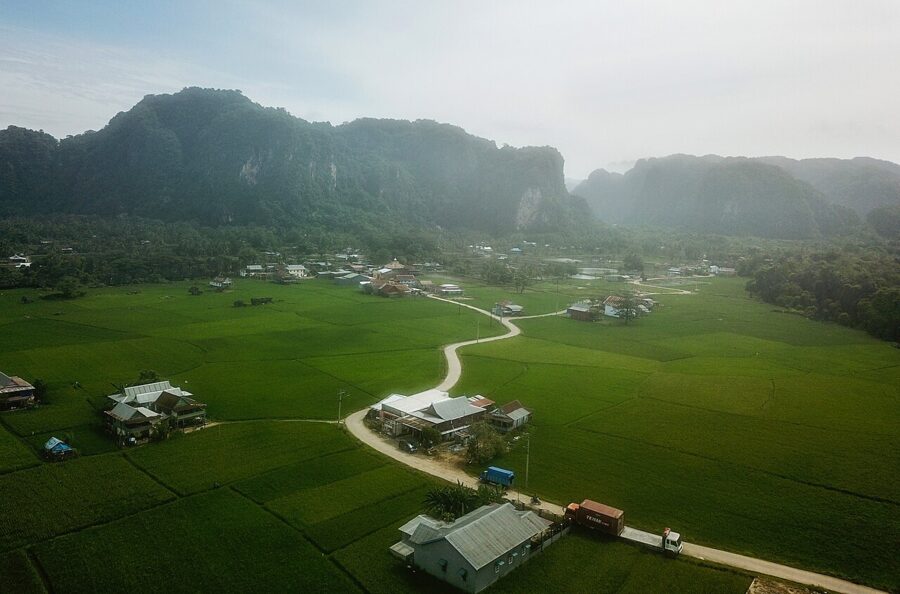
North of Makassar the flat coastal plain runs into a wall of grey limestone. The Maros-Pangkep karst was laid down as reef and sea floor tens of millions of years ago, lifted, and then dissolved by tropical rain into towers, pinnacles and caves. UNESCO recognized it as the Maros Pangkep Global Geopark in 2023, and Rammang-Rammang, in the village of Salenrang, is the part most people see.
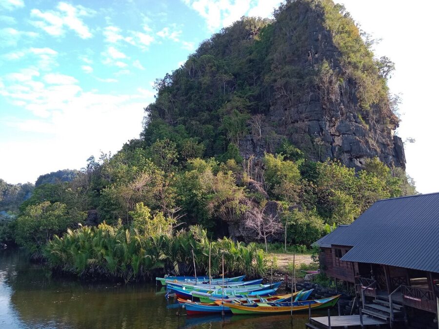
Villagers here fought off plans to quarry the karst for marble and cement and turned to tourism instead. Boat crews organized by the local tourism group run from three piers up the Pute River, between nipa palms and limestone walls, to Kampung Berua, a hamlet of a dozen or so households in a ring of karst towers. On weekends hundreds of boats run, so go on a weekday, and early.
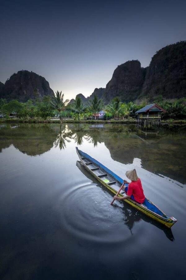
The rice fields around Berua are rain-fed and planted once a year, so the scene changes with the season. From about January to April the paddies are green; by August and September they are cut and golden. After rain, mist sits in the gaps between the towers early in the morning, and that is the picture worth getting up for.
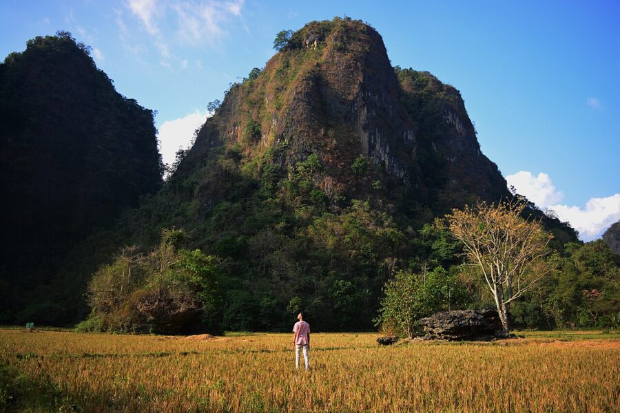
Boat fares go by the size of the boat, and you pay at the pier before you board. Take water, a hat and a dry bag for the camera. The paths in Berua are narrow embankments between the fields, so walk single file and stay off the planted rice.
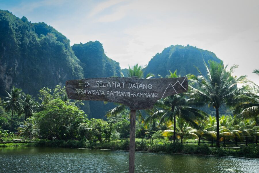
The drive from central Makassar takes one to one and a half hours, depending on traffic. The Makassar–Parepare railway also stops at a station called Rammang-Rammang, about a kilometer and a half from the piers; trains start from Mandai, near the airport, on a limited daily timetable, listed in the KAI Access app.
Leang-Leang and the oldest cave art
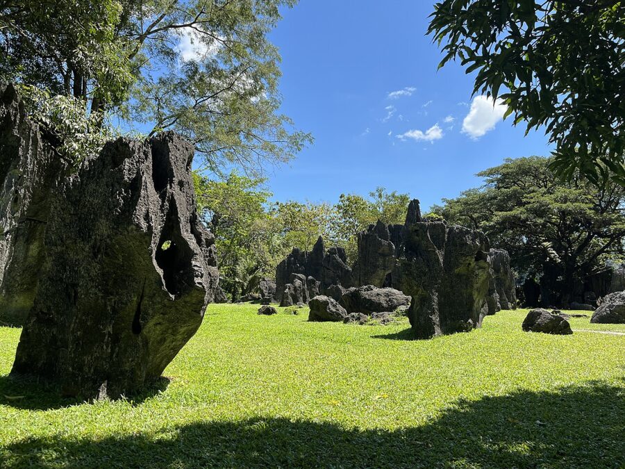
The karst is full of painted caves. The Leang-Leang Archaeological Park, in the Bantimurung district of Maros, is the one set up for visitors, with paths across a lawn of limestone pinnacles and stairs up to two cave mouths, Leang Pettae and Leang Petta Kere. Inside are red hand stencils and a painted babirusa, the pig-deer of Sulawesi.
In 2014 Indonesian and Australian researchers dated a hand stencil in another Maros cave, Leang Timpuseng, to at least 39,900 years. In July 2024 a team from Indonesia’s national research agency and Australian universities dated a scene at Leang Karampuang, also in Maros, to at least 51,200 years: three human-like figures around a Sulawesi warty pig. It is the oldest known painted scene that tells a story anywhere.
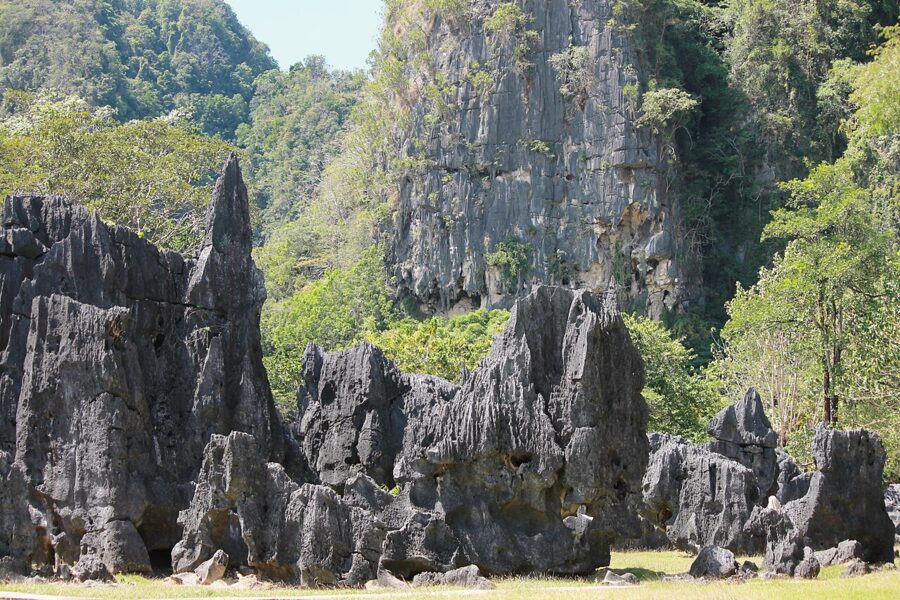
Leang Karampuang is a research site, not open to visitors, so Leang-Leang is where you see this kind of art. Keep flash off, do not touch the walls, and stand where the guards tell you. Leang-Leang is about fifteen minutes’ drive from Bantimurung, and most people pair the two.
Bantimurung waterfall and the butterflies
The Bantimurung–Bulusaraung National Park covers much of the Maros karst, and its most visited corner is the waterfall at Bantimurung, about 45 kilometers from Makassar. A broad sheet of water pours over a limestone ledge into a pool where children swim. On weekends and public holidays it is packed, so come on a weekday morning.
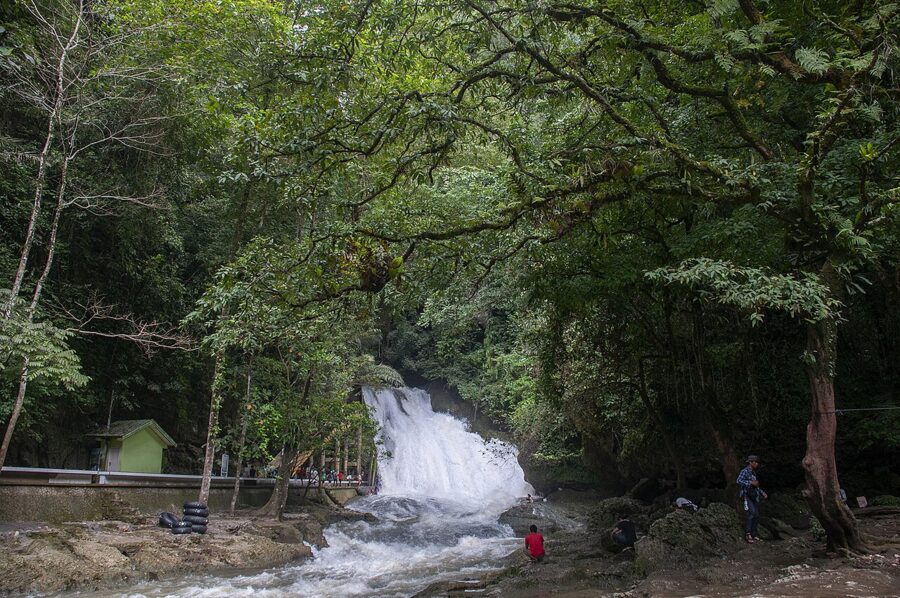
Bring a small tripod. The shade gives you a slow shutter without much trouble, and a quarter of a second or so smooths the water without turning it to fog. Expect spray near the foot of the falls. Above them a path runs upstream to two caves, Gua Batu and Gua Mimpi, where you will want a headlamp.
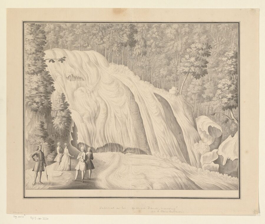
The naturalist Alfred Russel Wallace spent July to November 1857 near Maros and collected butterflies at Bantimurung, which he described in The Malay Archipelago (1869). The phrase on the park’s signs, a kingdom of butterflies, is often credited to him, though the words are not his. A butterfly museum and breeding house stand by the falls, and on sunny mornings butterflies gather on the damp sand along the river to drink.
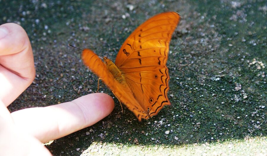
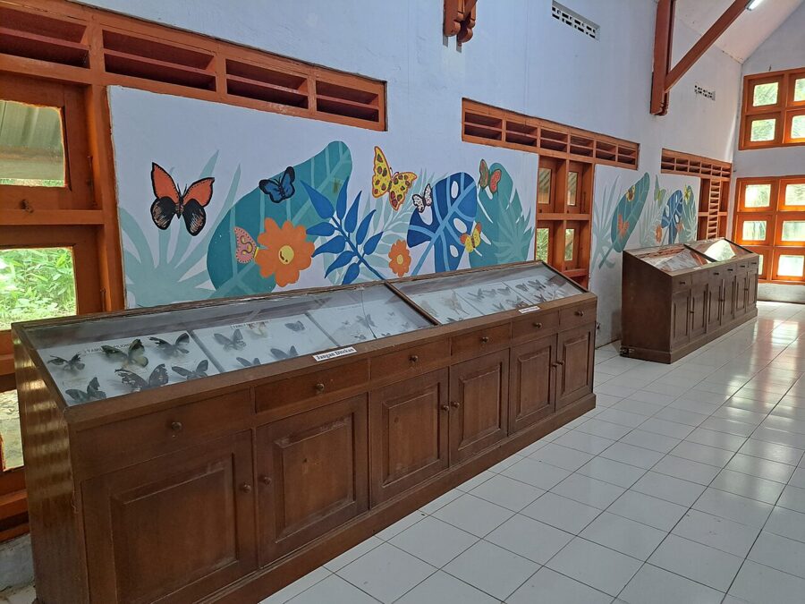
You pay a separate entry fee at the Bantimurung gate. Leave the drone at home unless you have the park’s written permission.
What to eat in Makassar
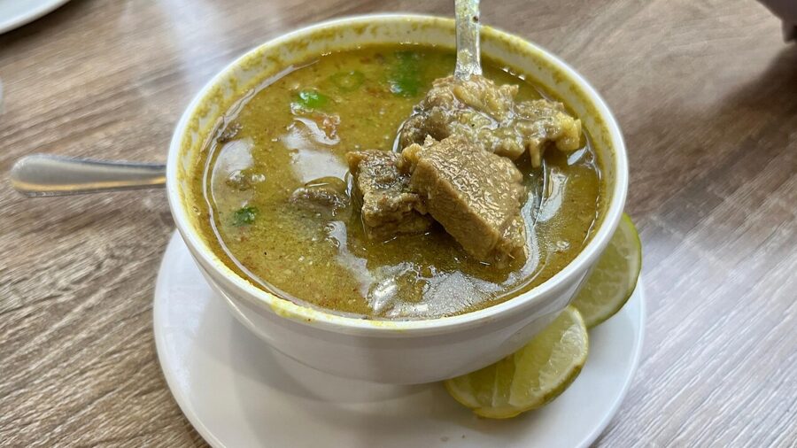
Coto Makassar is the city’s dish: beef and offal simmered in a broth thickened with ground roasted peanuts and spices, served in small bowls with lime and chili. You eat it with ketupat or burasa, rice cooked in woven palm leaf or in banana leaf with coconut milk. It is breakfast and lunch food.
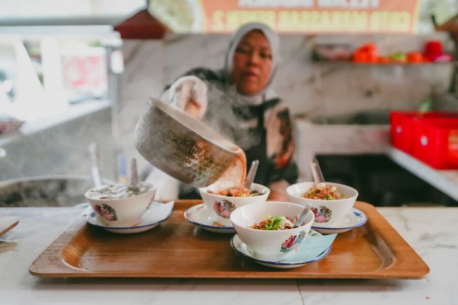
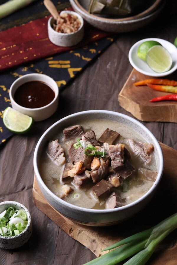
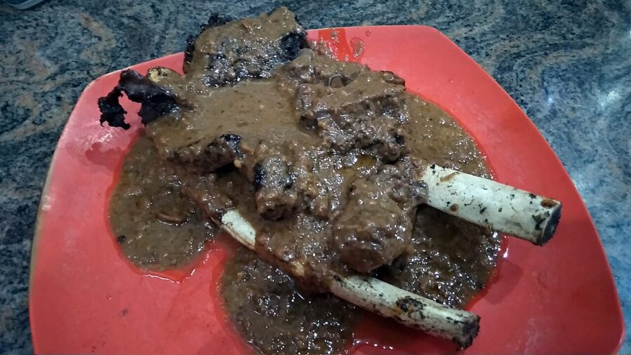
Konro is beef rib in a dark soup colored by keluak nuts; konro bakar is the same ribs grilled and served with peanut sauce. Pallubasa is coto’s close relative, richer with toasted grated coconut and often a raw egg yolk stirred in. Sop saudara, from Pangkep to the north, is a beef soup with rice vermicelli, eaten with grilled milkfish.
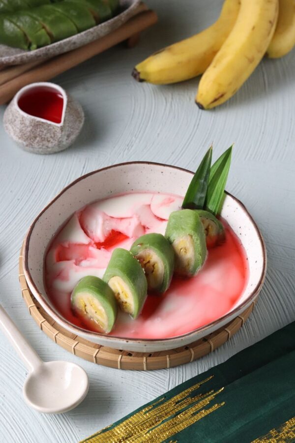
For something sweet, pisang ijo is banana wrapped in green rice-flour dough, served cold with coconut sauce, syrup and shaved ice. Jalangkote is a fried pastry dipped in sour chili vinegar, and mie titi is crisp fried noodles under a thick seafood gravy. Seafood is best near the water, grilled over charcoal.

Makassar is a largely Muslim city. Pork is rare outside Chinatown, and during Ramadan many daytime stalls close and Losari fills at sunset for the breaking of the fast.
Getting there and around
Flights
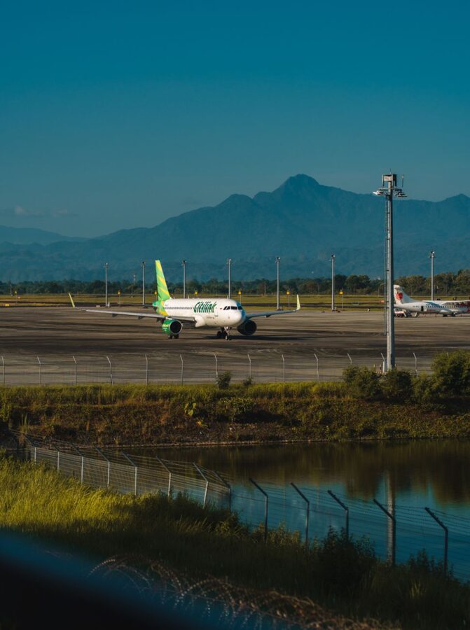
Sultan Hasanuddin International Airport (UPG) sits in Maros regency, about 20 kilometers northeast of the center, and is the main hub for eastern Indonesia. Jakarta is about two hours away by air, and there are direct flights from Surabaya and Bali. As of spring 2026 there were direct international flights from Kuala Lumpur and, a few days a week, from Singapore; check the airlines’ current schedules before you plan around them.
Most visitors need a visa or an electronic visa on arrival. Check the rules for your passport on the Indonesian immigration directorate’s official e-visa site before you fly.
In the city
Grab and Gojek, the ride-hailing apps, are the easy way around, by car or motorbike. The drive in from the airport takes thirty minutes to an hour on the toll road. For short hops between the fort, Chinatown and Losari, a becak (pedicab) is slow but pleasant. Makassar runs on Central Indonesian Time, UTC+8.
When to go
The dry season runs roughly from June to October, with the clearest sunsets and the calmest sea for the islands, though haze is common. The wet season peaks from December to February, when the karst is greenest and Bantimurung is at full flow, but storms are frequent. For both green paddies and a decent sky, I would aim for April or May.
The road north to Toraja
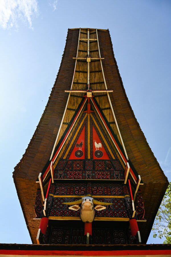
The Toraja highlands around Rantepao are about 330 kilometers north by road. The route follows the coast through Maros, Pangkep and Parepare, then turns inland and climbs through Enrekang, where the last stretch is steep and winding. Most people take a night bus and wake up in the mountains.
As of August 2026, night buses left Makassar between 8 and 9 p.m. and reached Rantepao between about 5 and 7 a.m., for Rp180,000 to Rp390,000 (about $11 to $24). Many leave from the Daya regional terminal in north Makassar and others from operators’ offices on Jalan Perintis Kemerdekaan and Jalan Urip Sumoharjo, so check where your ticket says to board. A car with a driver cost about Rp1.5 to 2.5 million (about $90 to $150) and lets you stop at Rammang-Rammang and the viewpoints above Enrekang.
Wings Air flies from Makassar to Toraja Airport at Buntu Kunik, about 25 kilometers from Rantepao, on selected days only, in about 55 minutes. The route was suspended in 2025, so check the airline’s schedule for your date before you count on it.
The night before your flight out of Makassar, go back to the seawall at five. Stand opposite the headland, watch where the sun meets the domes, and stay until the floating mosque lights up.