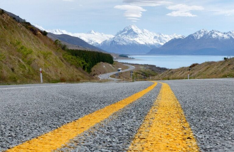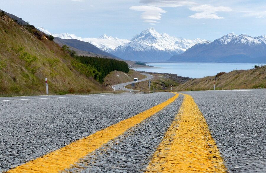
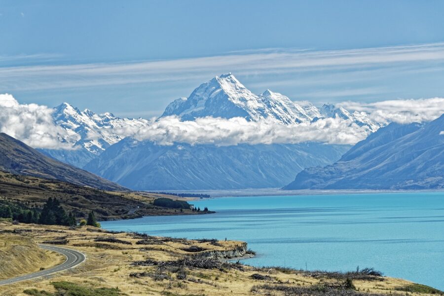
The road to Aoraki/Mount Cook runs 55 km up the western shore of Lake Pukaki, and for most of that distance the mountain sits at the far end of the lake, straight over your bonnet. Drive it in the morning and the range is lit from the side, the water is milky turquoise and every pull-off is a frame. Drive it at midday and you are looking north, which in New Zealand means looking into the sun.
That is the whole of this route in miniature. New Zealand gives you light from the north, weather from the west and a lot of driving between the views, so a good road trip here is mostly a matter of being at the right stretch of road at the right hour. The plan below covers both islands in three weeks, Auckland to Christchurch, with the drive times, the direction each viewpoint faces and the rules that changed in 2025 and 2026.
Most visitors run this loop in a campervan or a rental car with motels. Either works. What matters more is buffer: two spare days for rain, because Fiordland and the West Coast will take at least one from you.
Contents13 parts
- The route at a glance
- How long you really need
- The North Island, days 1 to 7
- Crossing Cook Strait
- The West Coast, days 8 to 11
- Wānaka and Queenstown, days 12 to 13
- Fiordland and the Milford Road, days 14 to 15
- Lindis Pass and the Mount Cook road, days 16 to 17
- Lake Tekapo and the night sky, day 18
- Campervan or car
- Freedom camping rules in 2026
- Seasons and light
- What to watch for on the road
The route at a glance
This is a 21-day loop that flies into Auckland and out of Christchurch, with about 3,000 km of driving and one ferry. The times below are driving times with no stops, rounded up, and New Zealand roads are slower than a map suggests: two lanes, constant bends, one-lane bridges and campervans. Add a third for photo stops and you will be close.
| Day | Leg | Distance | Driving, no stops | Be there for |
|---|---|---|---|---|
| 1 | Auckland to Piha and back | 40 km each way | 45 min | Sunset on the west coast |
| 2 | Auckland to Hahei | 175 km | 2 hr 30 min | Cathedral Cove next morning |
| 3 | Hahei to Rotorua | 205 km | 3 hr | Evening steam in town |
| 4 | Rotorua to Taupō via Wai-O-Tapu | 80 km | 1 hr 15 min | Morning at the thermal park |
| 5 | Taupō to Whakapapa | 100 km | 1 hr 30 min | Huka Falls on the way out |
| 6 | Tongariro Alpine Crossing | 20.2 km on foot | 7 to 8 hr walking | Emerald Lakes around midday |
| 7 | Whakapapa to Wellington | 330 km | 4 hr 30 min | Mount Victoria at blue hour |
| 8 | Ferry to Picton, drive to Nelson | 105 km after the crossing | 3 hr 30 min sailing, 2 hr driving | Tory Channel from the deck |
| 9 | Nelson to Punakaiki | 265 km | 3 hr 45 min | Pancake Rocks at sunset |
| 10 | Punakaiki to Franz Josef via Hokitika | 215 km | 3 hr | Glacier valley in the afternoon |
| 11 | Fox Glacier to Wānaka via Haast Pass | 265 km | 3 hr 45 min | Lake Matheson at dawn first |
| 12 | Wānaka | Short hops | That Wānaka Tree at sunrise | |
| 13 | Wānaka to Queenstown over the Crown Range | 65 km | 1 hr 15 min | Glenorchy road late afternoon |
| 14 | Queenstown to Te Anau | 170 km | 2 hr 30 min | An early night |
| 15 | Milford Road and Milford Sound | 120 km each way | About 2 hr each way | Leave Te Anau at first light |
| 16 | Te Anau to Twizel via Lindis Pass | 360 km | 5 hr | Lindis Pass in low sun |
| 17 | Twizel to Aoraki/Mount Cook Village | 65 km | 50 min | Hooker Valley at dawn |
| 18 | Mount Cook to Tekapo | 105 km | 1 hr 30 min | The night sky |
| 19 | Tekapo to Christchurch | 225 km | 3 hr | Your flight |
| 20 and 21 | Weather days | Fiordland or the West Coast |
How long you really need
Three weeks is the shortest trip I would plan for both islands with a camera. Two weeks covers the South Island alone at a sane pace, and it is the trade I would make: fly into Christchurch, run this plan from day 8 backwards or forwards, and fly out of Queenstown or Christchurch. If you have one week, pick a single region, Fiordland and the lakes or Mount Cook and the West Coast, and leave the rest for another trip.
Ten days for both islands is possible, and it means seeing most places at midday through a windscreen. Rental firms charge one-way fees, so price the Auckland-to-Christchurch version against a loop.
The North Island, days 1 to 7
Auckland and Piha
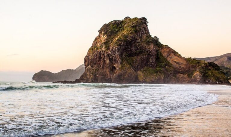
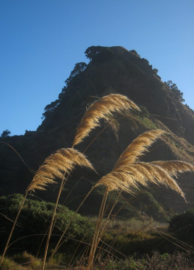
Piha is 40 km west of Auckland over the Waitākere Ranges, and it faces the Tasman Sea, which is why you go in the evening. Lion Rock splits the beach in two and takes the last of the light on its seaward side. Arrive an hour before sunset, walk to where Piha Stream meets the sea beside Lion Rock and use its lagoon or the wet sand for reflections.
Coromandel and Cathedral Cove
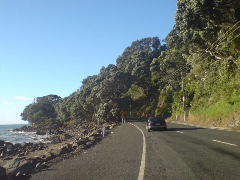
Day 2 is a drive east to Hahei, on the Mercury Bay side of the Coromandel Peninsula. If you have an extra day, go the long way up the Thames Coast Road, which faces west and glows in the afternoon. Storms closed parts of State Highway 25 several times in 2026, so check the NZ Transport Agency’s Journey Planner the morning you drive.
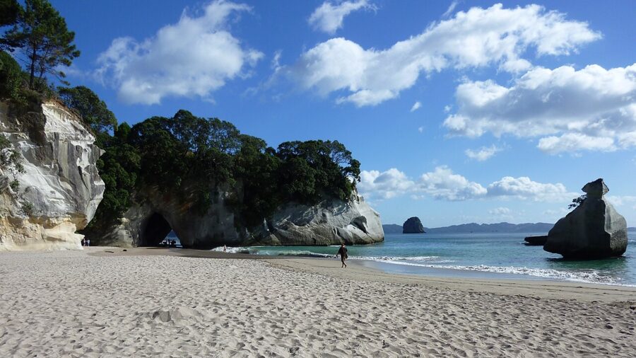
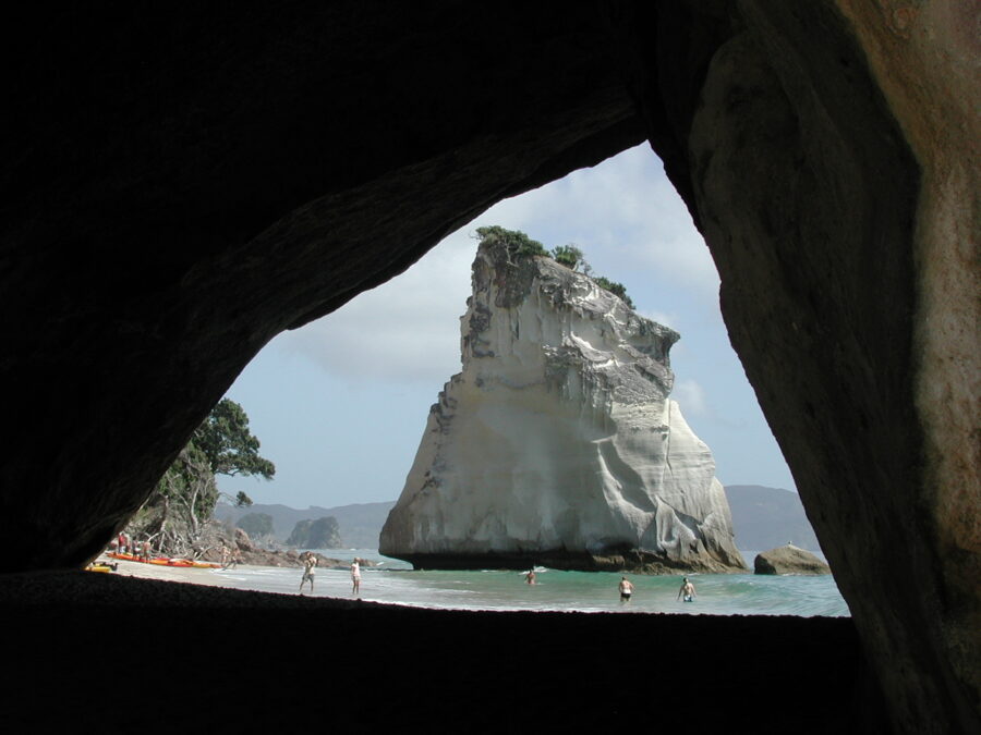
Mautohe Cathedral Cove is a 5 km return walk, about an hour and a half, from the top of Grange Road in Hahei. There is no parking at the track entrance: leave the car at the free Hahei Visitor Car Park and walk or take the shuttle up the hill. The coast here faces the sunrise, and the classic frame looks through the rock arch from Mares Leg Cove to the stack called Te Hoho.
Walking access was restored in December 2024 after storm damage in 2022 and 2023, and the Department of Conservation (DOC) closes the track when an orange or red rain warning covers Hahei. Don’t go during or just after heavy rain; the cliffs above the beach are unstable. Two side routes, the track to Gemstone Bay and the Hahei Short Walk, were closed at DOC’s October 2026 update.
Rotorua, Wai-O-Tapu and Taupō
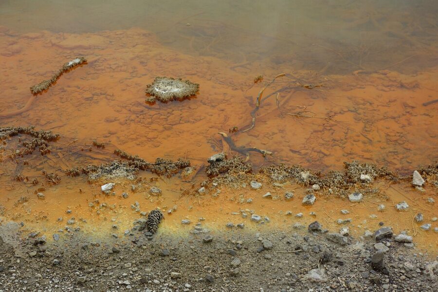
Rotorua is three hours from Hahei and smells of sulfur from the moment you arrive. Spend the morning of day 4 at Wai-O-Tapu, 30 minutes south of town, where the Champagne Pool’s orange rim and the steam over it are best on a warm, breezy morning. If you are a film fan coming from Auckland, Hobbiton near Matamata is about an hour from Rotorua and fits on day 3 with a detour inland.
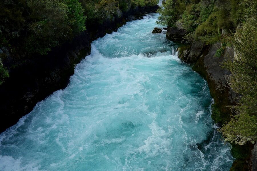
Taupō is an hour on. Stop at Huka Falls just north of town, where the Waikato River squeezes through a narrow rock channel and comes out bright blue. The footbridge over the channel gives the head-on view; the lookout on the far side gives the drop.
Tongariro
The Tongariro Alpine Crossing is 20.2 km one way across a live volcanic massif, seven to eight hours in summer, and DOC rates it intermediate. There is a four-hour parking limit at the road ends, and in summer no parking at all for crossing walkers at Mangatepōpō, so book a shuttle from Whakapapa, National Park village or Tūrangi. Track bookings are recommended for everyone and required if you use a shuttle.
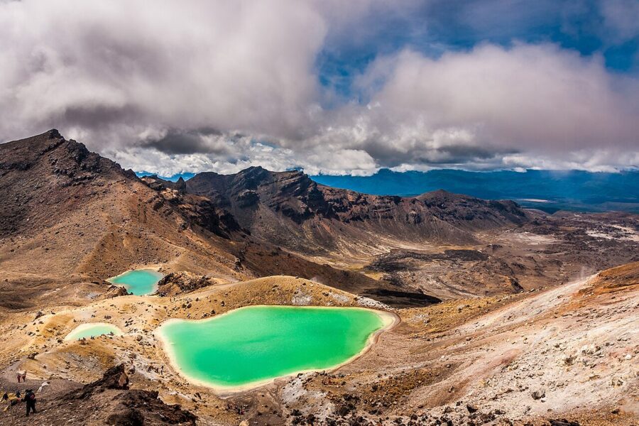
The Emerald Lakes sit about halfway, below Red Crater, and you will reach them around the middle of the day whatever you do. That is fine here: overhead sun is what makes the water glow green. Two fires burned large areas of the park in late 2025, so expect blackened ground near the start alongside the regrowth.
DOC posts a “Not Recommended Today” advisory in the summer season when the forecast for Red Crater crosses its wind, rain or temperature limits. From May to late October the crossing is an alpine winter trip with snow, ice and avalanche terrain. If the weather closes it, the Soda Springs walk, two hours return from Mangatepōpō, still gets you into the valley.
Wellington
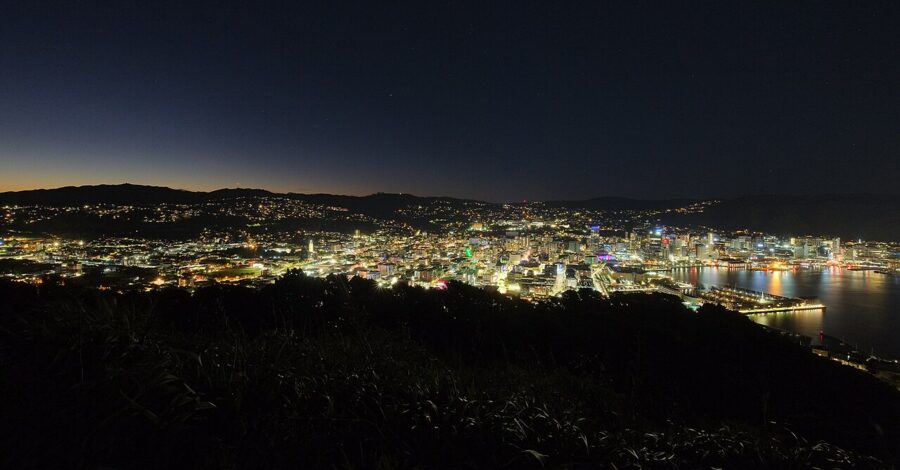
Day 7 is the long drive south. Get into Wellington in time to drive up Mount Victoria, the hill above the city’s east side, for sunset and the blue hour after it. The city and the harbor lie west of the lookout, so the lights come on under the last color in the sky.
Crossing Cook Strait
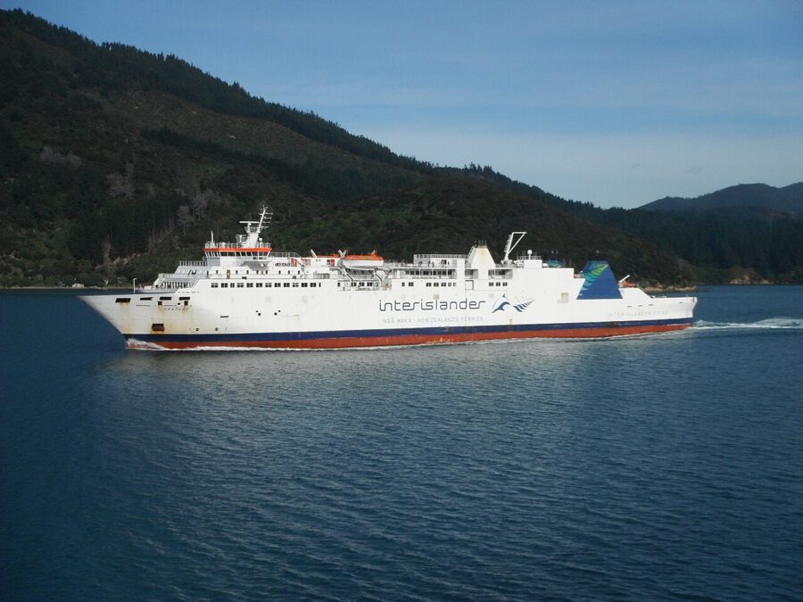
Two companies run the ferry between Wellington and Picton, and both take about three and a half hours. Interislander sails the Kaiārahi and the Kaitaki, a two-ship fleet since the Aratere made its last crossing in August 2025. Bluebridge runs the Livia and the Connemara, on a timetable that changes by season.
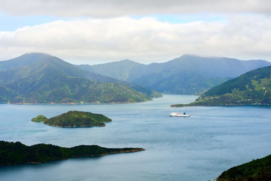
Book the car on the ferry well ahead for December and January. Some rental companies won’t let their cars cross, and instead have you drop one car at the Wellington terminal and collect another in Picton; ask before you book, because it changes which ferry and which day work. For pictures, the last hour is the one to be on deck, when the ship leaves the open strait and threads Tory Channel into Queen Charlotte Sound.
The West Coast, days 8 to 11
From Picton it is two hours to Nelson, then a long day down through the Buller Gorge to the coast. The West Coast is a strip of rainforest, river mouths and grey beaches between the Southern Alps and the Tasman Sea. It gets a lot of rain, and it is also where you are most likely to see the mountains reflected in still water.
Punakaiki
The Pancake Rocks at Dolomite Point are layered limestone that the sea has worn into stacks, with three blowholes between them. DOC’s own advice is that the blowholes perform best at high tide with a south-westerly swell, so check the tide before you plan the evening. The coast faces west, which puts sunset behind the stacks.
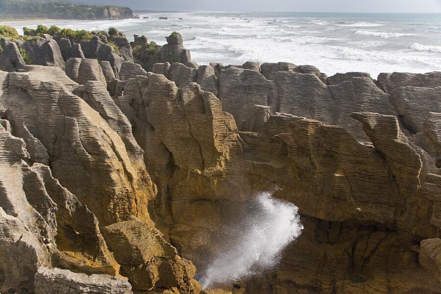
The loop walk from the highway takes about 20 minutes. The car park is now paid: NZ$2.50 (about US$1.40) per half hour or NZ$20 (about US$11) a day as of November 2026, by card at the machine. There is no petrol station in Punakaiki, so fill up in Westport or Greymouth.
Franz Josef, Fox and Lake Matheson
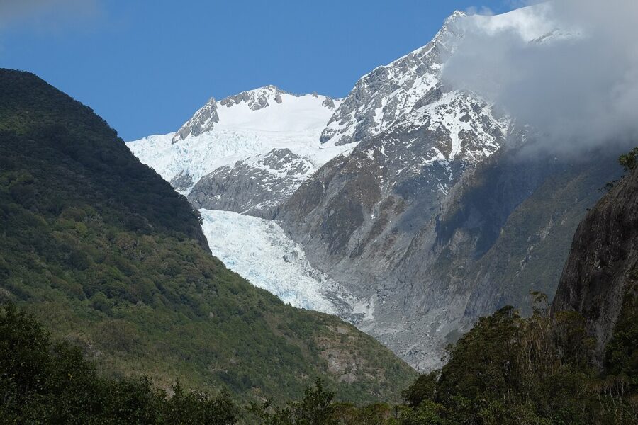
Both glaciers have retreated a long way, and the walks now end at viewpoints hundreds of meters from the ice. The Franz Josef access road is unsealed but fine for campervans, and its car park charges the same as Punakaiki. At Fox the old road up the north side of the valley has been closed since 2019; the South Side Walkway is 6.4 km return, about two hours, and DOC asks you not to go past the final viewpoint because of flood surges from the glacier.
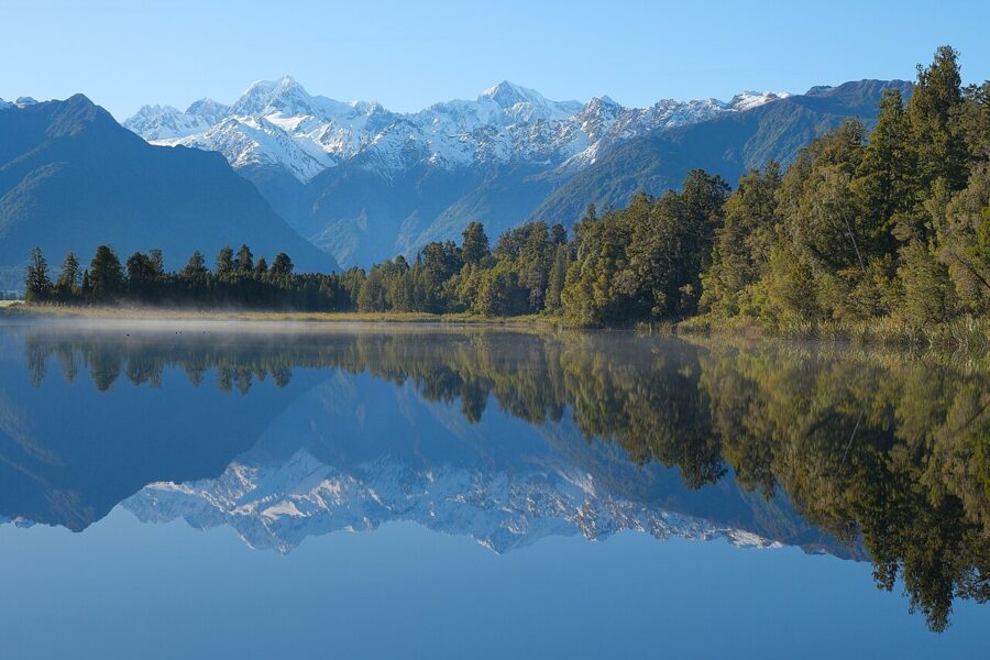
Lake Matheson, a few kilometers west of Fox Glacier township, is the reason to stay a night in glacier country. Its dark water mirrors Aoraki/Mount Cook and Mount Tasman, and DOC says the reflections are best at dawn and dusk on a windless day. The full loop is 4.4 km, an hour and a half; the Jetty Lookout is 2.4 km return and wheelchair accessible.
At sunset the peaks take light from the west, behind you, which suits the reflection. At dawn the water is usually stiller. I would stay at Fox, walk in the evening, and if the mountains were hidden, set an alarm and try again before driving south.
Haast Pass
State Highway 6 runs south from Fox along the coast, then turns inland over Haast Pass to Makarora and Lake Wānaka. Slips are a fact of life on it. Heavy rain in late August 2026 brought down about 30 slips between Makarora and Lake Hāwea, and the road ran on escorted convoys until it fully reopened on 23 October 2026; check its status on the Journey Planner the night before.
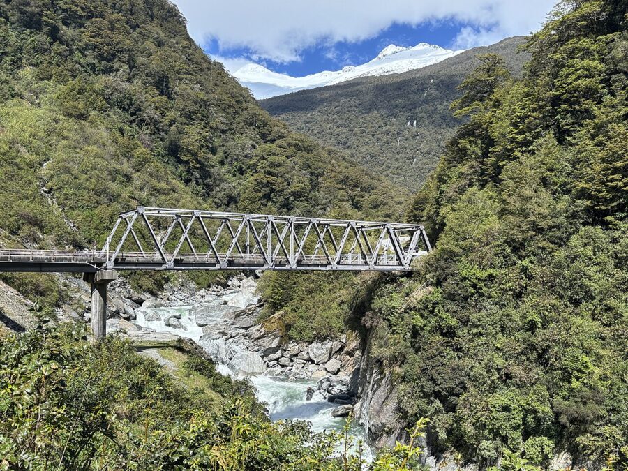
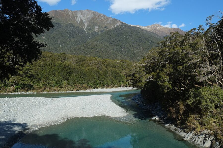
Stop at the Blue Pools, a short walk from the highway near Makarora over a swing bridge to clear water at the meeting of the Blue and Makarora rivers. DOC plans to charge for parking there from December 2026, at NZ$2.50 per half hour or NZ$20 a day.
Wānaka and Queenstown, days 12 to 13
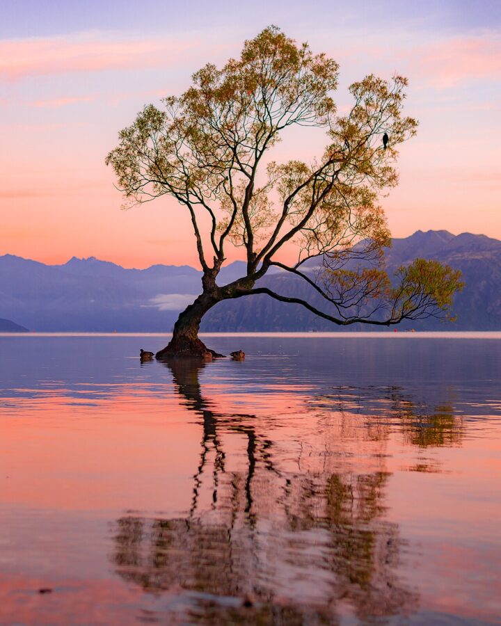
That Wānaka Tree is a willow growing in the shallows of Roys Bay, a short walk along the lakefront from town, and it is busy at every sunrise of the year. It faces you across water with the mountains to the west behind it, so dawn light falls on the range while the tree stays dark. Arrive early, stay on the shore, and don’t wade out to it; someone cut branches off it in 2020.
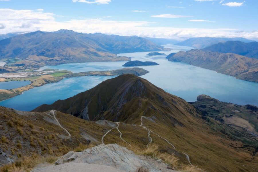
Roys Peak Track is a 16 km return climb on an exposed farm track to the ridge view over the lake. It closes every year from 1 October to 10 November for lambing; in that window DOC suggests Isthmus Peak Track, a similar walk on Lake Hāwea. Start in the dark for sunrise on the ridge, or accept a hot, shadeless climb.
The Crown Range Road from Wānaka to Queenstown is the shorter way and the more scenic one, climbing to the highest main road in the country before zigzagging down to Arrowtown. Some rental companies restrict campervans on it in winter, so read your contract. In April and early May the poplars and willows around Arrowtown and Lake Hayes turn yellow, and it is the best autumn color on the route.
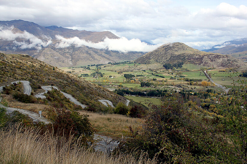
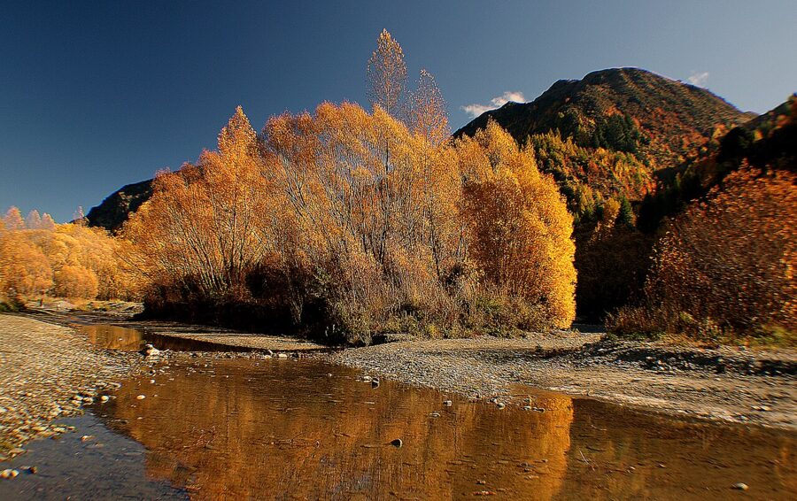
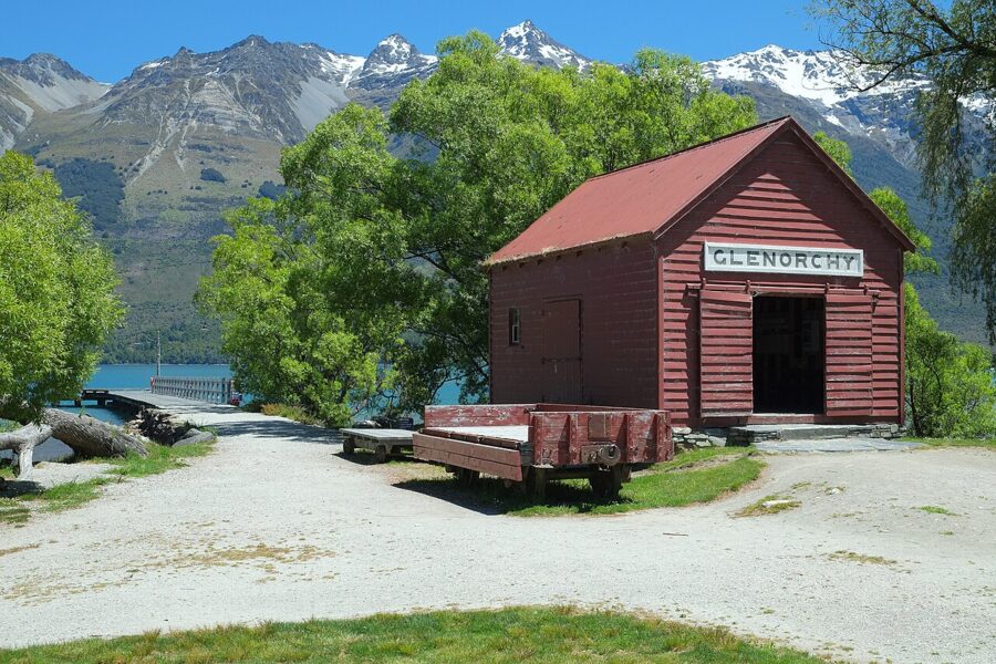
From Queenstown, the road along Lake Wakatipu to Glenorchy takes about 45 minutes and has a lookout at nearly every bend. Go in the morning: the Humboldt Mountains rise to the northwest of Glenorchy, so early sun lands on them, while by late afternoon they are backlit. The red shed on Glenorchy wharf is the foreground everyone uses.
Fiordland and the Milford Road, days 14 to 15
The Milford Road starts in Te Anau and runs 120 km to Milford Sound. DOC says to allow about two hours without stops, and you will stop. The area gets up to 7 m of rain a year, mobile reception is limited to Te Anau Downs, Totara campsite, The Divide and Milford itself, and there is no freedom camping within 200 m of the road.
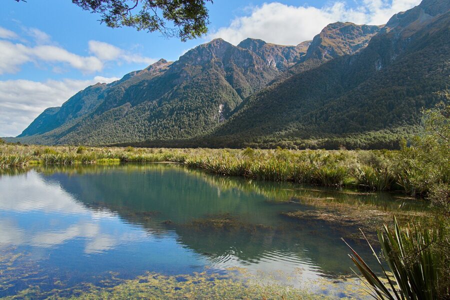
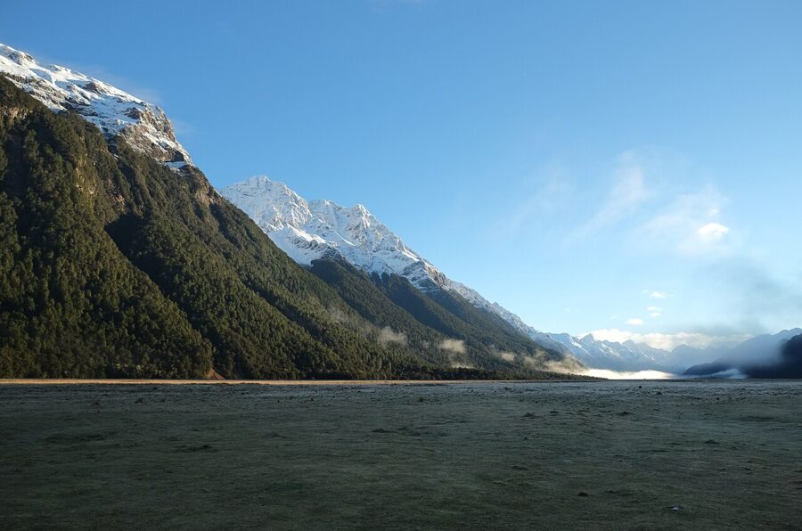
Leave Te Anau at first light. The Eglinton Valley is wide and open in the early sun, and the Mirror Lakes, a short boardwalk off the road, reflect the Earl Mountains only when the air is still. Later in the morning the day coaches from Queenstown start arriving and the boardwalk fills.
Beyond The Divide the road climbs to the Homer Tunnel, a single bore through the mountain with traffic lights at each end, started in 1935 and finished in 1954. This stretch is avalanche country, with the season usually running from June to October. When the signs at Te Anau say chains must be carried, carry them; you can hire them in town.
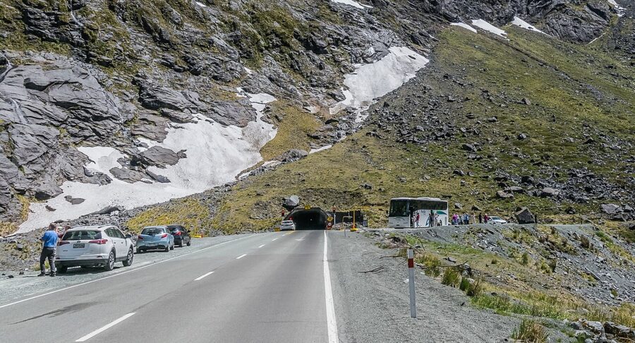
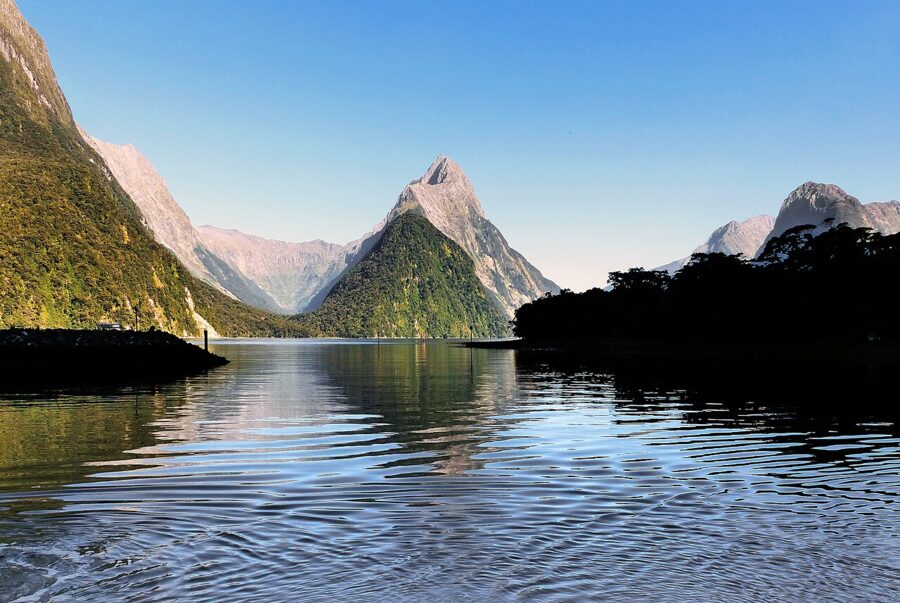
At Milford Sound the free Foreshore Walk gives you Mitre Peak across the water, and a cruise gives you the waterfalls and the fiord walls. The first boats of the morning and the last of the afternoon are quieter. Rain is not a reason to cancel: after a heavy night, hundreds of temporary waterfalls pour off the walls, and that is the picture most visitors never see.
Book any cruise before you go, and keep the drone in the bag: flying one without a DOC permit is prohibited throughout Fiordland National Park. A planned access charge for international visitors at Milford Sound, Aoraki/Mount Cook, the Tongariro crossing and Cathedral Cove was still a bill before Parliament in November 2026; DOC’s website will have the current position.
Lindis Pass and the Mount Cook road, days 16 to 17
From Te Anau, the long day back north goes through Cromwell and over Lindis Pass on State Highway 8. The pass is tussock country, round golden hills that turn to velvet when the sun is low and coming across them. In the middle of the day they look flat and brown, so if you can, time the crossing for late afternoon.
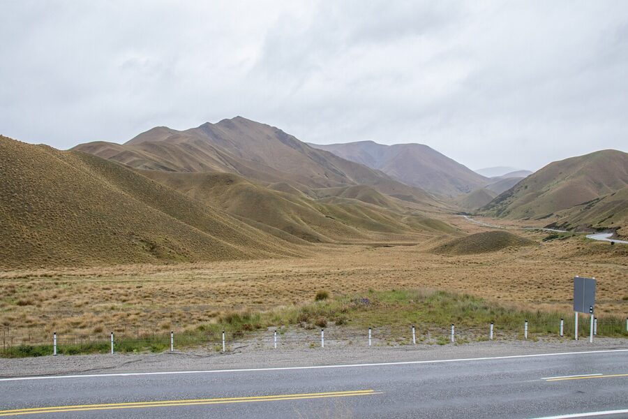
Sleep in Twizel, then drive the Mount Cook road, State Highway 80, early the next morning. Peters Lookout, near the start, gives the view down the lake. The village at the end of the road has a petrol station, a DOC visitor center and very little else, and snow can close the road between June and September.
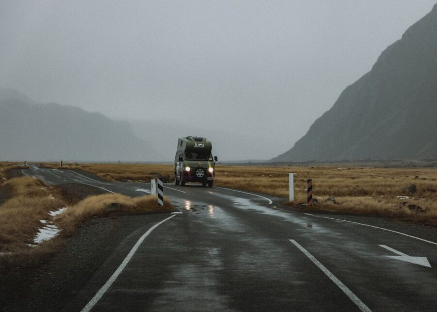
Hooker Valley
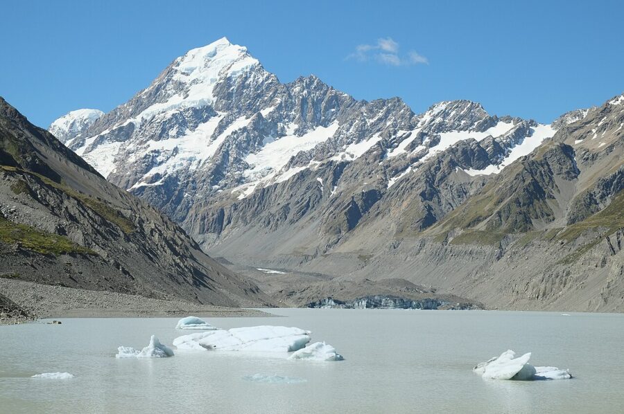
The Hooker Valley Track is 10 km return, about three hours, from the White Horse Hill car park to Hooker Lake at the foot of Aoraki/Mount Cook. It crosses three swing bridges; the second one, a new 189 m suspension bridge that opened in July 2026, is the longest in New Zealand. In summer the lake holds icebergs calved off the Hooker Glacier.
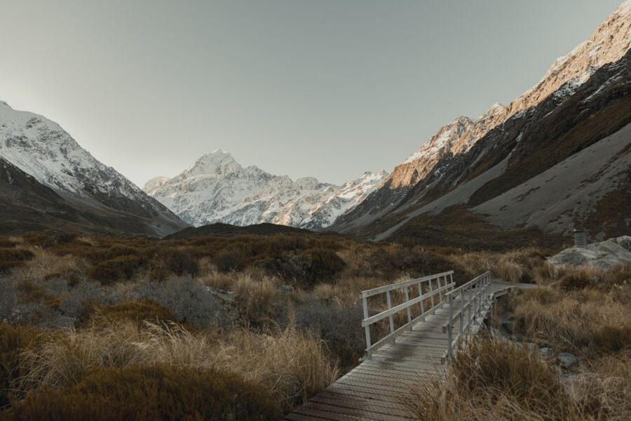
The track looks north up the valley at Aoraki, and dawn puts pink light on the summit while the valley floor is still in shadow. Leave the car park an hour and a quarter before sunrise with a head torch. DOC warns that from November to March the car park can fill between 10am and 4pm, which is another reason to go early.
Parking at White Horse Hill costs NZ$2.50 (about US$1.40) per half hour or NZ$25 (about US$14) a day as of November 2026, card only, with the first 20 minutes free. In winter the shaded sections ice over, and DOC recommends microspikes and poles. Recreational drones are banned everywhere in Aoraki/Mount Cook National Park.
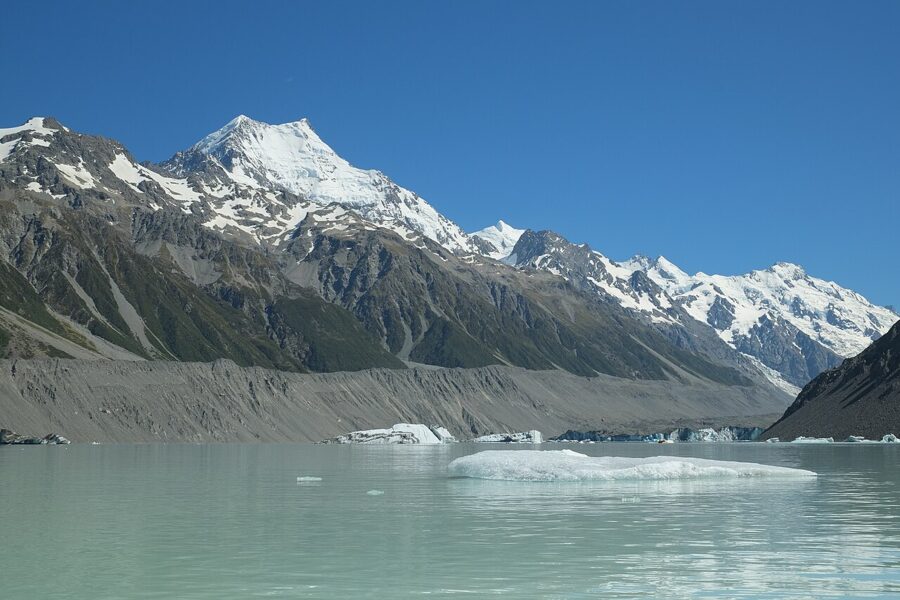
For a second walk, the Tasman Glacier road leaves SH80 just before the village and ends at a short climb to the moraine wall above Tasman Lake. The Tasman is New Zealand’s longest glacier, about 23 km, and its lake fills with large icebergs. DOC is adding paid parking at the Tasman Glacier car park from December 2026.
Lake Tekapo and the night sky, day 18
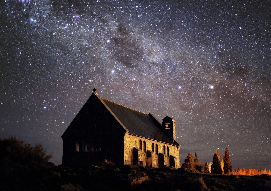
Tekapo sits inside the Aoraki Mackenzie International Dark Sky Reserve, 4,367 km² of the Mackenzie Basin and the national park, designated in 2012. Its pull for photographers is two things: the turquoise lake by day, and the Church of the Good Shepherd under the Milky Way by night.
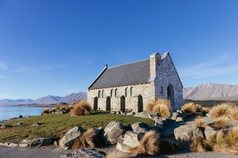
The parish has tightened the rules, and they matter for the night shot. The church grounds are open from 9am to 8pm in summer and 9am to 5pm in winter, and night access inside the fenced perimeter is not permitted. Photography inside the church is not allowed, drones are banned around the church and over the whole village because of the nearby airport, and commercial photographers need a permit.
So frame the church from outside the fence, from the lake shore or the footbridge side, and don’t climb the fence or sit on the tussock. Campervans and longer vehicles should park on the village side of the SH8 bridge and walk over the footbridge; the parish asks for a NZ$5 (about US$3) donation at the gate. Winter, roughly May to August, gives the longest nights and puts the galactic core high in the sky after dark.
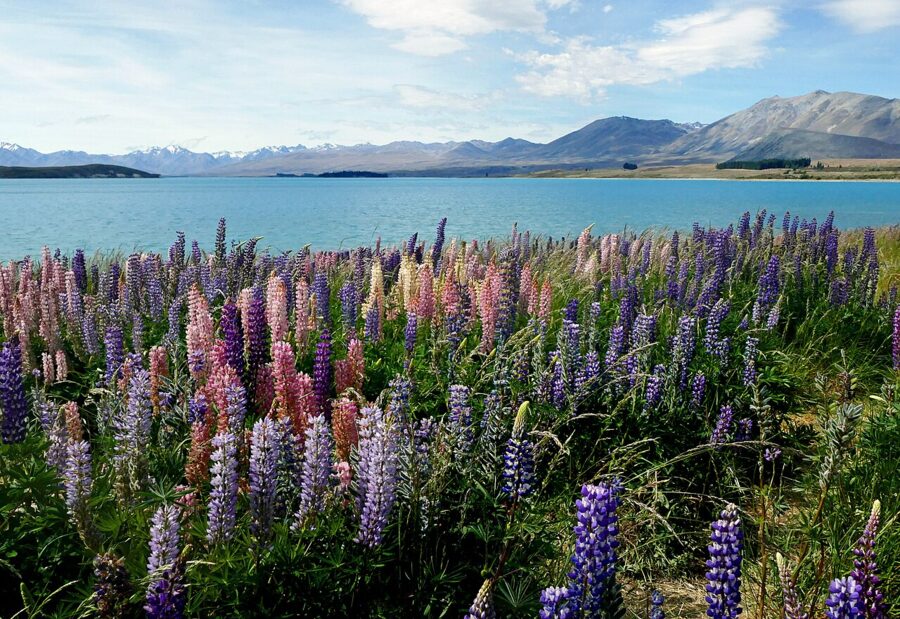
The lupins along the lakeshore flower from late November into December. They are pretty and they are a declared pest in Canterbury, spreading into the braided riverbeds and crowding out native plants. Photograph them from the path and don’t trample through them.
Campervan or car
A campervan puts you at the trailhead before dawn, which is what most of the pictures on this route need. It also costs more in summer, is slower on the passes and has to sleep somewhere legal every night. A small car with motels is cheaper in the shoulder seasons, easier on the Crown Range and the Milford Road, and parks anywhere in town.
My own rule is simple. For a summer trip built around sunrises in national parks, take a certified self-contained campervan and book DOC campsites ahead at White Horse Hill and on the Milford Road. For a winter or autumn trip with long nights and short days, take a car and sleep warm.
Freedom camping rules in 2026
The rules tightened on 7 June 2026. From that date a vehicle must hold a green warrant to count as certified self-contained, and only a toilet fixed to the vehicle floor qualifies; vans with a portable toilet can no longer be certified. Any area signposted “self-contained vehicles only” means a green warrant card displayed in the vehicle.
On DOC land freedom camping is generally allowed unless a site is prohibited or restricted, but not in scenic and recreation reserves without a campsite, not near Great Walks tracks and not on the Milford Road. Councils set their own bylaws, and the standard infringement fee is NZ$400 (about US$230). Queenstown Lakes, which covers Wānaka and Queenstown, has limited freedom campers in self-contained vehicles to designated sites since December 2025, 141 spaces across 15 sites plus a free campground at Luggate.
Treat freedom camping as a bonus, not a plan. Book campsites where you need to be up early, and keep DOC’s list of its 320-plus campsites for the nights in between.
Seasons and light
New Zealand is in the southern hemisphere, so the sun swings through the north. North-facing slopes and viewpoints that look south get the light all day; anything you photograph looking north, like Aoraki from the Hooker Valley or Mitre Peak late in the day, is backlit at noon. Check a sun calculator for each viewpoint and the date.
- Summer (December to February). Long days, with sunset after 9pm in the far south. Everything is open and the crowds are at their peak.
- Autumn (March to May). My pick. Calmer weather, morning mist on the lakes, yellow trees around Arrowtown and Wānaka from mid-April and far fewer people. The Tongariro crossing turns wintry from May.
- Winter (June to August). Snow on the ranges, the longest nights for the dark sky reserve, and the most road risk: avalanche closures on the Milford Road, snow on SH80 and the passes, ice on shaded tracks.
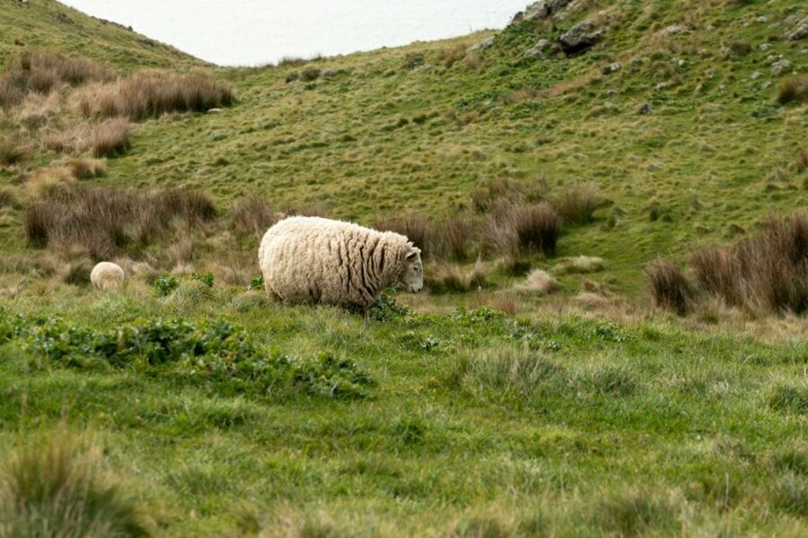
- Spring (September to November). Lambs in the fields, waterfalls running full, unsettled weather. Roys Peak is shut for lambing from 1 October to 10 November.
What to watch for on the road
Drive on the left, and say it out loud at every junction for the first two days. One-lane bridges are everywhere in the South Island: the sign before each one shows a large white arrow and a small red one, and if yours is the small red arrow, you give way. Use the pull-offs, let faster traffic pass, and never stop on the road for a picture, however empty it looks.
Fuel stops are far apart on the West Coast, in Fiordland and in the Mackenzie Basin, so fill up whenever you are under half a tank. Sandflies bite hard at Milford Sound and along the West Coast; carry repellent and shut the van windows at dusk. Alpine weather can turn from clear to sleet within an hour in any season, so check the Journey Planner every morning.
DOC car parks are going paid at a growing list of sites: Punakaiki, Franz Josef and White Horse Hill already charge, and from December 2026 DOC is adding the Tasman Glacier, the Blue Pools, the Routeburn Divide on the Milford Road and Deepwater Basin at Milford Sound, among others. None of them takes cash, and an unpaid stay can bring a NZ$75 (about US$43) breach notice. Overnight camping in these car parks is not allowed even if you pay.
Back on the Mount Cook road on your last morning in the Mackenzie, the light is the same as on the first: north, low and from the side. Leave Twizel before sunrise, stop at Peters Lookout on the way in, and keep the midday hours for driving.