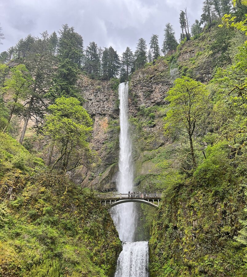
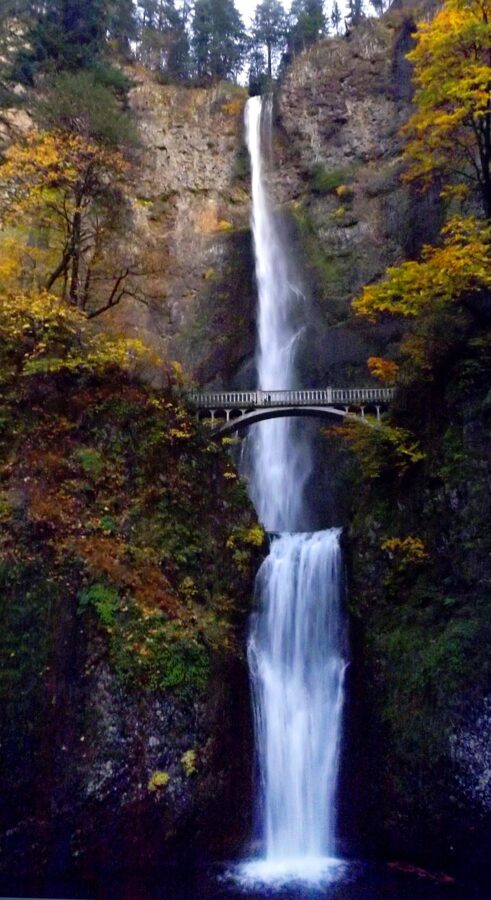
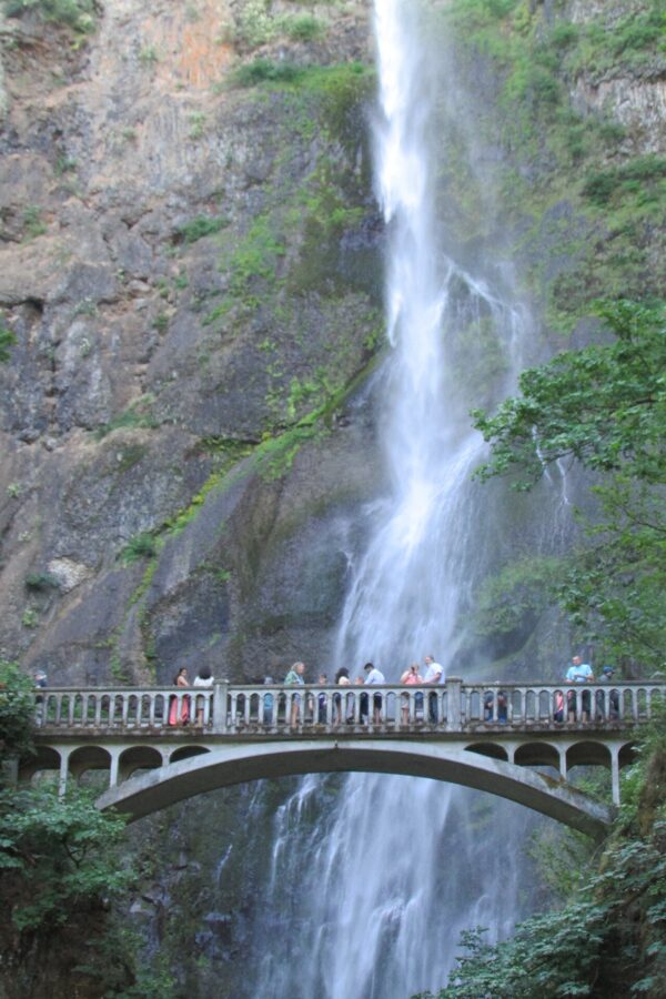
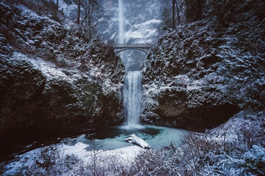
Multnomah Falls faces north. You stand on the plaza below it looking south, the sun sits somewhere behind 620 feet (189 m) of basalt, and for most of the year the face of the falls lives in open shade. That single fact decides how you photograph it: the best days here are the gray ones, and a bright blue afternoon gives you a white stripe of water between a black cliff and a burned-out sky.
It is also the most visited natural site in Oregon, more than two million people a year by the Forest Service’s count, and the access rules have changed to match. In summer you need a timed permit to park at the freeway lot, the old highway has its own rules, and the restrooms in the lodge have been closed for renovation through November 2026. Below is how to get there, where to stand, when the water and the light are worth the trip, and which of the other waterfalls along the Historic Columbia River Highway deserve the extra hour.
Contents6 parts
Why a creek falls 620 feet here
The cliff is layered basalt. Between roughly 17 and 12 million years ago, lava flows of the Columbia River Basalt Group flooded this part of the Northwest one sheet at a time, and the rock at Multnomah Falls belongs to the Grande Ronde Basalt, the thickest part of that pile. The flows cooled into the vertical columns and ledges you can see in the cliff walls, and each ledge is a place where water can drop.
The drop itself came later. About 15,000 years ago, at the end of the last ice age, the Missoula Floods tore down the Columbia over and over, scouring the Gorge walls into near-vertical cliffs. Side streams like Multnomah Creek were left hanging high above the new river, and they have been falling off the edge ever since. The bedrock tilts slightly to the south, so the Oregon side stayed steep while the Washington side slumped into landslides, which is why most of the Gorge’s big waterfalls are on the Oregon shore.
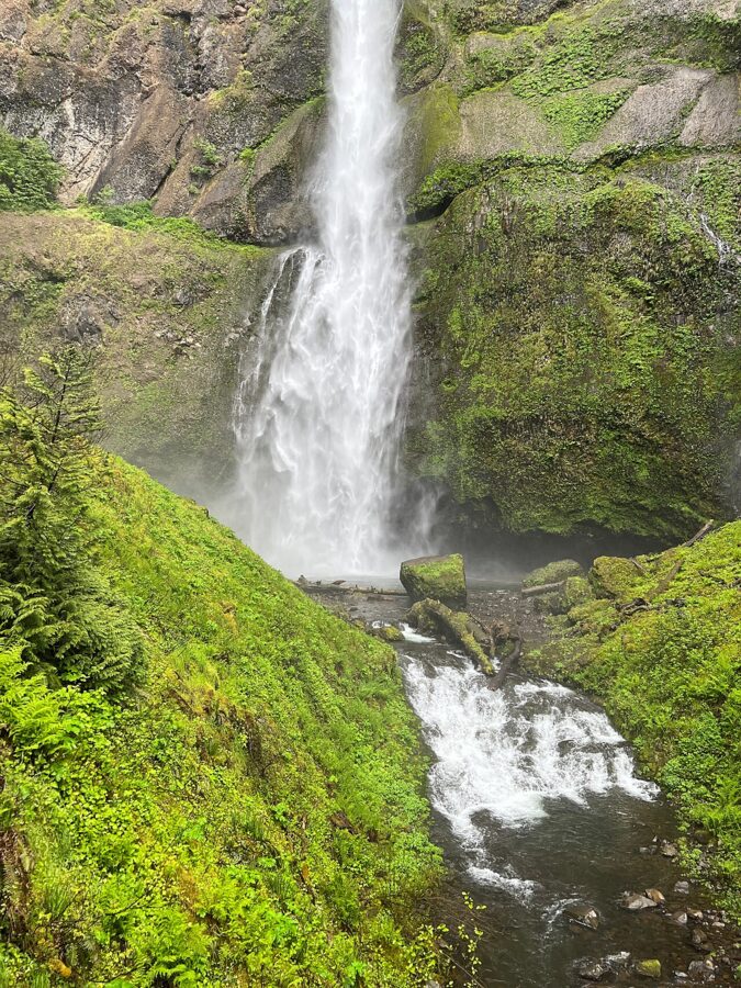
The numbers you will see on signs are 542 feet (165 m) for the upper falls, 69 feet (21 m) for the lower, and 620 feet for the whole thing including the short rapid between them. Springs on Larch Mountain feed the creek, so it runs all year, and rain and snowmelt push the flow highest in winter and spring.
The cliff is still moving. On Labor Day 1995 a slab estimated at 400 tons broke away from the face of the upper falls and fell into the pool below it. In January 2014 a falling boulder hit Benson Bridge itself and closed it until repairs were finished that May. The netting and fencing you see along the lower trail are there for the same reason.
The bridge and the trail, a century old
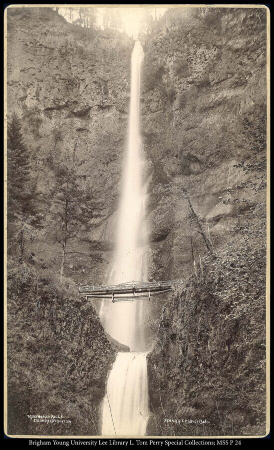
A log footbridge crossed the creek between the two tiers by the early 1880s, reached by a path from the train and steamboat landing on the river. It was gone before 1899. In August 1914, while the new Columbia River Highway was being built, the present concrete footbridge went up in a single continuous pour that took between 24 and 36 hours, and it was named for Simon Benson, the lumberman who bought much of this land and gave it to the City of Portland.
The highway opened to cars on July 6, 1915. Its engineer, Samuel Lancaster, had already pitched a trail from the base of the falls to the top of Larch Mountain, and Portland businessmen raised money for it with a musical comedy and a railroad excursion. The Forest Service built the trail that summer and dedicated it at the Larch Mountain lookout on October 3, 1915. You still walk it today as Larch Mountain Trail #441.
Getting there: Exit 31, the old highway and the bus
Multnomah Falls is about 30 miles (48 km) east of downtown Portland, and there are three ways in. Which one you use, and when, decides whether you need a permit.
Interstate 84, Exit 31
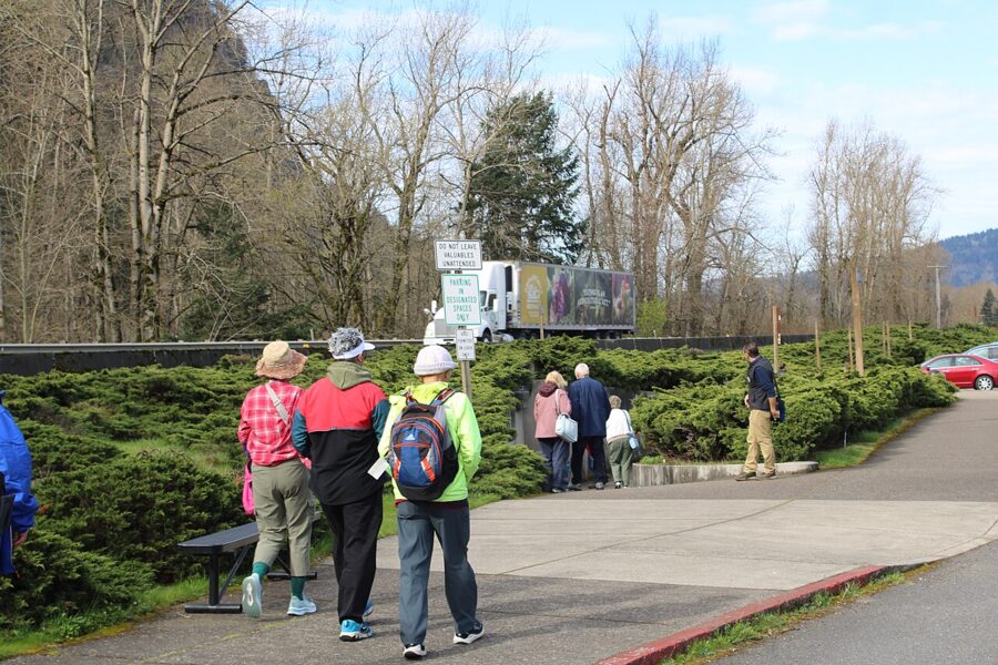
The big free parking lot sits between the lanes of Interstate 84 at Exit 31. The exit leaves from the left lane, not the right, which catches people out every day, so move over early. A pedestrian underpass takes you from the lot under the freeway and the railroad to the lodge in a few minutes.
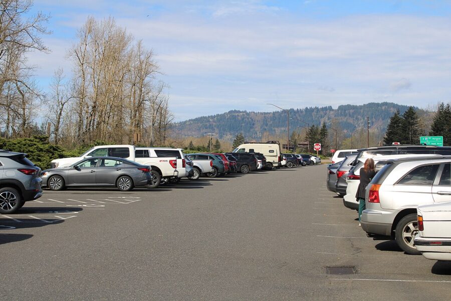
The lot closes itself when it is full: barriers come down at the entrance, and the Forest Service asks you not to try to enter when they are down. On busy summer days it can happen early. Oregon’s TripCheck site has live parking information and cameras, and it is worth checking before you leave Portland.
The summer timed-use permit
From May 22 to September 7, 2026, every car parking at the Exit 31 lot between 9 a.m. and 6 p.m. needed a timed-use permit from Recreation.gov. The permits were not sold on site. Dates for 2027 had not been announced as of November 2026, but the season has run from late May to early September, so plan on something similar.
| Rule (2026 season) | Detail |
|---|---|
| Dates and hours | May 22 to September 7, daily, 9 a.m. to 6 p.m. |
| Where it applies | The I-84 Exit 31 lot only |
| Cost | $2 transaction fee per vehicle on Recreation.gov |
| Booking | 14 days ahead at 7 a.m. Pacific, rolling; a second release 2 days ahead at 7 a.m. |
| Limit | Two permits per day; one permit covers one vehicle and one one-hour arrival slot |
| Arrival | Not before your slot; the permit expires an hour after the listed time. You can stay as long as you like once in. |
| Free permits | A limited number, first come, first served, at the Gateway to the Gorge Visitor Center in Troutdale and the Cascade Locks Historical Museum |
| No permit needed | Before 9 a.m., after 6 p.m., outside the season, on a bicycle, on the Columbia Gorge Express, the Gray Line trolley, the Sasquatch Shuttle or a similar tour shuttle |
A permit does not guarantee a space. It only lets you join the line at your hour. If you can arrive before 9 a.m., do that: you skip the permit, the light is softer, and the plaza is quiet.
The Historic Columbia River Highway
The old road, US 30, runs right past the front of the lodge. Recreation.gov listed no timed-use permit for it in 2026, but the parking there is tiny: a small private lot in front of the lodge, operated for a fee by the Sasquatch Shuttle on a first-come basis, with a few ADA spaces. When it is full you cannot stop or wait on the highway, and illegally parked cars get ticketed or towed.
Most of the highway has been through construction lately. The 1914 viaduct just east of the falls was closed for repairs from October 2025 and reopened on May 15, 2026; both viaducts are open to vehicles under 35 feet long and to bicycles. As of November 20, 2026, the Oregon Department of Transportation listed no traffic impacts on the road. Larch Mountain Road, the side road up to the summit viewpoint, closes every year at milepost 10 from November to late May or early June.
Without a car
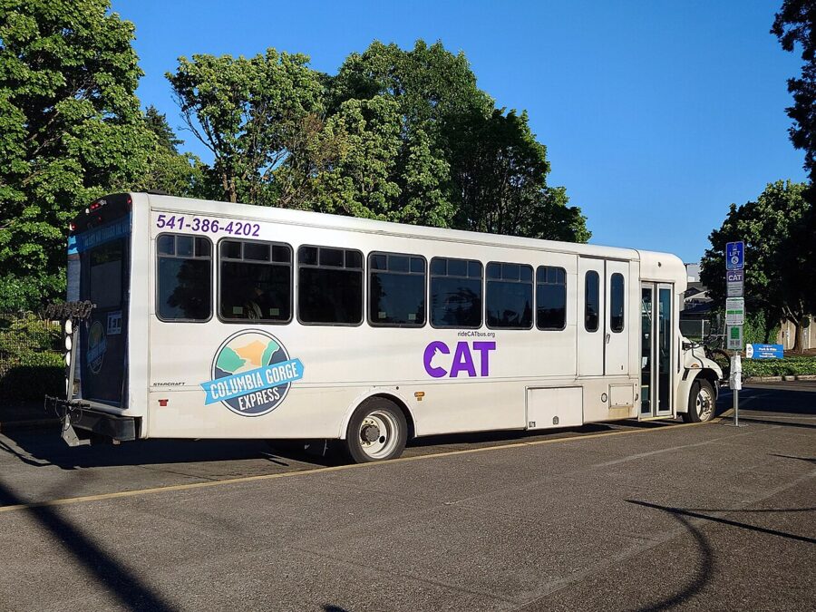
The Columbia Gorge Express bus runs seven days a week from Portland’s Gateway Transit Center to Troutdale, Multnomah Falls, Cascade Locks and Hood River. The fare between Portland and Hood River was $10 one way as of November 2026, and the summer and fall 2026 timetable stopped at the falls eight times a day in each direction. Riders need no timed permit. One caution from the operator: on the most crowded days the bus may skip the Multnomah Falls stop for safety and carry you on to Cascade Locks, so a weekday morning bus is the safe bet.
The plaza, Benson Bridge and the trail to the top
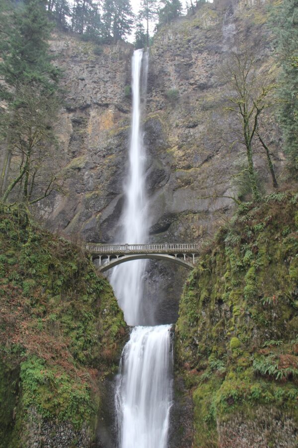
From the underpass you come out at the lodge, and a short walk brings you to the lower viewing plaza, which is paved and wheelchair accessible. This is where the full height of both tiers fits into one view. Spend your first ten minutes here before you start up anything.
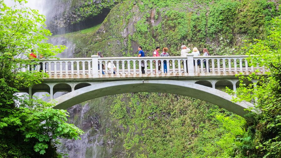
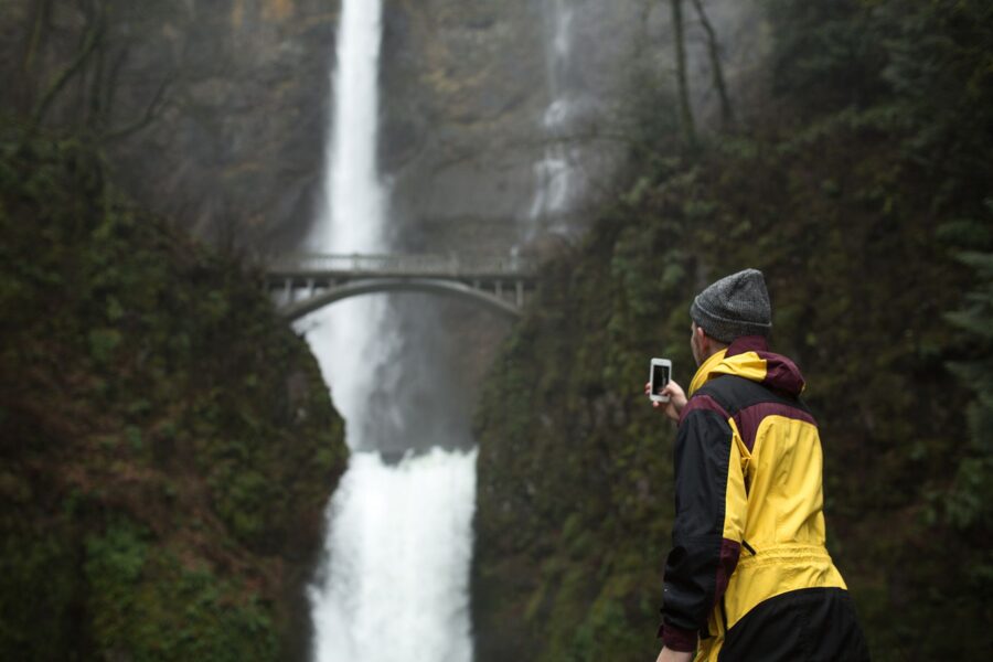
Benson Bridge is about a fifth of a mile up the paved trail from the plaza, a few switchbacks and a gentle climb. It crosses the creek just above the lower falls, with the upper falls pouring into its pool in front of you. Expect spray on everything, including your lens, and expect to share the deck with a lot of people.
To the top of the falls
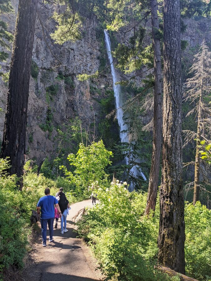
Past the bridge, Larch Mountain Trail #441 climbs a series of paved switchbacks up the cliff to the east of the falls; there are eleven, and signs count them for you. The round trip from the plaza to the overlook at the top is 2.4 miles (3.9 km) with about 600 feet (183 m) of climbing, which the Forest Service compares to 60 flights of stairs. It is steep, uneven in places and crowded for most of its length, so wear proper shoes and carry water.
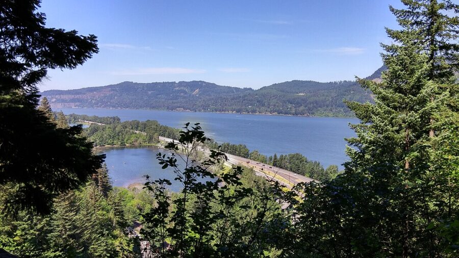
At the top a short spur drops to a platform at the lip of the upper falls. You look straight down the 542-foot drop to the lodge roof and the parking lot, and out across the river. I would not climb for a picture of the falls themselves, which you barely see from up here; climb for the river view and the creek above the lip.
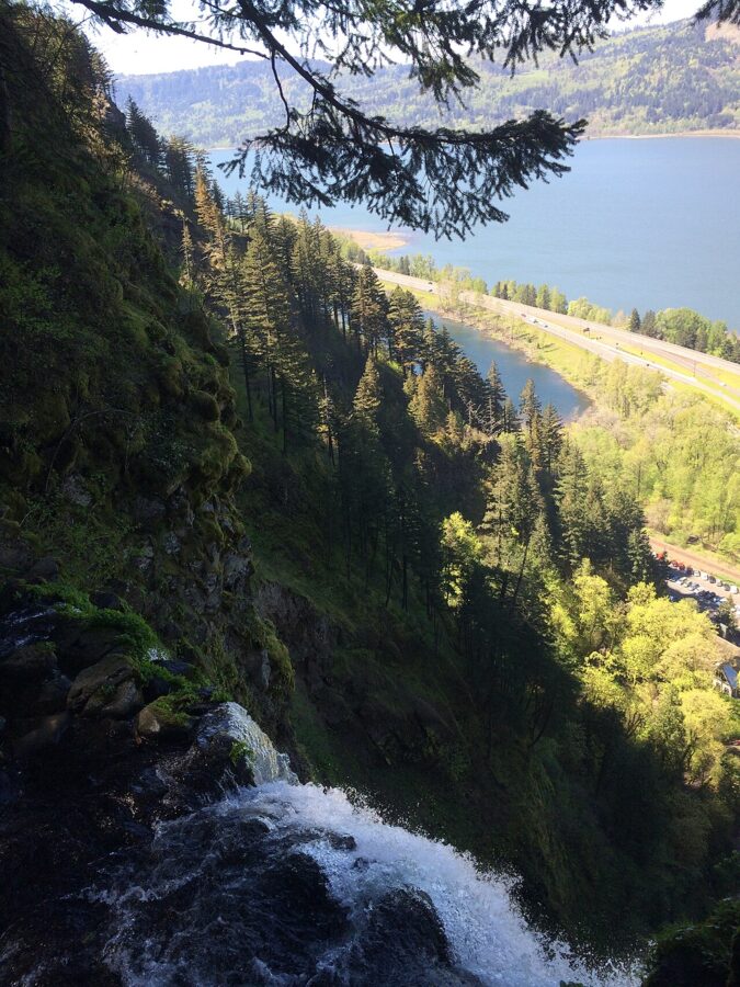
As of November 2026 the trail was open, with no closure listed by the Forest Service. Two things can change that. In icy weather the Forest Service closes the Multnomah Falls trail, unlike the nearby Wahkeena Trail, which stays open and on which you need traction devices. And from time to time it shuts for maintenance or search and rescue training, so check the Columbia River Gorge National Scenic Area alerts page the morning you go.
If you want more, keep going. The trail continues past two more waterfalls on the upper creek to Larch Mountain, 6.8 miles from the falls, and a popular loop of 4.8 miles links the lower 1.2 miles of this trail with the Wahkeena Trail and the Return Trail, passing Fairy Falls on the way back down to the old highway.
Photographing Multnomah Falls
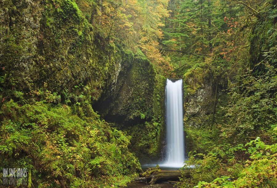
The falls face north, which works for you and against you. You never get direct morning or evening light on the water, and there is no sunrise or sunset shot at the falls themselves. What you do get is even, soft light on cloudy days, and the Columbia River Gorge supplies a lot of those.
The classic frame
Stand on the lower viewing plaza, near the middle of the railing, and shoot vertical. To get the top of the upper falls, the bridge and the lower pool in one frame you need about a 24mm equivalent on a full-frame camera, or the ultrawide on a phone. Step back toward the lodge if the crowd at the rail is thick; you lose a little of the pool and gain a clean foreground.
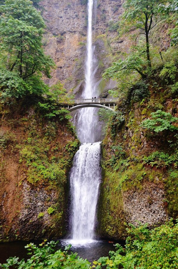
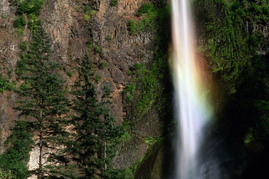
The hard part is the contrast. On a sunny day the rim of the cliff and the sky are bright and the base is in shade, so expose for the water and let the sky go, or bracket and blend. A polarizer cuts the glare off wet rock and leaves and deepens the greens, and it costs you about a stop and a half, which you will be glad of if you want a slower shutter.
Long exposures
Water this tall looks best somewhere between a quarter of a second and two seconds: long enough to soften the falls, short enough to keep some texture. On an overcast morning at ISO 100 and f/11 you will often get there without a filter. On a bright day, or for anything longer, a six- or ten-stop neutral density filter does it.
A tripod is the real problem, because the plaza and the bridge are crowded and narrow. Set up at the edge of the plaza, not in the middle of the walkway, and leave the tripod off Benson Bridge entirely unless you are there at opening time. One trick: with a ten-stop filter and an exposure of 20 or 30 seconds, people walking across the bridge blur into faint ghosts or vanish, while anyone standing still stays sharp.
Season and flow
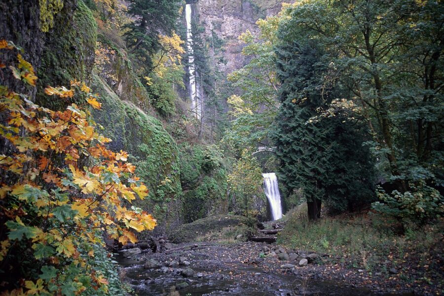
Water is highest from late fall to spring. December through April is when the upper falls look thickest and the lower pool churns; by late summer the flow thins to a ribbon and the permit system is running. If I could come only once, I would come on a cloudy weekday in late October or early November: autumn color is still on the bigleaf maples around the base, the flow is back up after the first rains, and the crowds and permits are gone.
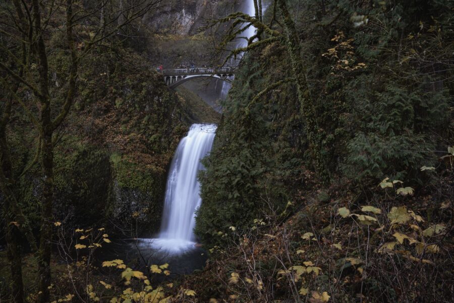
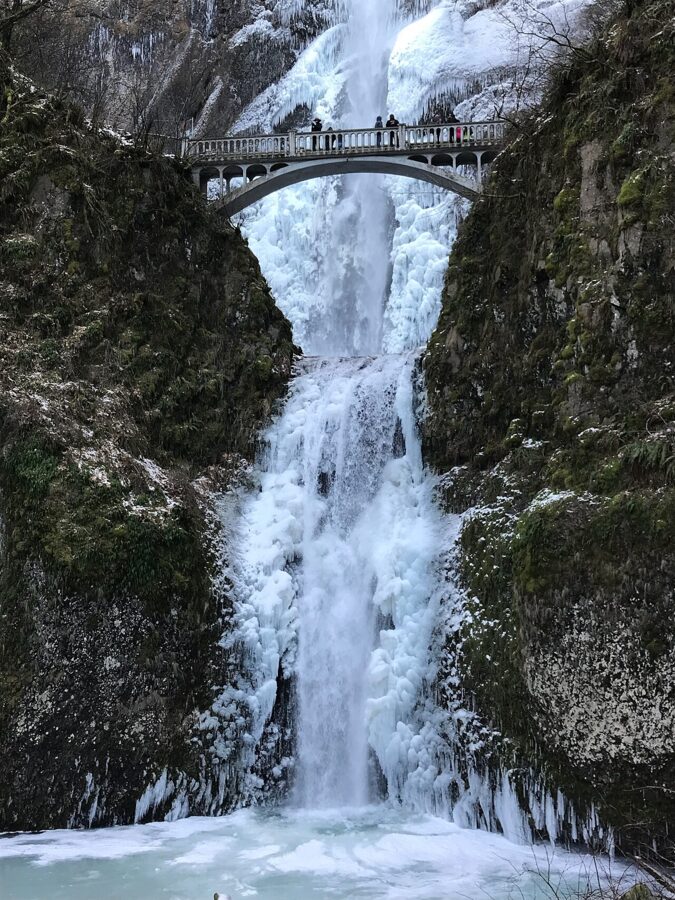
Winter can deliver ice. Every few winters a long cold spell freezes the spray into columns and lids the pool, as in December 2013 and again in early 2019. When that happens the trail closes, the plaza gets slick, and the old highway can be icy too. Watch the Portland forecast for a run of nights well below freezing and go the morning after.
Crowds and timing
Expect company. More than two million people a year come through, and the Forest Service warns of high-density crowds on the first mile and a half of the trail. The quiet hours are the first ones: before 9 a.m. in permit season, when you also skip the permit, and on weekday mornings the rest of the year. Evenings after 6 p.m. in summer are calmer too.
Sun times change fast through the year at this latitude, and the high walls block the low winter sun for much of the day, so check a sun calculator for your date before you plan around light on the cliff tops. Drones are not an option: the Forest Service prohibits drone takeoffs and landings here.
Other angles worth the walk
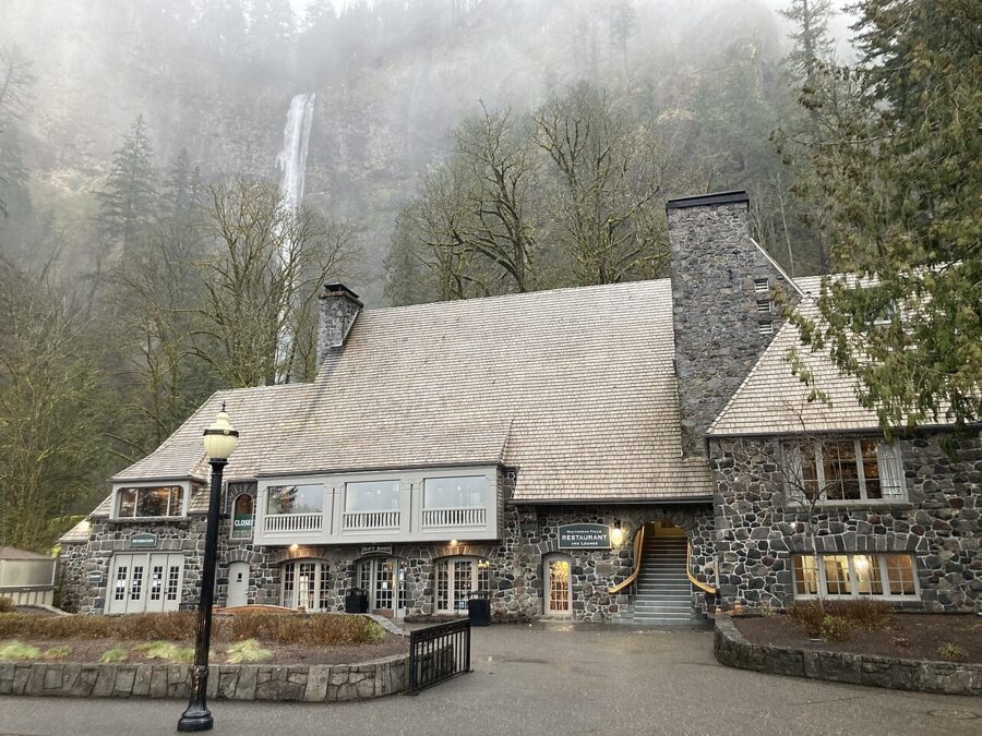
From the walkway in front of the lodge, the stone gables and the upper falls line up, which is a better picture than most people realize and one you can take without joining the crowd at the rail. From the Historic Columbia River Highway just east of the lodge you can see the full height through the trees. And from Benson Bridge itself, a wide lens pointed straight up the upper falls gives you the scale of the drop that the plaza flattens.
The waterfall corridor on the historic highway
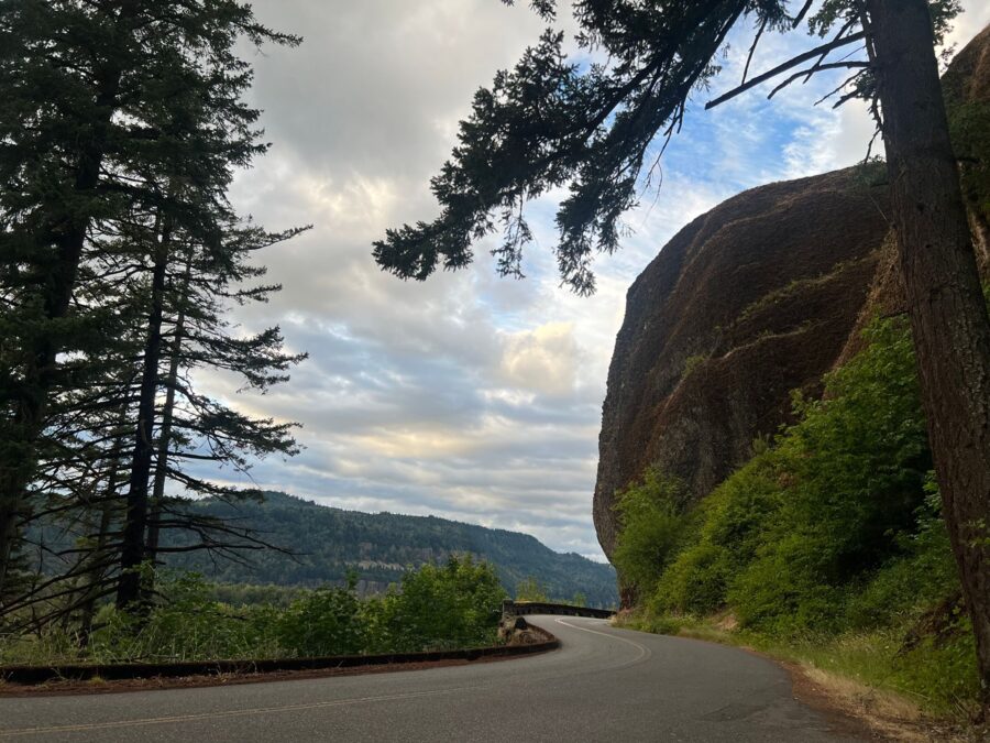
Multnomah is the tallest, but the old highway between Corbett and Dodson passes a string of falls, most a short walk from the road. Driven west to east they read like this, with distances measured from Multnomah Falls on the Forest Service’s waterfall loop map. Two of the stops, Latourell and Bridal Veil, are Oregon state parks that began charging day-use parking on March 30, 2026: $10 per vehicle for Oregon residents and $12 for out-of-state visitors, good at any state park that day.
Portland Women’s Forum viewpoint and Vista House
At Chanticleer Point, about 9.5 miles west of Multnomah, the Portland Women’s Forum State Scenic Viewpoint looks east up the Gorge to Crown Point and Vista House. Because you are facing east, this is an afternoon and evening view: the sun drops behind you and lights the cliffs, the river and the little domed building on its point. It is the best-known view of the Gorge, and a short telephoto is all it needs.
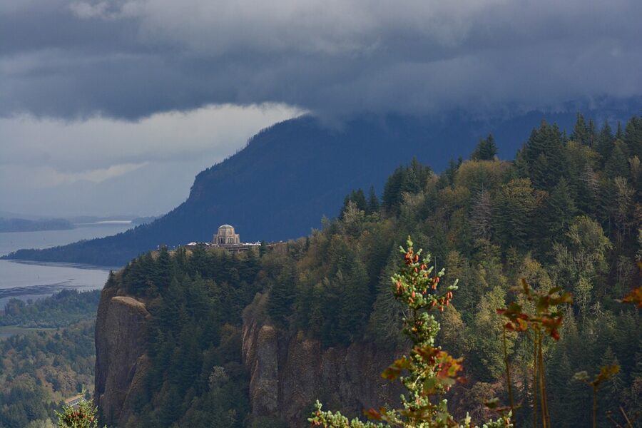
Vista House itself stands on Crown Point, about 725 feet above the river. Edgar M. Lazarus designed it as a rest stop and memorial to Oregon’s pioneers; work began in late 1916 and it was dedicated on May 5, 1918. The Friends of Vista House list it open Friday through Monday from 10 a.m. to 4 p.m., weather permitting, and close it when winds exceed 50 mph, which on this point happens more than you would think.
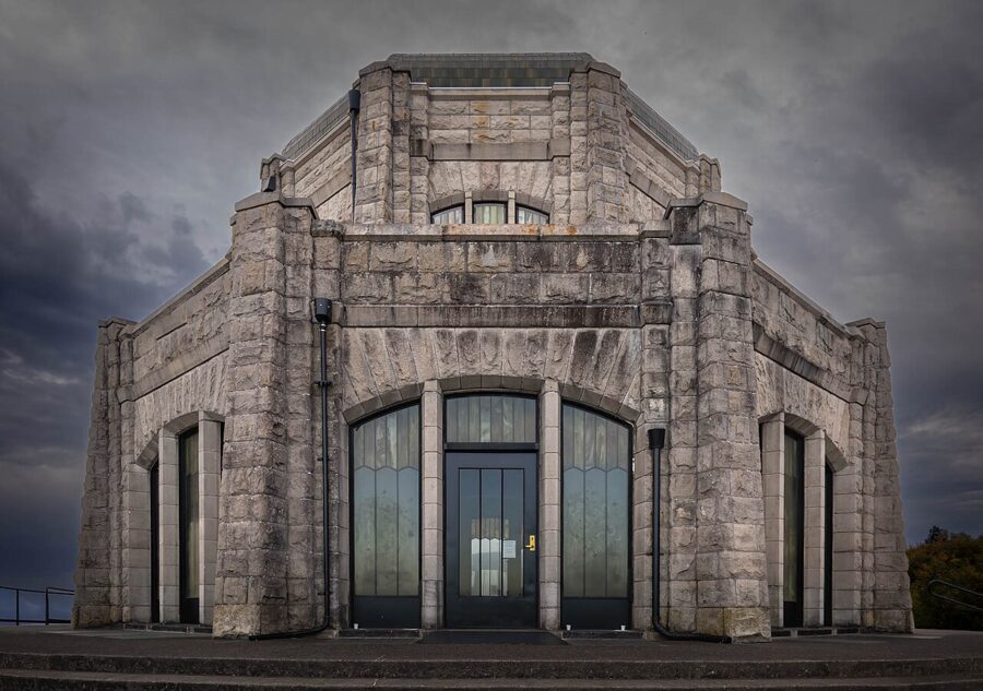
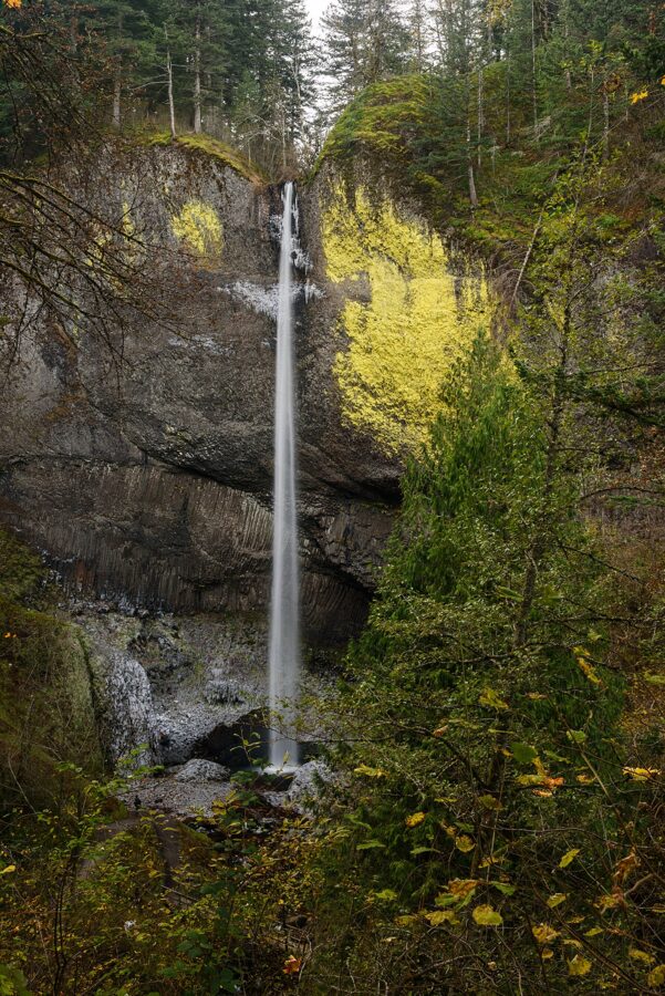
Latourell Falls
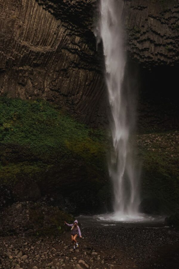
Latourell Falls, at Guy W. Talbot State Park about 6 miles west of Multnomah, drops in a single plunge over a wall of columnar basalt streaked with yellow-green lichen. Oregon State Parks gives the height as 224 feet; other sources say 249. A short walk from the lot under a 1914 highway bridge takes you to the base, and a 2-mile loop climbs to Upper Latourell Falls.
Shepperd’s Dell and Bridal Veil
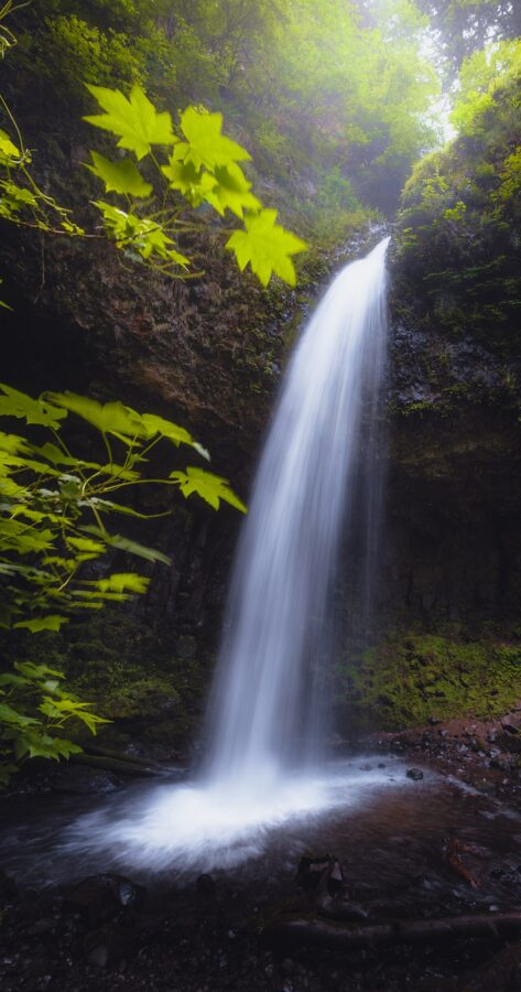
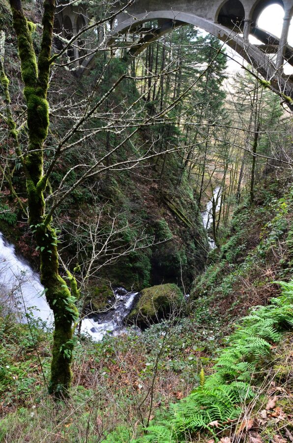
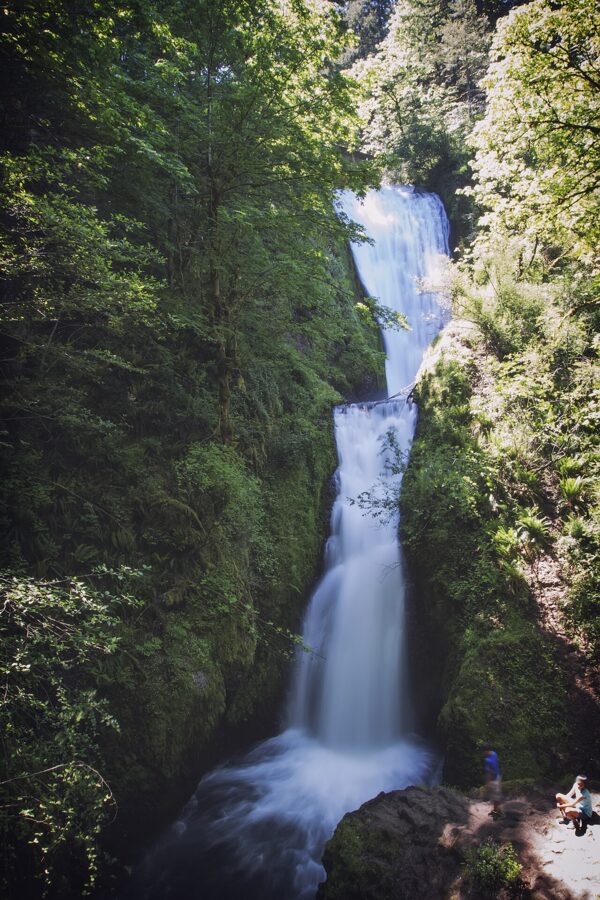
Shepperd’s Dell, about 5 miles west, is a two-tier fall in a tight green cleft, seen from the highway bridge that crosses it and from a short path down from the road. Bridal Veil Falls State Scenic Viewpoint, about 3.5 miles west, has a short trail down to the base of its lower tier, and a separate short path to an overlook above the river.
Wahkeena Falls
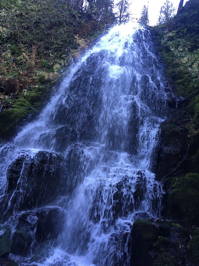
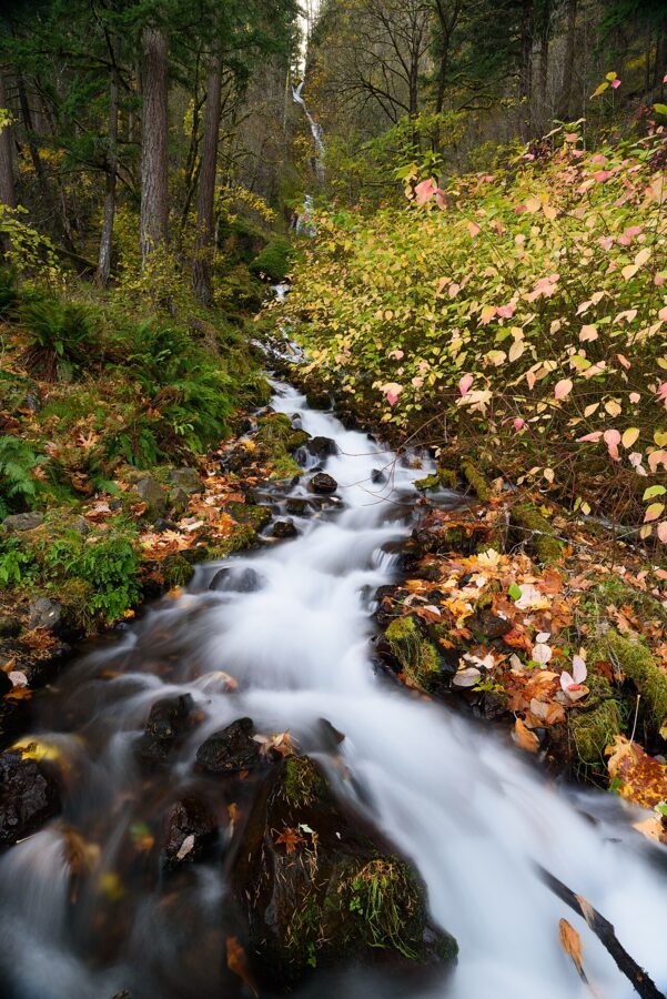
Half a mile west of Multnomah, Wahkeena Falls tumbles 242 feet through a forested ravine in a series of steps rather than one clean drop. The name is said to come from a Yakama word meaning “most beautiful.” It is visible from the viewing area at the picnic site on the highway, and the Wahkeena Trail climbs beside the falls to Fairy Falls, a small fan of water 1.1 miles up. Simon Benson gave this land to Portland along with Multnomah in 1915.
Oneonta, Horsetail and Ponytail
East of Multnomah, Oneonta Gorge, the narrow slot canyon people once waded up, has been closed since the 2017 Eagle Creek Fire, and a Forest Service closure is still posted on the Scenic Area’s alerts page. Don’t go past the gate.
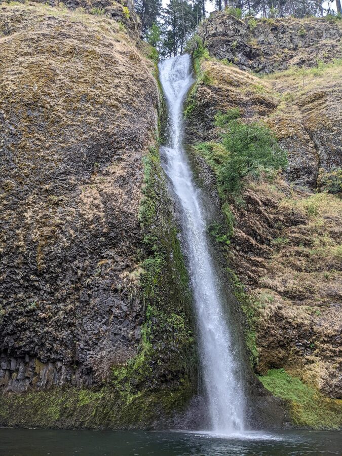
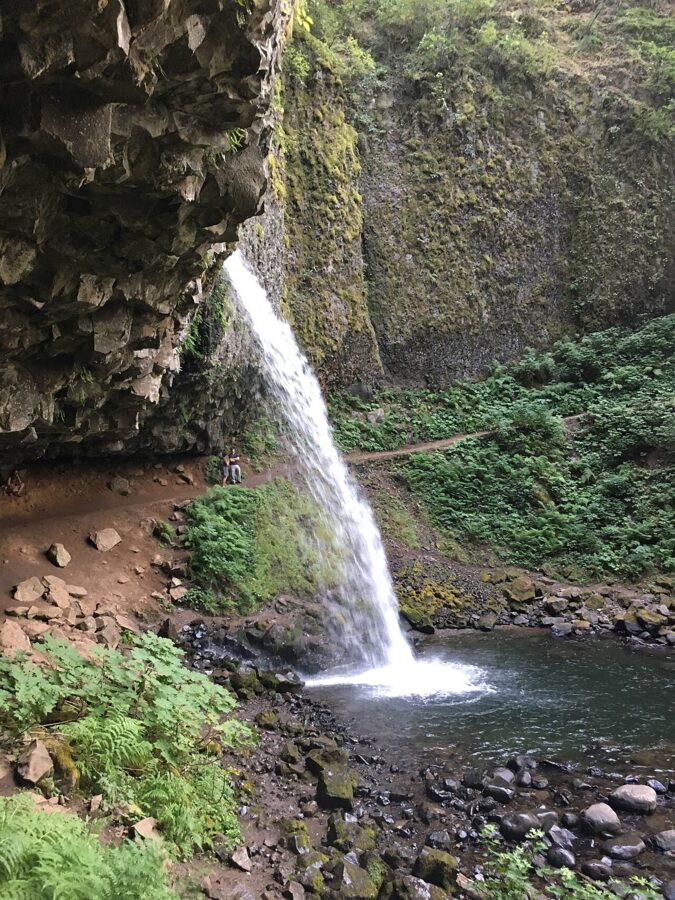
Horsetail Falls, under 3 miles east, plunges 176 feet in plain view of the road, with a turnout beside it. The Horsetail Falls Trail climbs steeply from there to Ponytail Falls, where the path runs behind the water through a hollow in the basalt.
The lodge, the season and how long to allow
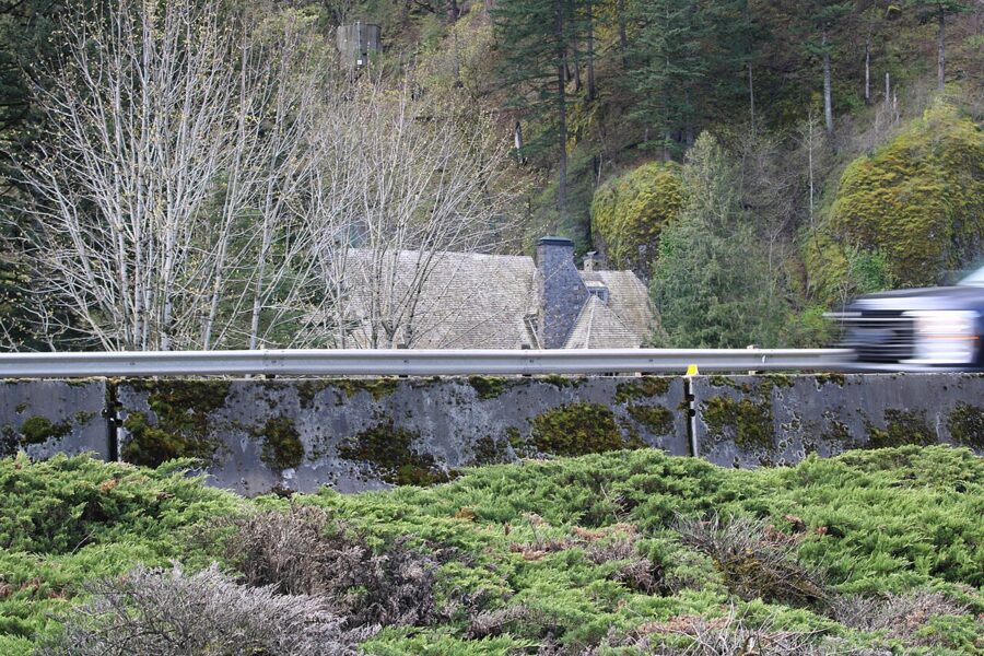
The City of Portland built Multnomah Falls Lodge in 1925 to serve the motorists the new highway brought. A. E. Doyle, one of Portland’s leading architects, designed it in split fieldstone of black, gray and red with steep shingled roofs, and the Waale-Shattuck Company built it for $40,000. It is on the National Register of Historic Places and marked its centenary in 2025.
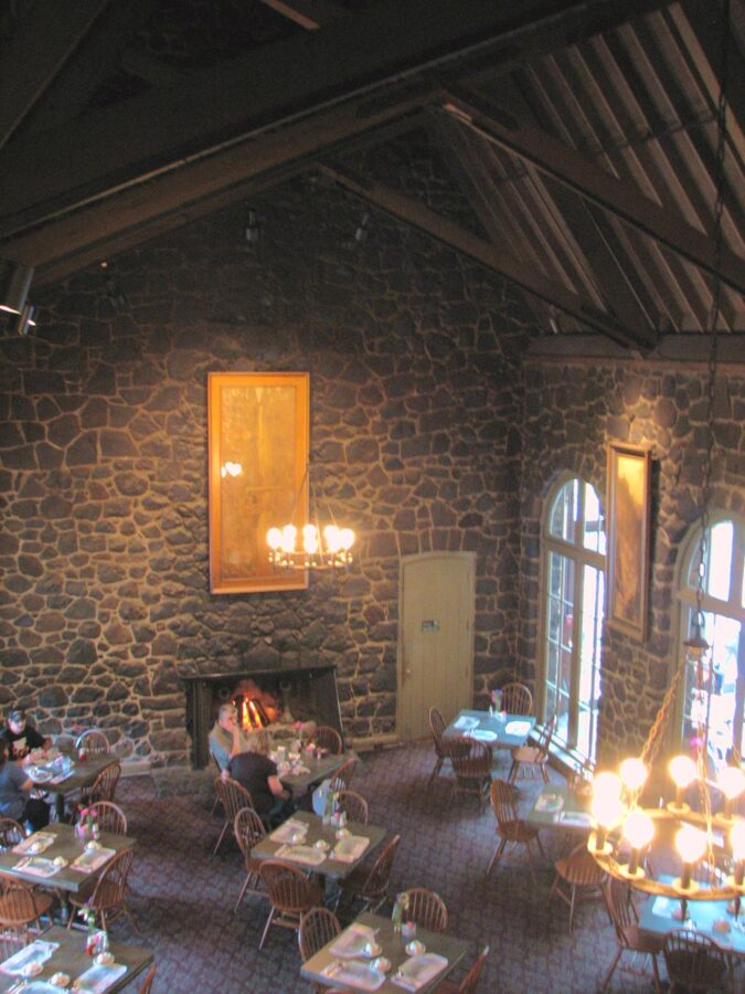
Inside, the ground floor holds a Forest Service visitor center, a snack bar and a gift shop, with a restaurant upstairs. The lodge website lists hours of 9 a.m. to 6 p.m. Monday to Friday and 8 a.m. to 6 p.m. on weekends, and suggests reservations for the restaurant. The lodge reported in November 2026 that renovations had put the elevator to the restaurant out of use. The Forest Service lists the visitor center as staffed daily from 10 a.m. to 2 p.m., jointly with volunteers from the Friends of Multnomah Falls.
The public restrooms in the lodge were closed for renovation through November 2026, with a limited number of portable toilets on site, so plan around that if you go before work is finished. Drinking water is available, including a bottle filler near the elevator.
When to go and how long to stay
For the falls alone, allow 45 minutes to an hour for the plaza, the bridge and the lodge, and about two hours if you climb to the top. A morning on the corridor, with Multnomah, Wahkeena, Latourell and Horsetail, fills three to four hours with short walks; add Vista House on a Friday to Monday and the Women’s Forum view in the afternoon and you have a full day out of Portland.
The rules to remember: keep dogs on a leash, leave bikes, e-bikes and scooters off the plaza and trails, stay on the paved paths and behind the railings, and don’t throw coins in the creek, where fish still spawn. Cell service is patchy along the corridor, so download your permit and a map before you leave Portland.
And pick a gray day. Get to the plaza before 9, stand at the middle of the rail, and take the vertical frame while the bridge is still empty; then climb, or drive west to Latourell while the clouds hold.