Stand on the Chicago Riverwalk at noon and every tower across the water is lit from the front. The river’s main stem runs east to west through downtown, so the buildings on its north bank face south and hold the sun most of the day, while you stand on the shaded south bank with the light behind you. That one fact decides where most of your river pictures get made.
Chicago is the city where the skyscraper grew up, and it still keeps the whole story within a short walk: Romanesque office blocks from the 1880s, Art Deco towers, Mies van der Rohe’s steel and glass, and the newer curves along the river. You can photograph almost all of it from public ground for the price of a transit fare. The paid extras, a boat on the river and an elevator to the 103rd floor, are worth it for different reasons, and I would pick by the light rather than by the ticket.
Work through the city the way the light does: the river in the afternoon, the Loop’s tracks and lobbies at midday, the lakefront at either end of the day, and the churches between services. Holy Name Cathedral is the one to plan around, because its hours and tours run on a parish timetable.
Contents8 parts
The river, bridge by bridge
The Chicago Riverwalk runs along the south bank of the main stem from Lake Shore Drive west to Lake Street, a little over a mile of terraces, piers and stairs below street level. It is free and open from 6 a.m. to 11 p.m. (as of November 2026). The city’s only stated rule for photographers is courtesy toward everyone else on it; restaurant and bar terraces can set their own policy, so ask before you shoot across someone’s table.
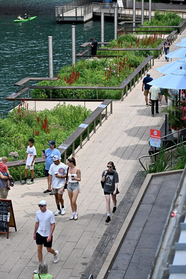
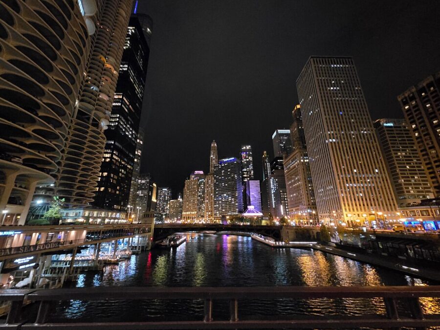
Work it from east to west in the late afternoon. The towers on the north bank, from the Wrigley Building to Marina City, take warm, low light on their south faces while the walk under your feet sits in shadow. At midday the same view still works because the light falls straight on the facades, which is rare in a downtown of tall buildings.
DuSable Bridge and the bridge lifts
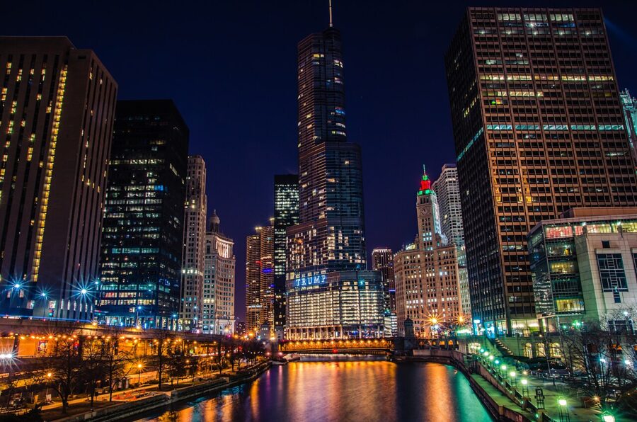
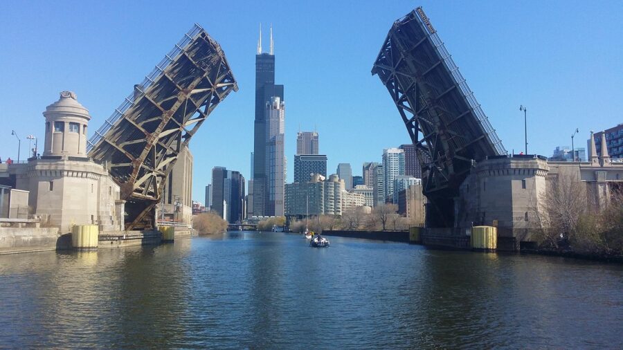
The DuSable Bridge carries Michigan Avenue over the river on two decks, and its four stone bridge houses are the best foreground on the main stem. The southwest tower holds the McCormick Bridgehouse and Chicago River Museum, which in 2026 opened from May 9 to October 25, Wednesday through Sunday from 10 a.m. to 5 p.m., on a pay-what-you-can basis with $5 to $10 suggested. It closes for the winter, so check the museum’s site for the 2027 season.
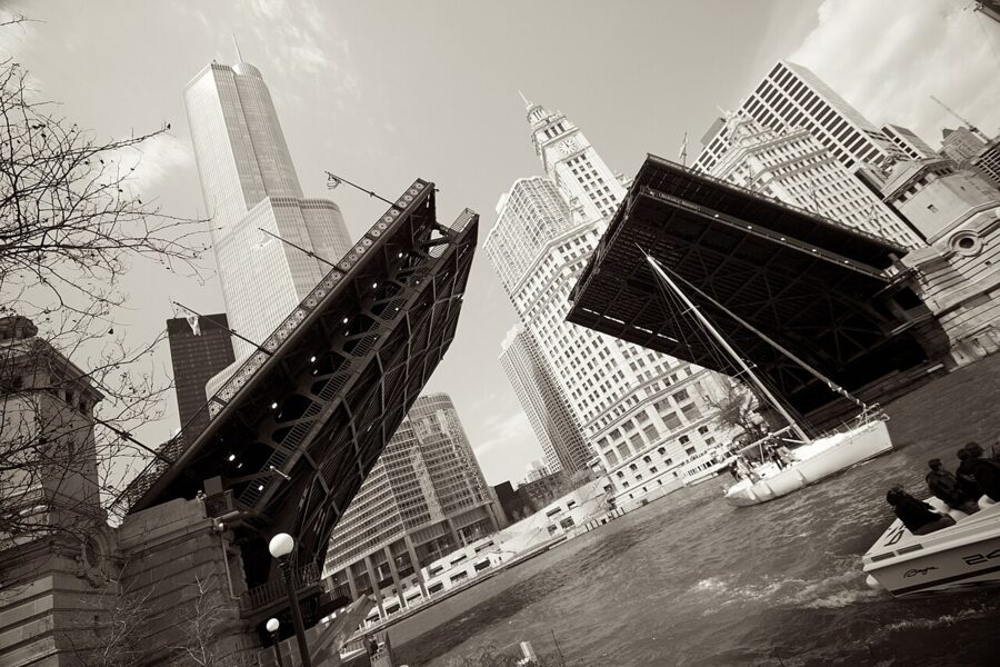
Twice a year the city raises its downtown bascule bridges one after another so sailboats can pass between Lake Michigan and boatyards upriver. The Chicago Department of Transportation began the 2026 spring lifts on April 22, and the fall run had eleven lifts between September 30 and November 14, mostly on Wednesdays at 9:30 a.m. and Saturdays at 9 a.m. Each bridge stays up for about 8 to 12 minutes, so pick one bridge and wait for the boats to arrive.
The department publishes each season’s schedule ahead of time. Stand on the Riverwalk or on the next bridge along, not on the bridge being lifted: the road and sidewalks close while it is up, and you want the whole leaf in the frame anyway.
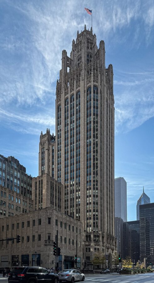
From the north end of the bridge the view runs up Michigan Avenue between the Wrigley Building and Tribune Tower. The Wrigley’s white terra cotta takes floodlights at night and morning sun from the east, and Tribune Tower’s Gothic crown is best from the plaza on its south side, looking up.
Marina City from State and Dearborn
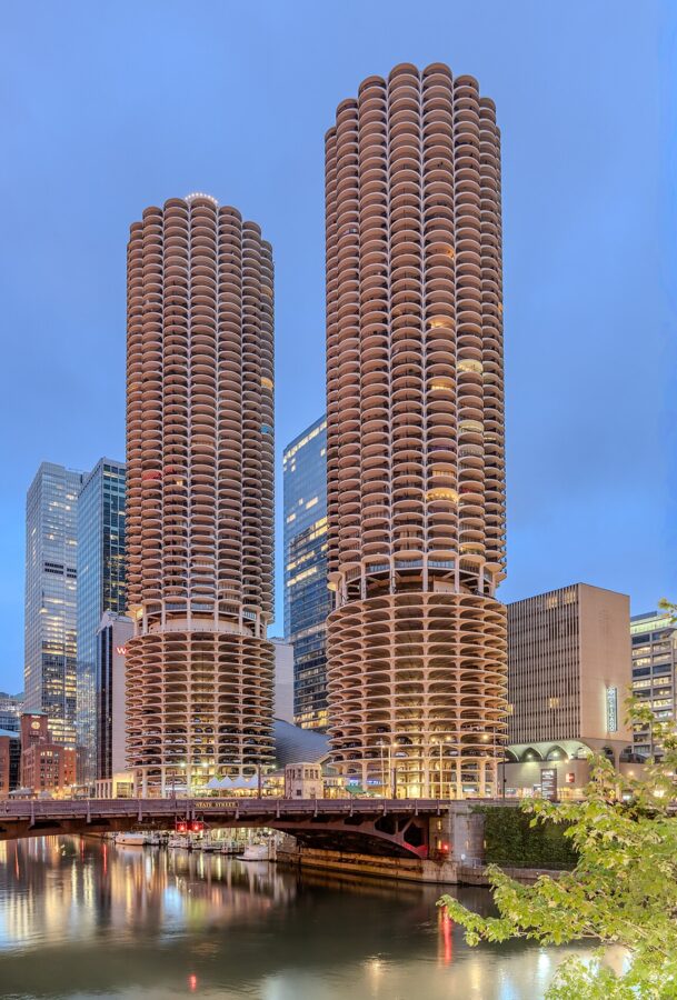
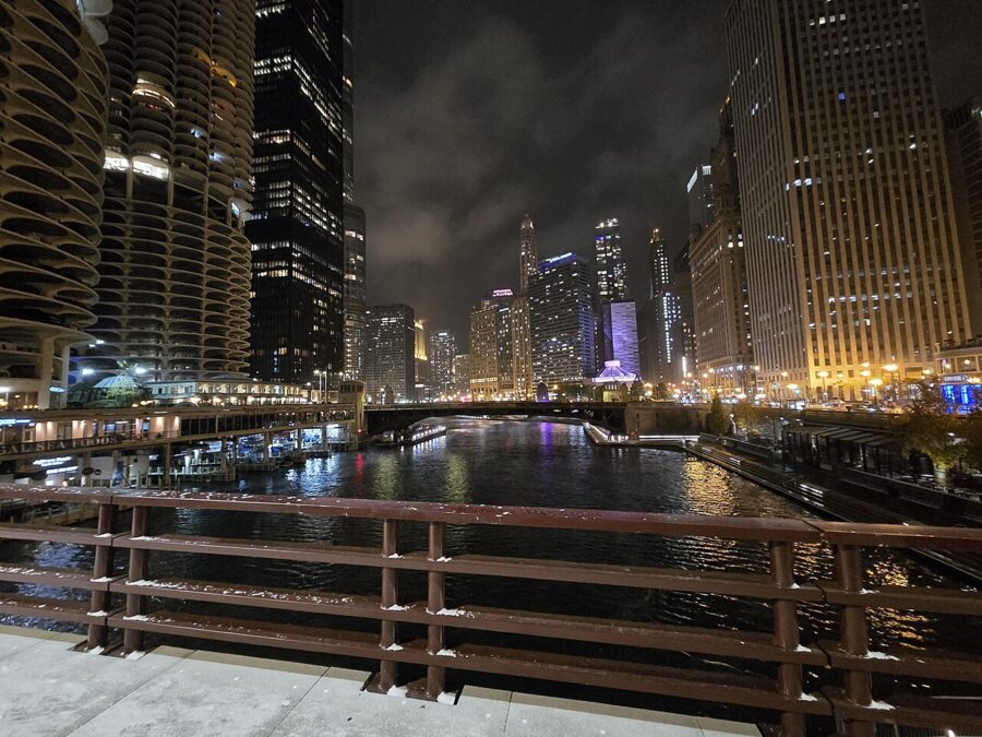
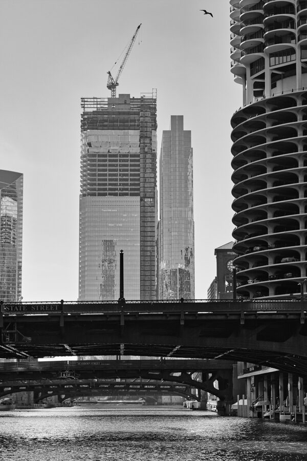
Marina City’s two round towers, opened in 1964, are easiest to read from the bridges on either side of them. The Riverwalk opposite puts them square across the water, and the State Street and Dearborn Street bridges give you angles from either side, with the river running away behind them. Before sunrise in summer, the eastern sky behind you lights their concrete balconies a soft blue.
The bend at Wolf Point
At the west end of the main stem the river splits into its North and South branches at Wolf Point, and the buildings bend with it. 333 West Wacker Drive curves its green glass along the river’s turn, and on a still evening its face mirrors the water and the towers opposite. Cross to the north bank by the Franklin Street Bridge for the whole curve with the river in front of it.
From the water: the architecture cruise
The Chicago Architecture Center’s river cruise aboard the boats of Chicago’s First Lady is the one tour I would book for pictures. It lasts 90 minutes, leaves from 112 E. Wacker Drive at the southeast corner of the Michigan Avenue bridge (look for the black awning over the stairs), and runs rain or shine. Tickets started at $57 as of November 2026, and the 2026 season ran from March 15 to November 22, so check the center’s site for 2027 dates.
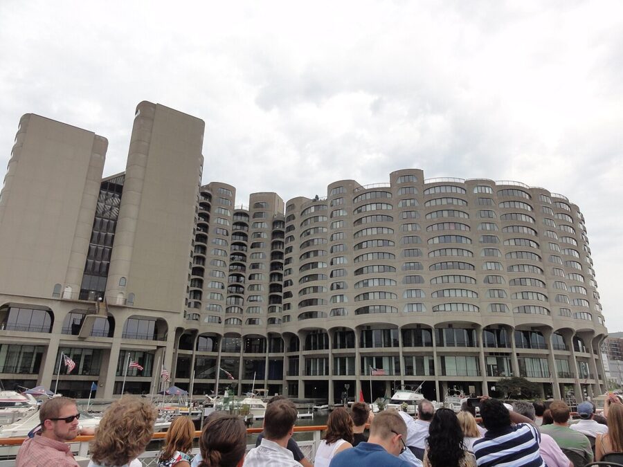
The boats have open-air upper decks, an open bow deck and a climate-controlled cabin, and the upper deck is where you want to be. The docents’ commentary on who built what helps you decide what to come back to on foot.
A boat solves the problem every street photographer has in Chicago: you can’t step back far enough. From mid-river the towers stand upright in the frame, and the branches show buildings you never see whole from the sidewalk. Use a wide lens and a fast shutter, since the boat is always moving.
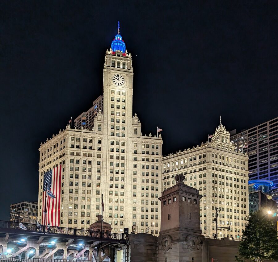
Choose the time by the light. A morning departure puts sun on the east-facing buildings along the South Branch, while a late-afternoon cruise lights the north bank of the main stem. The sunset and evening departures end in the blue hour, which is when the river looks most like Chicago.
Inside the Loop: tracks, canyons and lobbies
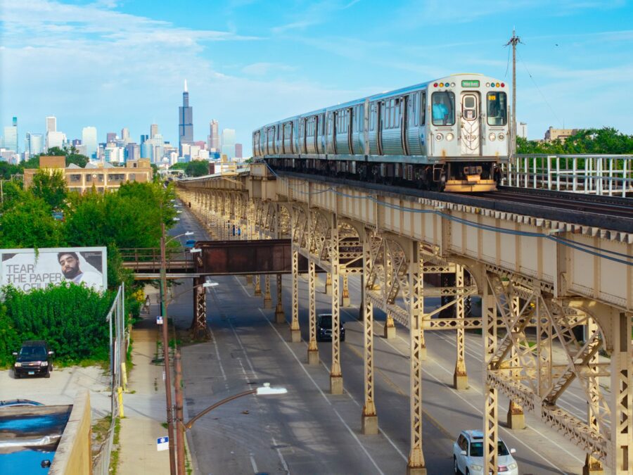
The Loop is named for the ring of elevated track that circles it, and the L is still the best moving foreground downtown. Trains cross at the four corners of the ring, and the southeast corner at Wabash and Van Buren is the busiest junction to watch. The crossover walkway at the Adams/Wabash station looks along the tracks toward it.
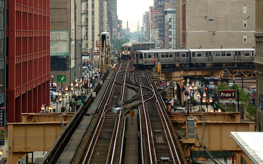
Down on the street, Wabash Avenue and Wells Street sit under the tracks, so trains pass overhead with steel columns striped by the light coming through the ties. A slow shutter of around a quarter second blurs the train while the structure stays sharp.
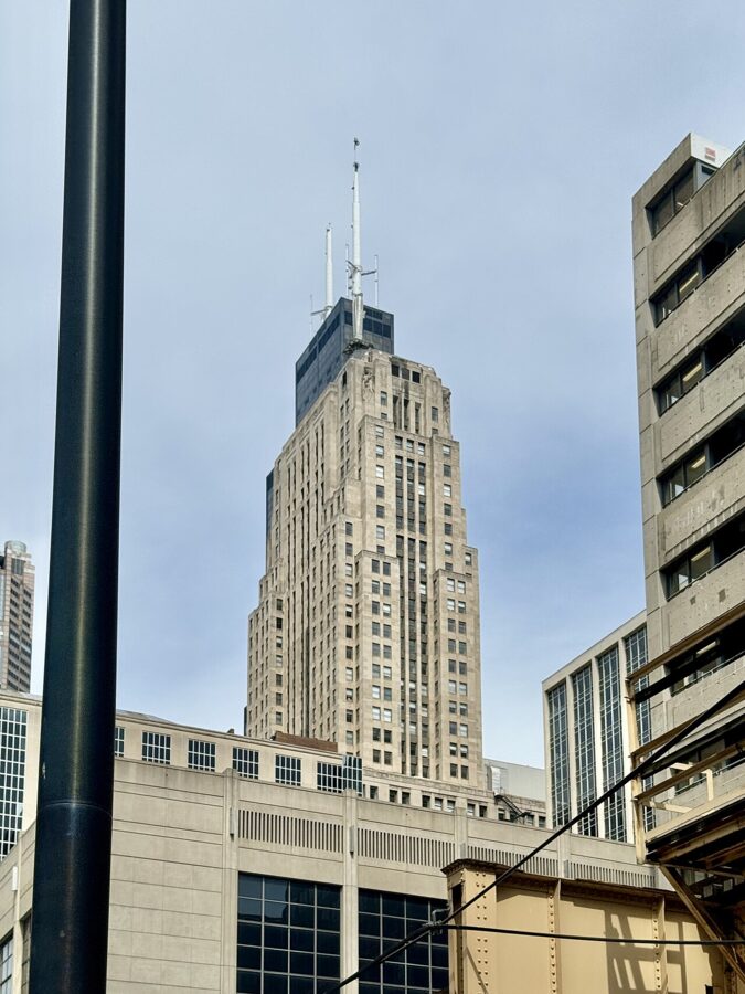
LaSalle Street is the Loop’s banking canyon, and the Chicago Board of Trade closes its south end at Jackson Boulevard. The Art Deco tower by Holabird and Root went up between 1925 and 1930, with a statue of Ceres, the goddess of grain, on the roof. Shoot it from the corner of LaSalle and Monroe or Madison, on a telephoto, so the street walls close in around it.
The Rookery and the Tiffany dome
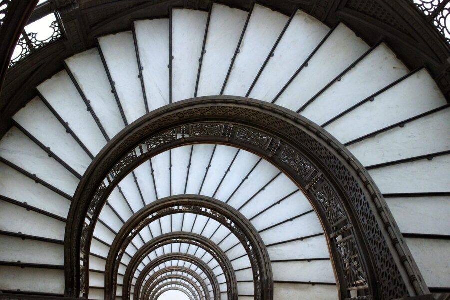
One block north, at 209 S. LaSalle, the Rookery holds the best free interior in the Loop. Burnham and Root finished the building in 1888, and Frank Lloyd Wright redesigned its two-story, skylit lobby in 1905. The light court is open to the public Monday through Friday from 7 a.m. to 6 p.m. and Saturday from 8 a.m. to 2 p.m., closed Sundays; enter by the Adams Street door.
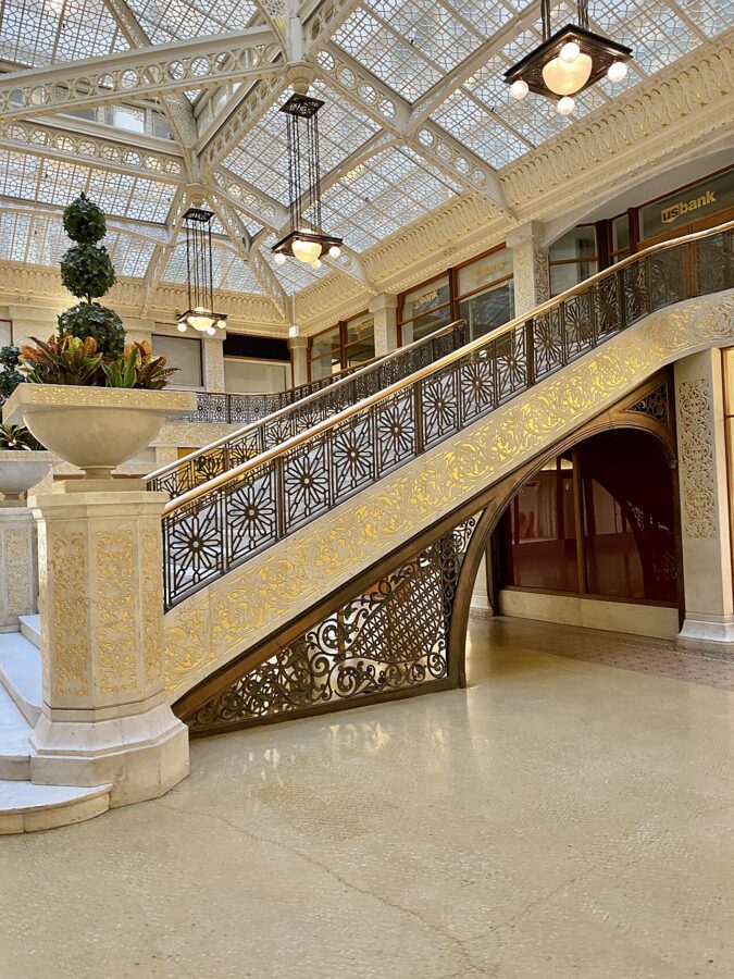
The court is bright enough that handheld works fine. Guided tours through the Frank Lloyd Wright Trust go beyond the lobby; book on the trust’s site, and note that still photography is allowed on its tours.
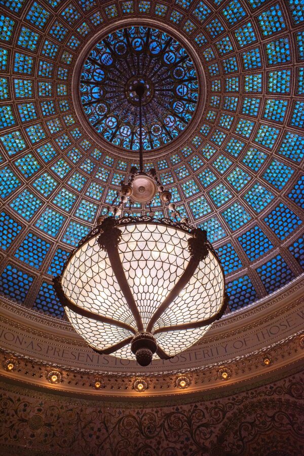
Over on Michigan Avenue, the Chicago Cultural Center at 78 E. Washington Street opened in 1897 as the city’s central library. Climb to Preston Bradley Hall on the third floor for the Tiffany glass dome, 38 feet across, glowing over white marble. The building is free and open daily from 10 a.m. to 5 p.m. (as of November 2026), closed on major holidays.
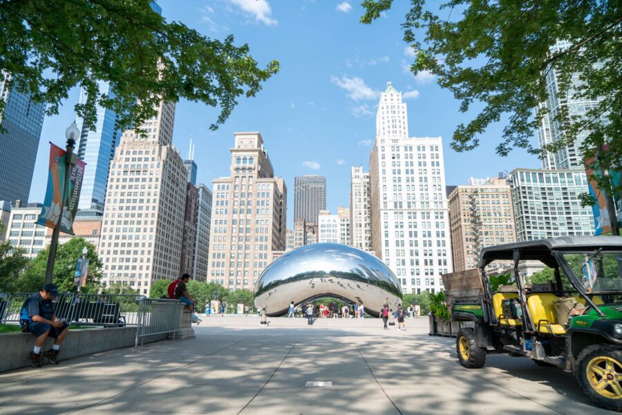
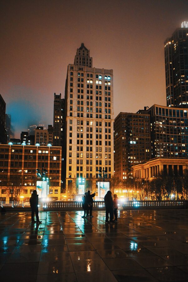
Across the street, Cloud Gate in Millennium Park bends the Michigan Avenue skyline around its steel skin. The park is open daily from 6 a.m. to 11 p.m., and the plaza is quietest in the first hour after opening. Walk underneath the sculpture into the omphalos, the hollow in its underside, and the reflections fold back on themselves.
Chicagohenge
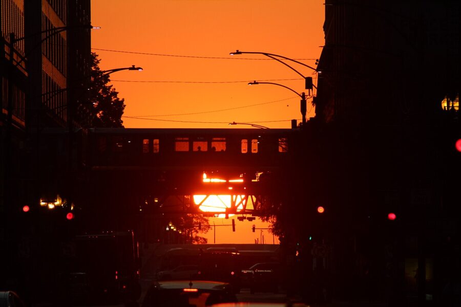
Chicago’s street grid runs almost exactly north to south and east to west. Around the March and September equinoxes the sun rises and sets straight down the east to west streets, filling the canyons with light from end to end. Locals call it Chicagohenge.
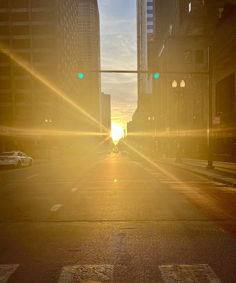
The sunset version is the popular one, shot looking west from the Loop along streets like Madison, Monroe, Adams and Jackson. The sunrise version faces the lake and is quieter. Check a sun calculator for the exact days, because the alignment depends on the height of the buildings at the end of the street; stand on a median or a corner, never in the traffic lane.
Skydecks and the lakefront skyline
Chicago has two public observation decks, and they show different cities. Skydeck Chicago is on the 103rd floor of Willis Tower, 1,353 feet up, and looks down on the Loop from its west edge. Its glass boxes, called the Ledge, stick out 4.3 feet from the building. Winter hours, October 1 to February 28, are 9 a.m. to 8 p.m., to 9 p.m. on Saturdays, with last entry half an hour before closing, and adult tickets started at $32 as of November 2026.
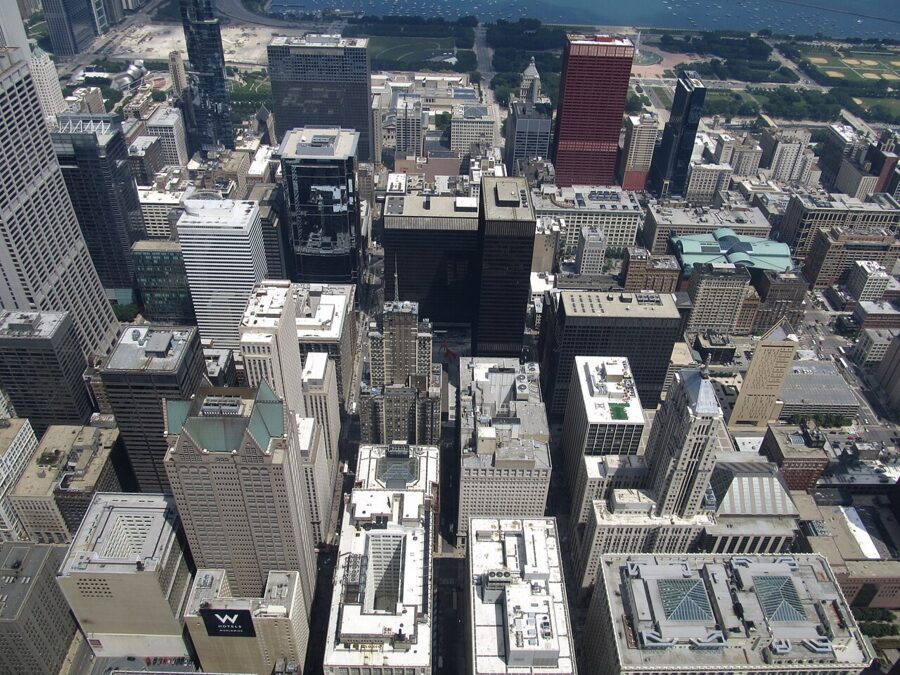
360 Chicago is on the 94th floor of 875 N. Michigan Avenue, the black tower most people still call the Hancock. It sits about 1,030 feet up at the north end of downtown, so it looks south over the whole skyline and north along Lake Shore Drive and the beaches. It is open daily from 9 a.m. to 11 p.m., with last entry at 10 p.m., and general admission was $27 online and $35 at the door as of November 2026.
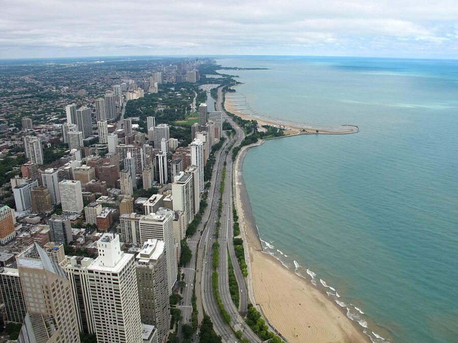
For architecture I would choose 360 Chicago at sunset: the skyline is in front of you rather than under you, and the low sun comes in across the city. The Skydeck is for the drop and the street grid, best after dark on a clear winter evening. At either one, press the lens flat against the glass and wear something dark, or the room’s lights will ghost into every frame; ask staff at the entrance before you bring out a tripod.
North Avenue Beach
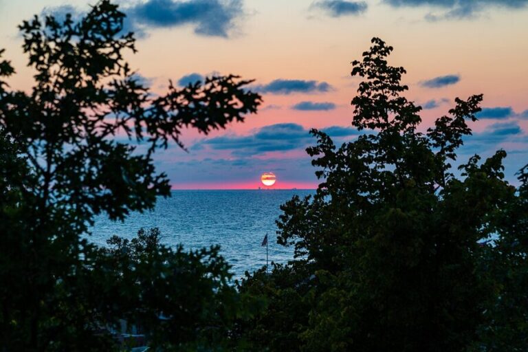
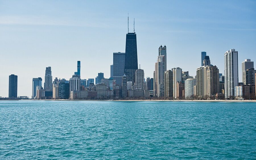
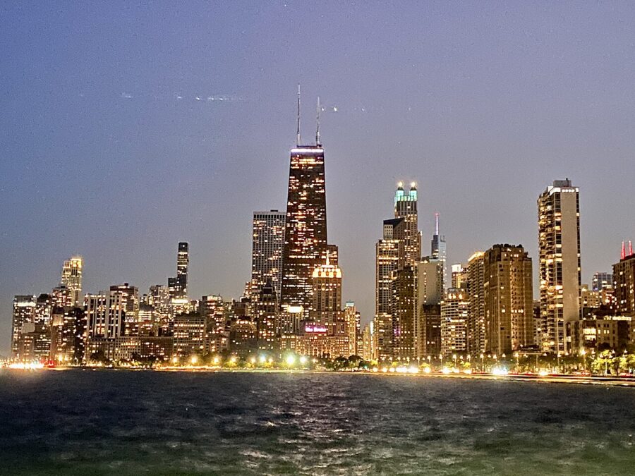
North Avenue Beach is the classic lakefront view, looking south over the water to the Gold Coast and Streeterville towers with the Hancock in the middle. Walk out onto the pier for the clearest line. The view faces south-southeast, so on summer evenings the sunset comes over your right shoulder and warms the towers, while in winter the sunrise comes up to the left of the skyline.
The Adler Planetarium lakefront
The Adler Planetarium sits at the tip of the Museum Campus peninsula, and the lawn and lakeshore walk outside it are the widest skyline view in the city: Willis Tower on the left, Lake Point Tower on the right, and the harbor in between. You don’t need a museum ticket for the grounds. The view faces northwest, so the sunrise behind you lights the whole skyline head-on, and on summer evenings the sun goes down behind the towers for silhouettes.
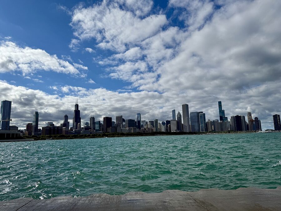
The walk out from the Roosevelt station takes about half an hour. Concerts at the pavilion on Northerly Island and games at Soldier Field fill the parking lots, so check their calendars before you plan a sunset here.
| Viewpoint | Faces | Best light | Cost and hours (November 2026) |
|---|---|---|---|
| Riverwalk, main stem | North across the river | Late afternoon, blue hour | Free, 6 a.m. to 11 p.m. |
| North Avenue Beach pier | South-southeast | Summer sunset, winter sunrise, blue hour | Free |
| Adler Planetarium shore | Northwest | Sunrise; summer sunset for silhouettes | Free outside the museum |
| 360 Chicago, 94th floor | All directions | Sunset into dark | From $27 online; 9 a.m. to 11 p.m. |
| Skydeck Chicago, 103rd floor | All directions | After dark on a clear evening | From $32; winter 9 a.m. to 8 p.m. |
Holy Name Cathedral and the downtown churches
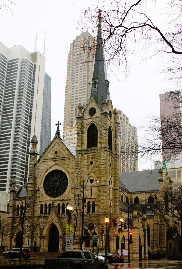
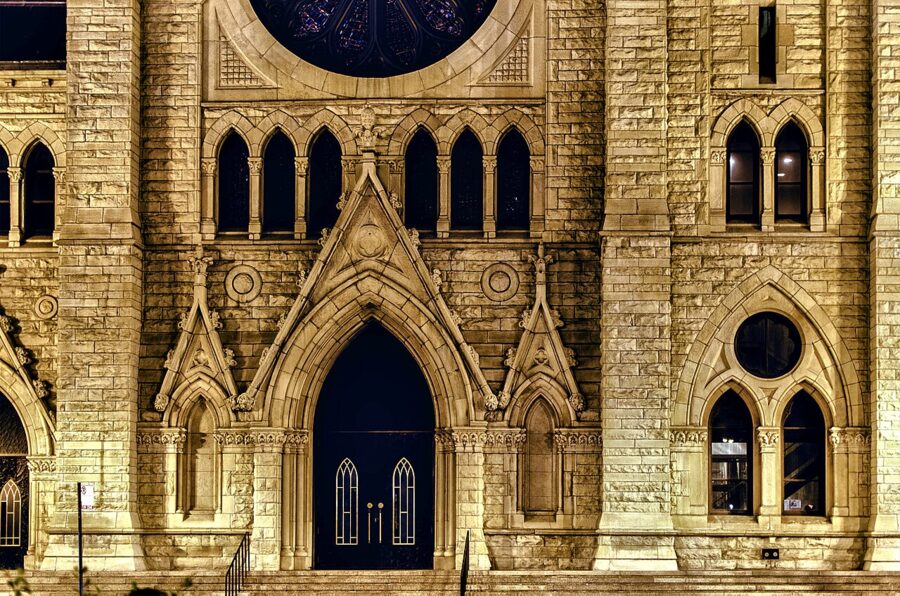
Holy Name Cathedral stands on the northeast corner of State and Superior streets, half a block from the Chicago Red Line station, and it is the seat of the Archdiocese of Chicago. The Great Chicago Fire of 1871 destroyed the parish’s earlier church. Brooklyn architect Patrick Charles Keely designed the Victorian Gothic replacement, and Bishop Thomas Foley dedicated it on November 21, 1875.
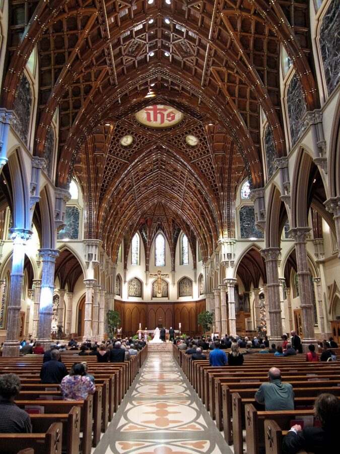
The nave is 218 feet long and 70 feet high, and the spire rises 210 feet including its cross. The west front faces State Street and is lit from mid-afternoon on. Cross to the far side of State, or stand near the corner of Superior, to fit the spire without tilting the camera too far back.
The corner carries a darker story. On an October afternoon in 1926, gangster Earl “Hymie” Weiss was shot dead at State and Superior by Al Capone’s gunmen firing from across the street, and he was refused a funeral from the cathedral. Inside, things are quieter: in 2009 a piece of the ceiling fell, and the church closed for seven months while workers rebuilt it and restored its 32 roof columns.
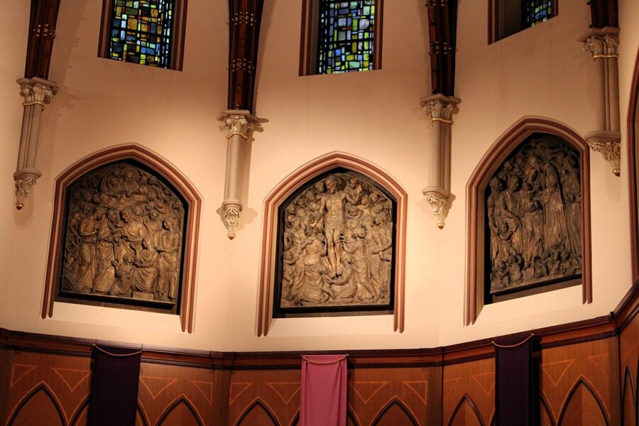
As of November 2026 the cathedral is open Monday to Friday from 7 a.m. to 5 p.m., Saturday from 8:30 a.m. to 6:30 p.m. and Sunday from 6:30 a.m. to 6:30 p.m. Weekday Mass is at 7 a.m., 8 a.m. and noon, with an extra 5:15 p.m. Mass on Wednesdays. Free docent tours run Monday through Saturday between 9 a.m. and 5 p.m., except at noon and on Wednesday afternoons, and need requesting at least five days ahead; on Sundays a short tour follows the 8:30 a.m. and 10:30 a.m. Masses without booking.
Treat it as a working church: photograph between services, never during Mass, a funeral or a wedding, and leave the flash off. If you want a tripod or anything more than a phone, ask at the rectory on Wabash Avenue first, or call the parish office. The Flentrop organ, 5,558 pipes in a case of solid French oak handmade in the Netherlands, is worth a long lens.
Fourth Presbyterian Church
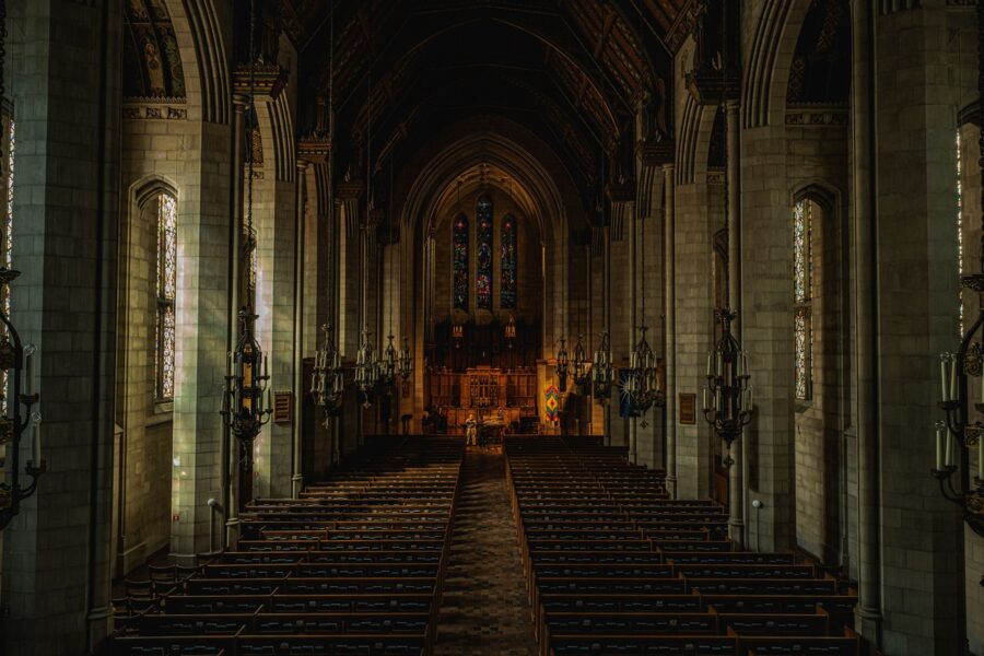
Fourth Presbyterian Church faces Michigan Avenue across from 875 N. Michigan, a Gothic stone church at the foot of a skyscraper. Ralph Adams Cram designed it, and it was built between 1912 and 1914. The courtyard and cloister open onto the avenue, and they face east, so come in the morning for sun on the stone.
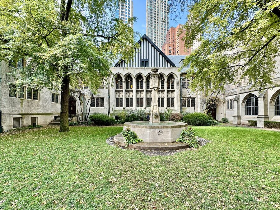
The 1914 sanctuary is open to visitors from 10 a.m. to 2 p.m. Monday through Friday, except on holidays when the campus closes, and it is closed on Saturdays for special events (as of November 2026). The sanctuary is at the corner of Delaware Place and Michigan Avenue, and the reception desk inside the 126 E. Chestnut Street entrance can point you to it.
The Chicago Temple
The First United Methodist Church shares its address, 77 W. Washington Street, with an office building. The 1924 Chicago Temple Building is topped by a Gothic spire, and just below the spire sits the Chapel in the Sky. Stand in Daley Plaza and look southwest across Washington Street for the spire above the Loop’s offices.
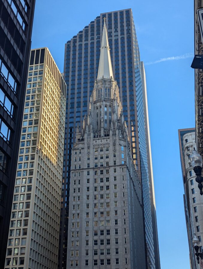
Free tours of the Chapel in the Sky go after each Wednesday and Sunday service and at 2 p.m. on other days, never on Mondays; they last about an hour, take stairs and are not wheelchair accessible. The ground-floor sanctuary normally opens Monday to Friday from 10 a.m. to 2 p.m., but it is closed until December 10, 2026, while a restored organ goes in. Meet the guide at the welcome desk outside the sanctuary.
Old St. Patrick’s
Old St. Patrick’s Church, at Adams and Des Plaines streets in the West Loop, was dedicated on Christmas morning in 1856. The Great Chicago Fire missed it by two blocks, which makes it the oldest public building in the city. Its two spires, completed in 1885 by the architect of Holy Name Cathedral, are not a matching pair: one is pointed, the other capped by an onion dome.
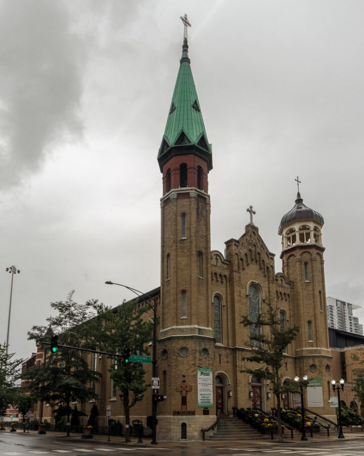
Inside, Thomas A. O’Shaughnessy designed, made and installed fifteen stained-glass windows between 1912 and 1922. The twelve side windows draw on the Celtic patterns of the Book of Kells, and a sunny day makes them glow. Check the parish site for open hours before you go, and as at Holy Name, photograph between services.
Seasons and light, winter included
Spring and fall are the photographer’s seasons here. The bridge lifts happen then, the architecture cruise runs, and the sun sits low enough to rake across the facades at a usable hour. Open House Chicago, the Chicago Architecture Center’s free weekend of open doors into lobbies, churches and offices, comes every October; the 2026 edition ran October 17 and 18.
Summer gives long evenings and the haziest skies, and the sun sets far to the northwest. That suits the Adler shore for silhouettes and North Avenue Beach for warm light. It is also the busiest season on the Riverwalk and at Cloud Gate, so I would shoot those two at dawn.
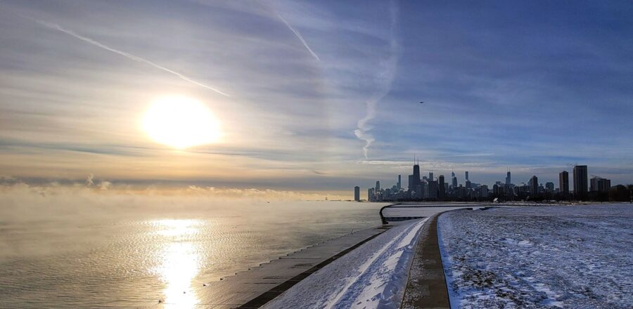
Winter is the season I would not skip. On the coldest mornings, when the air is far colder than the lake, steam lifts off the water and hangs around the skyline, and the low sun turns it orange for a few minutes. Snow on the bridge houses and along the Riverwalk railings gives the river a clean foreground, and the Riverwalk keeps its normal hours all year.
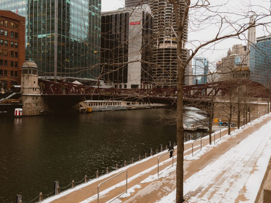
The cruise season ends in late November and the Bridgehouse museum closes in late October. Wind off the lake makes the North Avenue pier and the Adler shore much colder than the Loop, so take gloves that work a touchscreen and keep spare batteries in an inside pocket.
Tripods, permits and drones
Hand-held photography is welcome almost everywhere downtown. Tripods are where the rules start, and they differ by owner:
- CTA trains and stations: personal, non-commercial photography with a hand-held camera is allowed in public areas, but tripods, lighting and other large equipment are prohibited, and lingering in stations for extended photography is not allowed.
- Chicago Park District: a permit is required for photo sessions, including non-commercial ones such as engagement and wedding pictures. As of November 2026 a non-commercial permit is $45 per location per hour plus a $45 application fee; commercial photography is $890 per location per day with a $520 deposit and insurance.
- Millennium Park and Olive Park: managed separately from the Park District, so permits for those come from their own offices.
- The Rookery: handheld cameras and phones only, no tripods.
- Churches and observation decks: ask on arrival, and never shoot during services.
Drones are a different matter. The Park District controls the lakefront parks and beaches, and federal rules apply everywhere. Before you fly anything in Chicago, check the FAA’s B4UFLY app and ask the Park District. I leave the drone at home downtown; the decks and the boat give you height without the paperwork.
Getting around
The river, the Loop, Holy Name and Fourth Presbyterian all sit within about a twenty-minute walk of the DuSable Bridge. The L fills the gaps: as of November 2026 a ride costs $2.50, and a 1-Day pass is $5. Fares stayed flat for 2026 after Illinois passed new transit funding in late 2025.
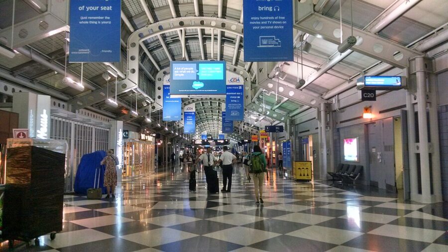
From O’Hare, the Blue Line runs from the airport station straight into the Loop. The fare when you board at O’Hare is $5, deducted at the gate, but an unlimited pass covers it at no extra charge, so buy the 1-Day pass first. For Holy Name, take the Red Line to Chicago; for the Adler, the Red, Green or Orange Line to Roosevelt.
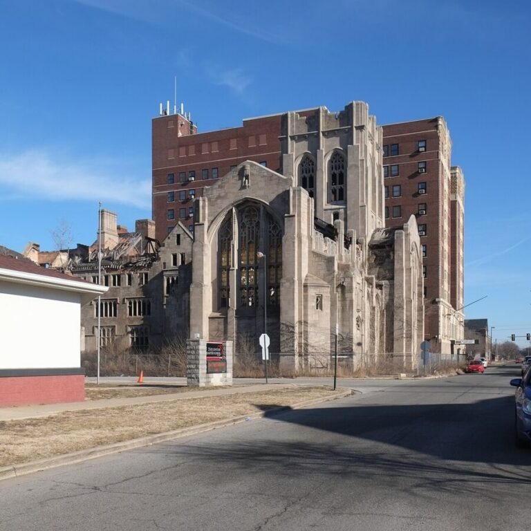
If you have a spare day, the South Shore Line from Millennium Station runs east to Gary, Indiana, where City Methodist Church stands in ruins.
On your first evening, walk the Riverwalk west from Michigan Avenue as the light fades. Stop on the Dearborn Street Bridge when the office windows come on, and stay twenty minutes into the blue.