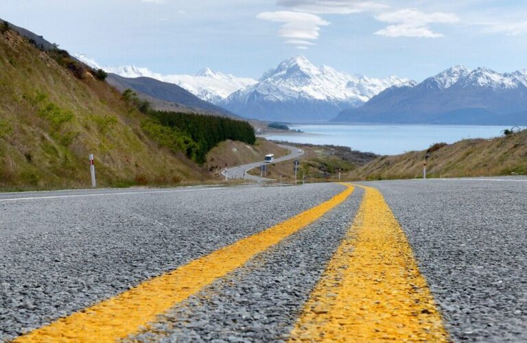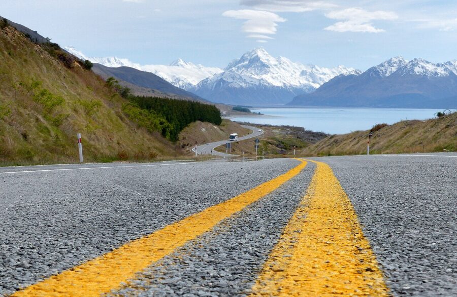
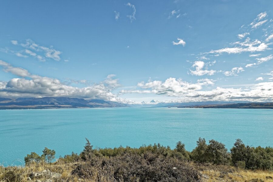
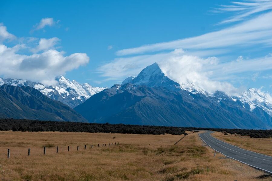
From the south end of Lake Pukaki, Aoraki/Mount Cook is a white point more than 60 km away across turquoise water, and State Highway 80 sets off up the shore aiming straight at it. The road in is the first photograph of the trip, and on a clear morning it is often the best one.
At the other end of the road is a national park of 70,696 hectares, 40 percent of it under ice, and a short list of walks that put you at the foot of New Zealand’s highest peak without a rope or a permit. The Hooker Valley Track is the famous one, and in July 2026 it reopened in full over a new 189-meter suspension bridge. Kea Point and the Tasman Glacier view are shorter, quieter and, in the right light, every bit as good.
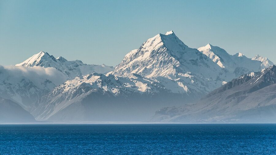
The mountain sets the timetable. Cloud off the Main Divide can bury the summit for days, then lift for an hour at dawn, so the one rule I’d give anyone driving in is to stay the night. A day trip from Queenstown or Christchurch spends most of its daylight in the car and arrives at Hooker Lake in the flattest light of the day.
Contents9 parts
- The road in: State Highway 80 along Lake Pukaki
- A mountain that lost 40 meters
- Hooker Valley Track
- Kea Point: an hour for the Mueller wall
- Tasman Glacier View and the Blue Lakes
- After dark: the dark sky reserve
- Seasons, weather and closures
- Getting there, fuel and a bed
- Rules: drones, fires and an ancestor
The road in: State Highway 80 along Lake Pukaki
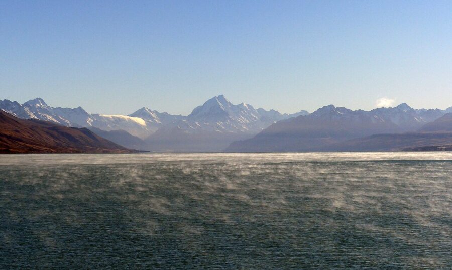
The drive starts at the junction with State Highway 8 near the lake’s southern end, between Twizel and Lake Tekapo. From the shore there you look straight up the lake to Aoraki. The view faces north, so the sun is behind the mountain at midday, and the best light comes early and late, when it rakes across the peaks from the side.
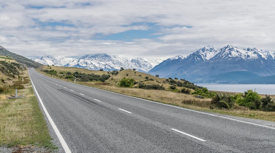
Peter’s Lookout is the classic stop: a signposted pull-off on SH80 above the western shore, where the highway, the lake and the mountain line up in one frame. Many of the best-known road shots are taken from here, looking north along the tarmac. Arrive early if you want the empty-road version, because in summer the pull-off fills by mid-morning.
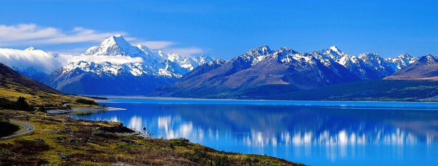
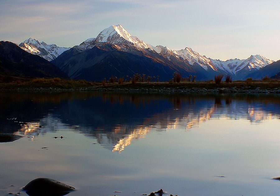
Sunrise is the better bet for the mountain itself. First light hits Aoraki’s eastern faces while the lake is still in shadow, and the snow goes pink for a few minutes before it turns white. At sunset the range is side-lit from the west and the lake picks up the color of the sky: sunset for the wide frame, dawn for the long lens. Check a sun calculator for your date.
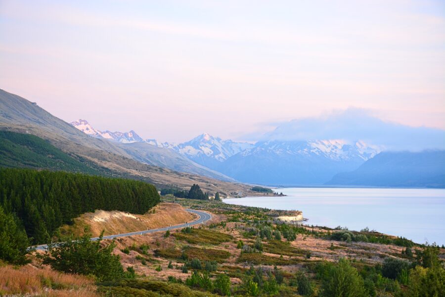
The water is that turquoise because of rock flour: glaciers at the head of the Tasman Valley grind stone into a silt so fine it stays suspended in the lake and scatters blue light. The lake you see is also partly man-made. Pukaki is a storage lake for the Waitaki hydro scheme: a high dam in the 1970s raised it by 37 meters, and its level still rises and falls with power demand, so the shoreline and the width of the gravel beach change from month to month.
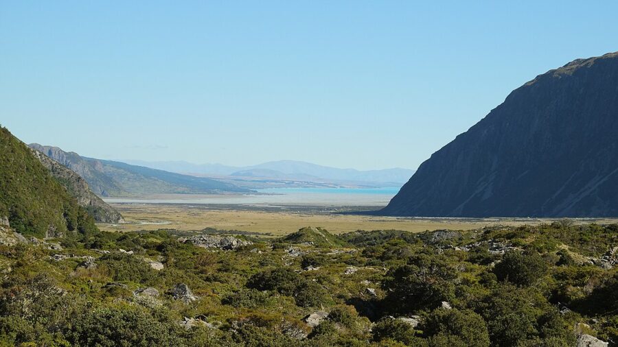
Past the head of the lake the road crosses the gravel flats of the lower Tasman Valley, where the mountain grows from a skyline shape to a wall. Small roadside ponds on the flats hold reflections on still mornings, a good fallback when Peter’s Lookout is crowded.
A mountain that lost 40 meters
Aoraki stands where the Pacific and Australian plates grind past each other along the Alpine Fault, which runs down the West Coast a short distance beyond the Main Divide. The rock is pushed up fast, by recent measurements up to about a centimeter a year around the summit, and rain, ice and rockfall tear it down almost as quickly. The result is a young, steep, crumbling range.
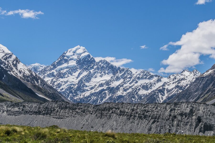
Its height proves the point. On 14 December 1991 a rock and ice avalanche took about 10 meters off the top of the mountain, which until then had measured 3,764 meters. A GPS survey in November 2013 found the summit ice cap had kept eroding and settled on 3,724 meters, the figure now used for New Zealand’s highest point. Older maps and books that say 3,754 or 3,764 meters are out of date.
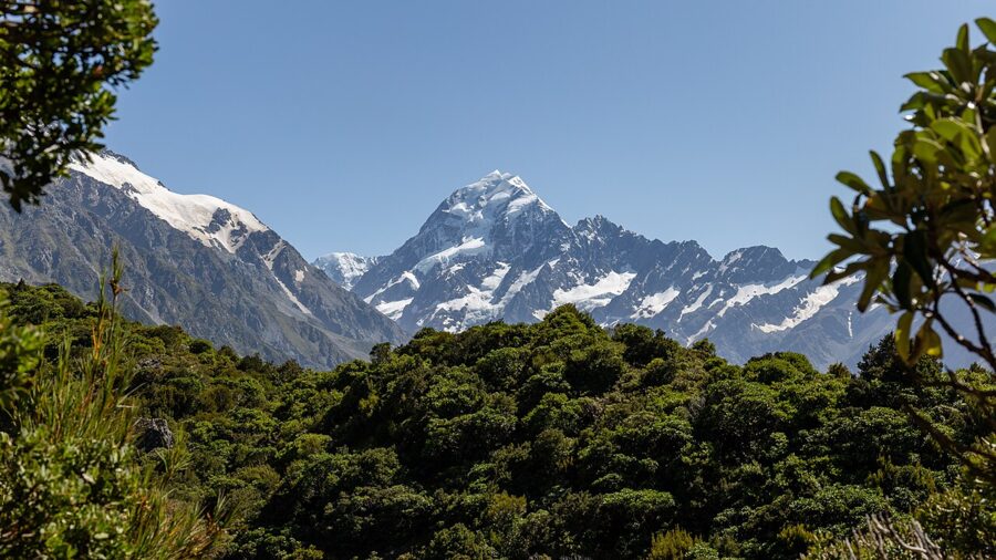
Hooker Valley Track
The Hooker Valley Track starts at White Horse Hill car park, at the end of Hooker Valley Road a few minutes’ drive from the village, and runs 5 km up the valley to Hooker Lake. It is 10 km return on the same track, about three hours on foot, gravel and boardwalk with some steps and only about 80 meters of climbing. The Department of Conservation (DOC) estimates around half a million people walk it each year.
The first 15 minutes, about 1 km, pass signposted side tracks to the Alpine Memorial, a memorial to climbers who have died in the park, and to Freda’s Rock. Just before the first swing bridge, Mueller Lookout looks west across Mueller Lake to the moraine wall and the ice of Mount Sefton.
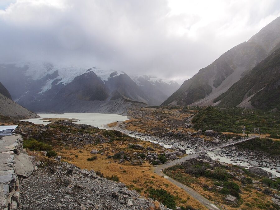
The bridges
The first swing bridge is 47 years old, and in September 2026 DOC’s engineers found wear in its cables. Rangers had regularly counted more than 40 people on it at once, so its 20-person limit is now enforced, with self-closing “pause gates” at each end and rangers on duty at peak times over summer. Expect to wait your turn on a busy morning, and don’t stop mid-span for photographs while a queue builds.
The section from the first bridge to the second takes about 30 minutes and 1.5 km, winding between humps of moraine to the Kakīroa/Mount Sefton View Lookout. You’ll hear Sefton before you understand it: its hanging glaciers shed ice often enough that the rumble of an avalanche across the valley is a normal part of the walk.
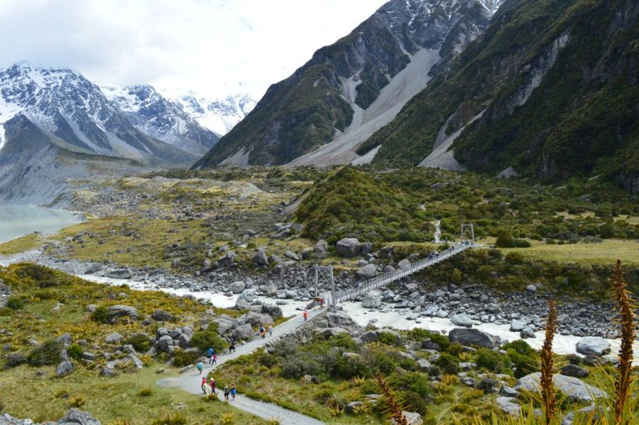
The second bridge is the new one. The old crossing was closed for good in April 2025 after heavy Easter rain eroded the riverbank under it, closing the upper valley to walkers for more than a year. Its replacement opened on the afternoon of 28 July 2026 after a blessing from mana whenua: 189 meters across the Hooker River, the longest suspension bridge in New Zealand and, by its designer’s account, the longest single-span footbridge of any kind in the country. It cost NZ$4.85 million (about US$2.8 million) and was built to stand up to the floods and snow loading that finished the old one.
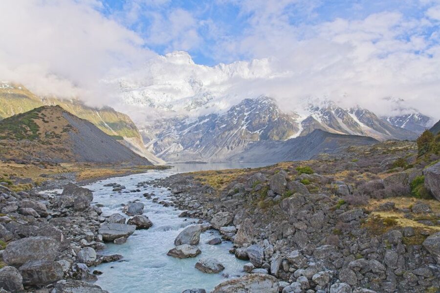
The upper valley and Hooker Lake
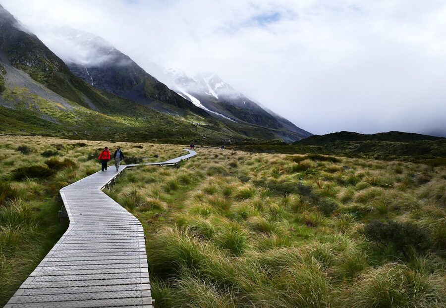
After the second bridge the valley floor opens into tussock and the track becomes boardwalk, about 45 minutes and 2.5 km to the lake. Toilets at the Stocking Stream shelter are about 15 minutes past the second bridge, the only ones between the car park and the lake. A third swing bridge crosses to the east side of the river, and the track ends at the lake.
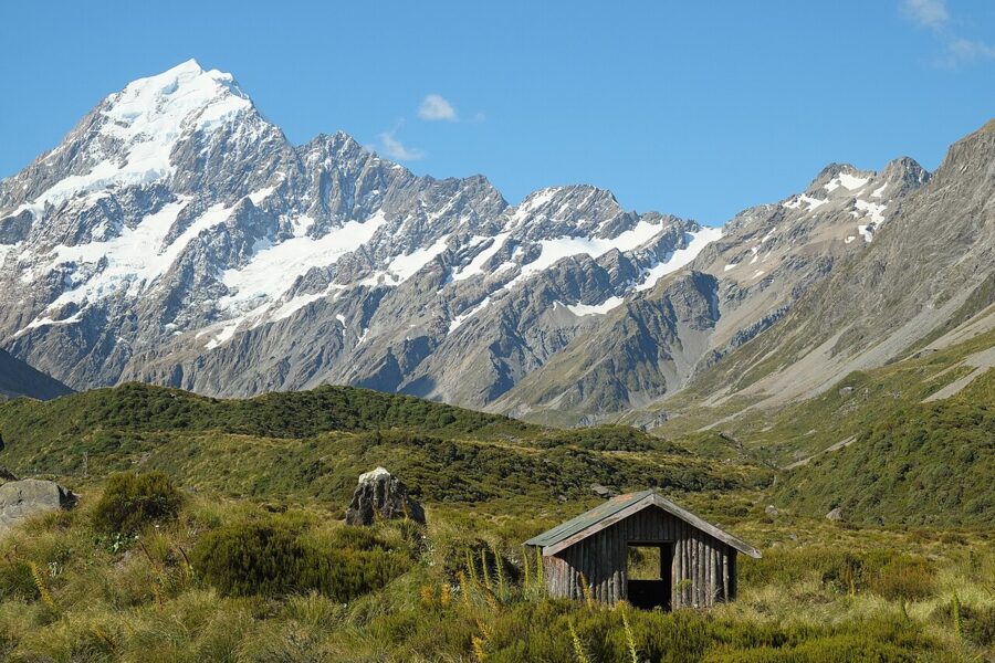
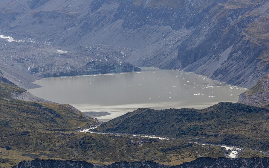
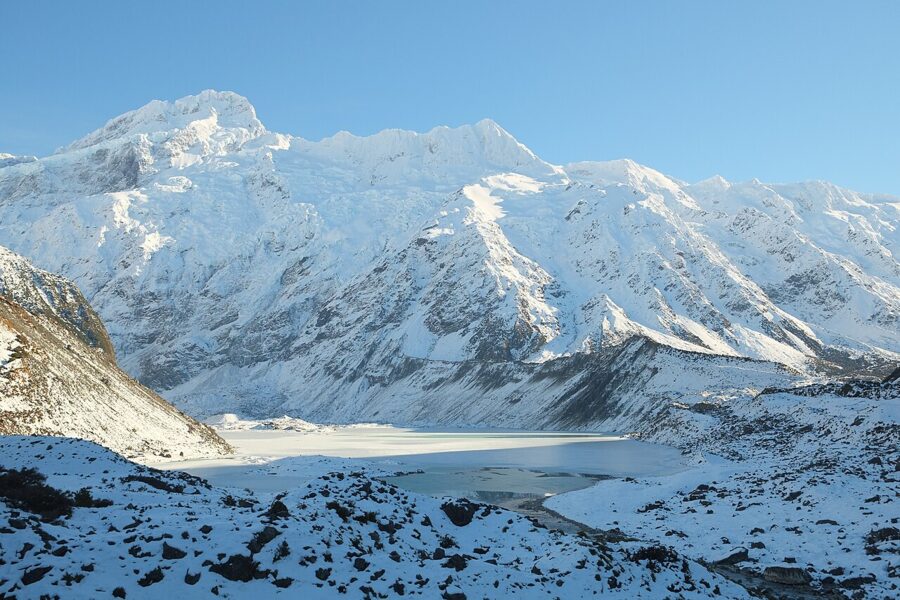
The lake is the terminal lake of the Hooker Glacier, whose rock-covered snout sits at its far end. In summer it is speckled with grey icebergs, and in a cold winter it freezes from shore to shore. DOC’s advice here is short and worth repeating: the water is about 3°C, stay out of it, stay off the ice and never climb an iceberg, because they roll without warning.
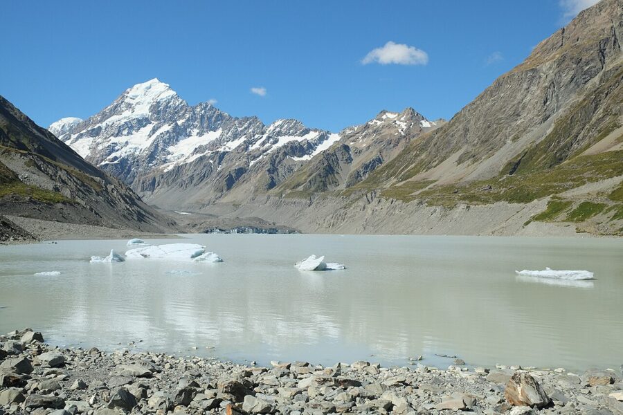
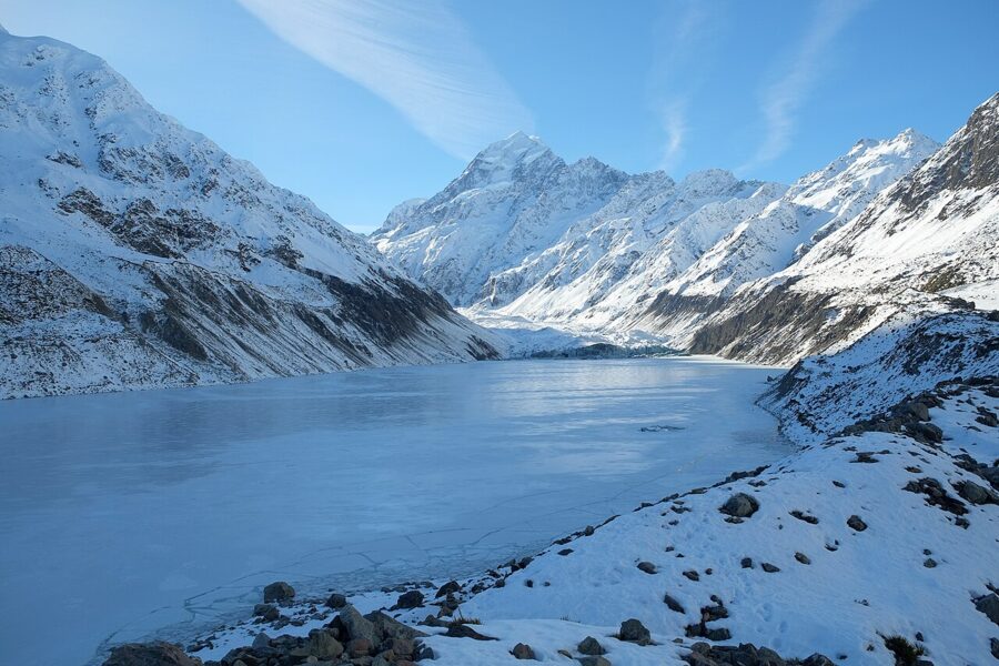
Stop at the lake. DOC’s avalanche guidance rates the track to the lake as simple terrain, but says you should not go beyond the outlet end of the lake without avalanche experience, and it rates the western shore of the lake as complex terrain.
Light and crowds on the Hooker
The valley runs roughly north, so you walk toward the sun. At dawn the light comes from the right, across the valley, and lights the summit before anything else; DOC’s own advice is that dawn is the best time to walk it. By midday you’re shooting into the sun, and by late afternoon the high ridges to the west have put the valley floor in shadow while the summit keeps its light.
The car park is the other reason to go early. DOC warns that White Horse Hill can run out of spaces between 10am and 4pm from November to March, and parking there is charged: NZ$2.50 (about US$1.40) per half hour or NZ$25 (about US$14) per day as of November 2026, card only, with the first 20 minutes free. Arrive one day and leave the next and DOC charges two days, so a night shoot that runs past midnight pays twice. If the car park is full, the walk from the village adds about an hour to the return trip.
Kea Point: an hour for the Mueller wall
Kea Point is the walk I’d do first on arrival, because it takes about an hour return from White Horse Hill car park and ends on a viewing deck with three of the park’s best views in one turn of the head. The track climbs gently through subalpine scrub, about 180 meters over 3 km if you start from the village, which adds an hour.
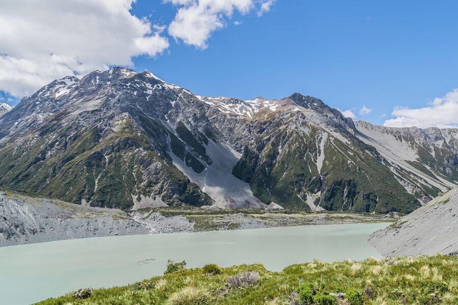
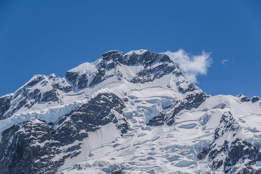
Across the lake, Mount Sefton and The Footstool are hung with glaciers that face the deck, so they take the morning light. Turn right and Aoraki stands at the head of the Hooker Valley. Sit for half an hour and there is a fair chance of an ice avalanche on Sefton: watch the hanging glaciers, because the sound reaches you a few seconds after the ice moves.
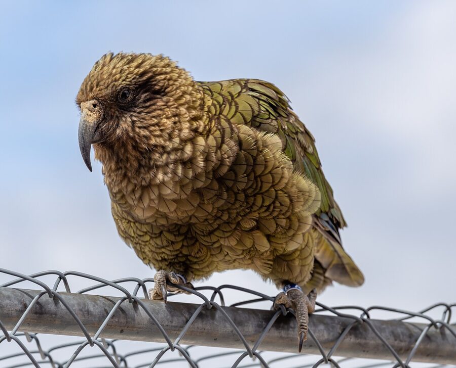
Despite the name, you may not see a kea at Kea Point. The alpine parrots are as likely around the village, the car parks and the high huts, where they investigate cars, packs and tents with a heavy beak. Don’t feed them: human food harms them.
Tasman Glacier View and the Blue Lakes
The Tasman Valley is the park’s other half, reached by the unsealed Tasman Valley Road that leaves SH80 a short way below the village. From the Blue Lakes car park at the end of it, the Tasman Glacier View track climbs steps to a viewpoint on the moraine wall, about 40 minutes return with 100 meters of climbing.
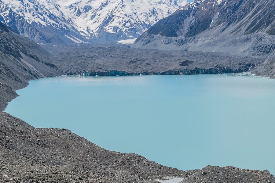
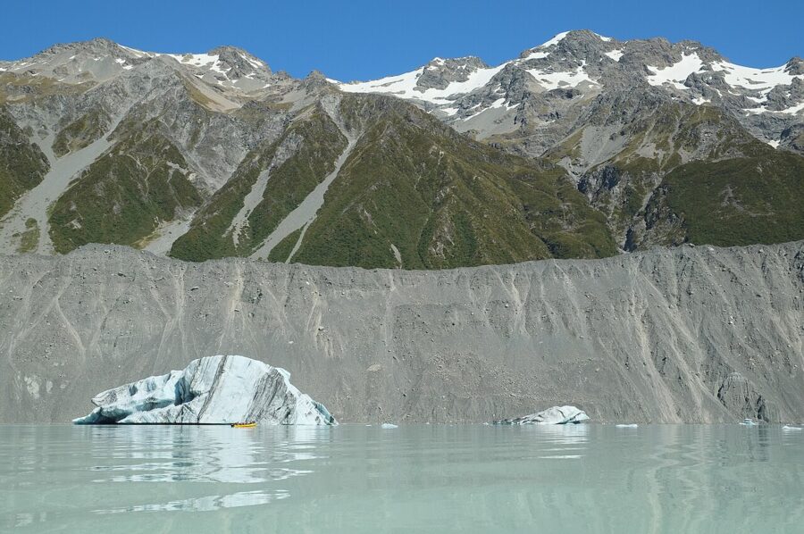
The Tasman is the longest glacier in New Zealand, about 23 km, and near the Hochstetter Icefall its ice is around 600 meters thick. Its terminal lake only began to form in 1974 as the glacier retreated, and it has grown steadily since, with the ice front pulling back more than 100 meters a year. The moraine walls around the lake show how much has gone: they mark how high the ice once stood.
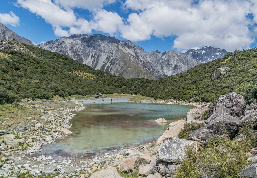
The Tasman Lake Track branches off the same path for a flat 50-minute to one-hour return walk to a viewpoint by the lake. The moraine viewpoint gives you the overview; the lower track brings the icebergs closer to eye level. Neither has shelter, and the valley can be cold and windy on bright days.
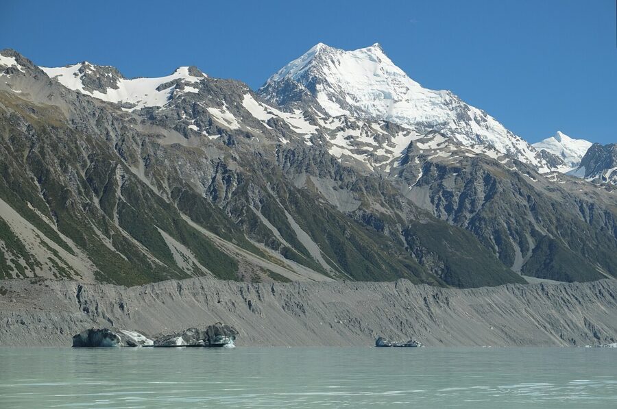
To get onto the lake, the Glacier Explorers boat trip runs from the Hermitage hotel: a bus to the Blue Lakes car park, a 1.5 km walk to the jetty and about an hour on the water among the icebergs. As of November 2026 it costs NZ$219 (about US$125) for an adult, takes 2 hours 45 minutes in all and now runs year-round, weather permitting. You must be able to walk the 1.5 km in 25 minutes to join.
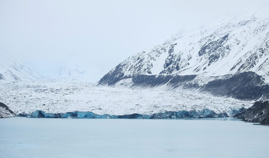
Tasman Glacier car park is on DOC’s list of planned paid car parks, so check the paid car park page on DOC’s website before you go. Large avalanches cross the 4WD Ball Hut Road further up the valley every winter and into spring, and DOC says not to stop in the marked avalanche paths.
Shorter and steeper: Red Tarns and Sealy Tarns
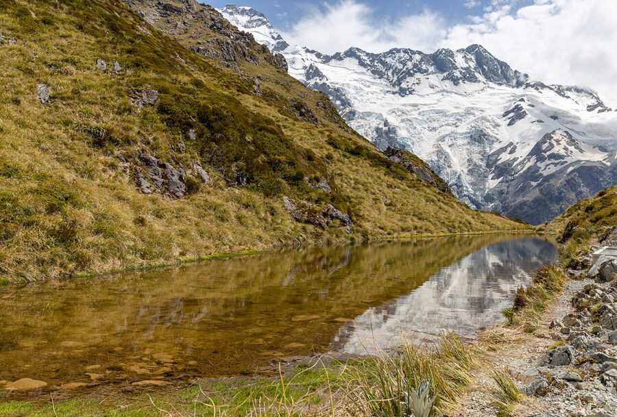
Two climbs start from the village and suit the evening. Red Tarns is about two hours return and 300 meters of steep track with steps, up to small ponds colored by red pond weed and a seat facing the mountain; DOC singles it out for summer sunsets. Glencoe Walk, 30 minutes return from behind the Hermitage, gives a bird’s-eye view of the village and Aoraki at sunrise or sunset when you have little time.
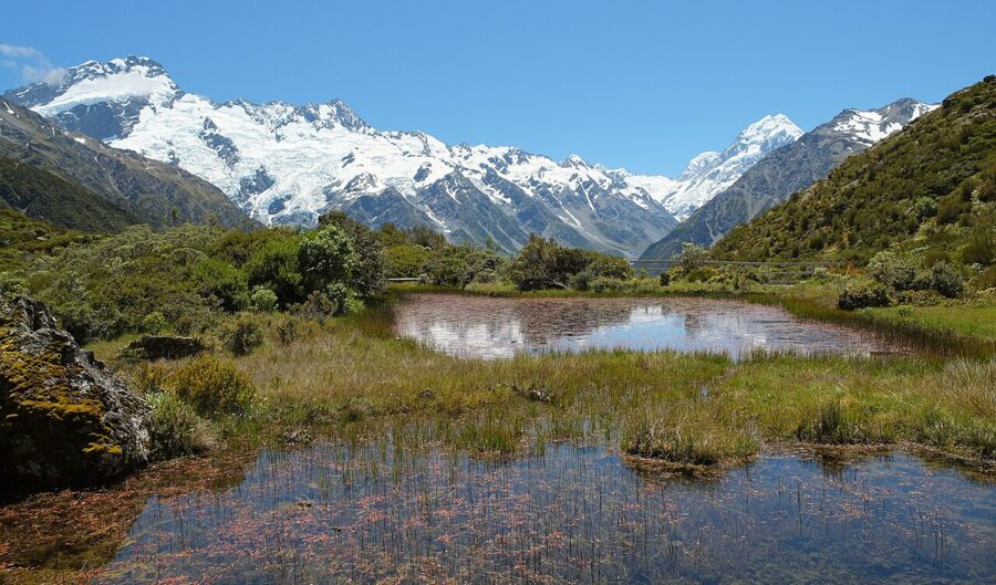
Sealy Tarns is the hard one: three to four hours return and 600 meters of climbing, most of it on about 2,200 steps, to a pair of tarns with the Hooker Valley below and Aoraki opposite. DOC rates the track as complex avalanche terrain, so outside summer ask at the visitor centre about snow before you go up. Above the tarns the route to Mueller Hut is an alpine trip, not an extension of the day walk.
After dark: the dark sky reserve
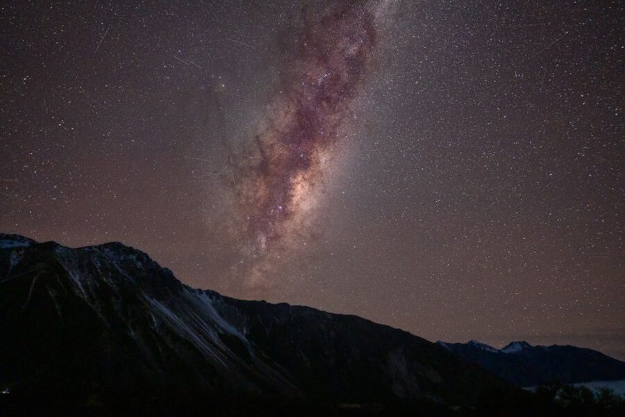
The park sits inside the Aoraki Mackenzie International Dark Sky Reserve, designated in June 2012 and covering about 4,367 km² of the Mackenzie Basin, Lake Pukaki, Lake Tekapo and the national park. Lighting controls here go back to the early 1980s, and the village’s lights point down, so on a clear moonless night the Milky Way runs from ridge to ridge over the Hooker Valley.
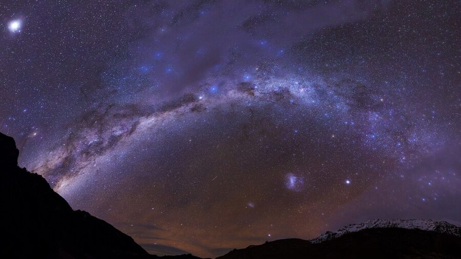
On your own, plan around the moon: the week either side of the new moon gives the darkest skies. Use a red headlamp, keep it pointed at the ground when others are shooting, and don’t sweep the car park with your headlights. Camping in the White Horse Hill car park is not allowed, even with a paid ticket.
The Hermitage runs a guided tour, Big Sky Stargazing, at a purpose-built base a short drive from the hotel. As of November 2026 it costs NZ$165 (about US$95) for an adult and NZ$94 (about US$55) for children 8 to 14, lasts 75 to 90 minutes, and runs at 10.30pm and 12.30am, weather permitting. If cloud cancels it, guests get a planetarium show and a 75 percent refund.
Seasons, weather and closures
The weather is the real gatekeeper. The park sits hard against the Main Divide, and DOC warns of strong wind, heavy rain, snow and sudden temperature drops in any month. A long arch of cloud over the range in a north-westerly usually means wind behind it, so if the mountain is clear when you arrive, walk the Hooker that day instead of saving it.
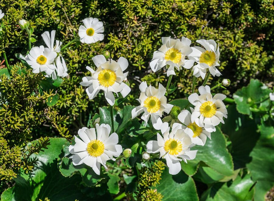
Summer, December to February, brings long days and the biggest crowds. October to March is wildflower season along the Hooker, including the Mount Cook buttercup, the world’s largest buttercup. Mid-February to Easter is quieter, with better odds of a site at the campground. Winter, June to August, brings snow to the valley floor, frozen lakes and clear cold mornings; DOC recommends microspikes and walking poles for the Hooker then, and its own staff suggest late morning to mid-afternoon as the most comfortable hours on the track.
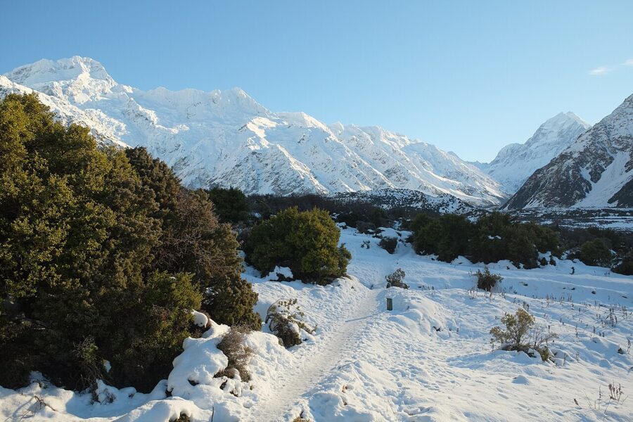
Avalanches can happen in any season above the valleys, and on some park tracks in winter and spring. Before any walk off the main valley floor in those months, check the New Zealand Avalanche Advisory and ask at the visitor centre. Summer brings its own hazard in the tutu shrub, which grows throughout the Hooker Valley and is poisonous in every part, berries included.
SH80 is the only road in and it closes. Snow shuts it in winter and spring, and in late October 2025 flooding at Dead Horse Stream closed it between SH8 and the village. DOC says access may be limited from June to September because of snow. Check NZ Transport Agency’s road conditions on the morning you drive, and keep a spare day in the plan.
Getting there, fuel and a bed
By car, DOC puts the park about 3.5 hours from Queenstown and 4.5 hours from Christchurch; Twizel is about 50 minutes from the Hooker car park and Lake Tekapo about 1.5 hours. Without a car, InterCity runs daily coaches to Mount Cook Village that leave from the Hermitage’s Aoraki Lobby, about four hours from Queenstown and five and a half from Christchurch.
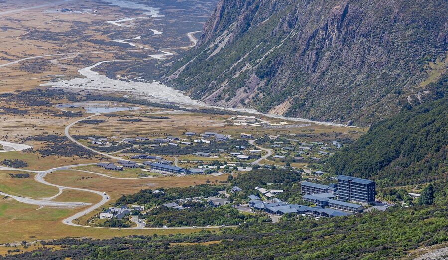
Fill the tank and buy food before you leave Twizel or Tekapo. The village has a self-service fuel pump, card only, but no banks and no shops beyond the Hermitage’s small store; the nearest supermarket is in Twizel, 70 km away. Electric cars get two charging points in the visitor centre car park, and that is all.
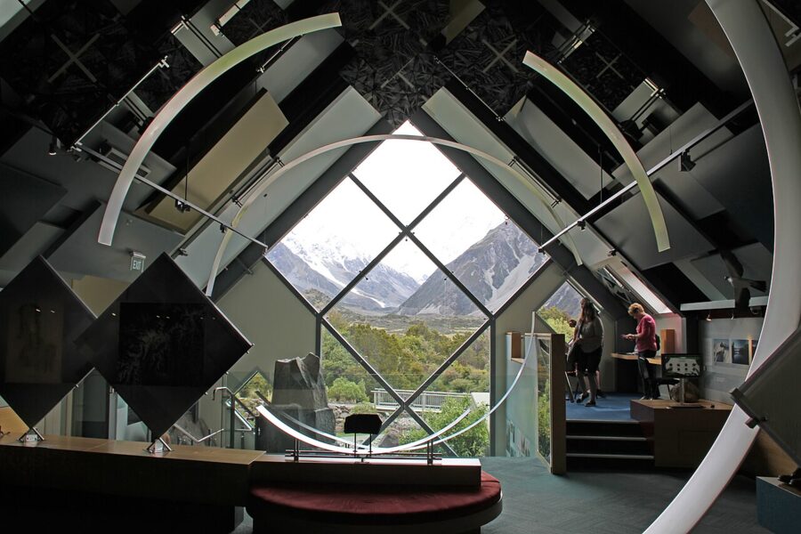
The Aoraki/Mount Cook National Park Visitor Centre at 1 Larch Grove is free and open daily, 8.30am to 5pm from October to April and 8.30am to 4.30pm from May to September. It has current track and avalanche information, and overnight trampers sign in there.
Beds in the park are few. The Hermitage group runs the Hermitage Hotel, whose Premium, Superior and Mount Cook View rooms look at the mountain, plus Mt Cook Lodge and Mt Cook Motels, about 1 km away, which have valley views but none of Aoraki. Its restaurants and the Sir Edmund Hillary Café are the main places to eat. Beyond those and the campground, beds in the village are limited, Twizel and Lake Tekapo have far more choice, and summer books up early.
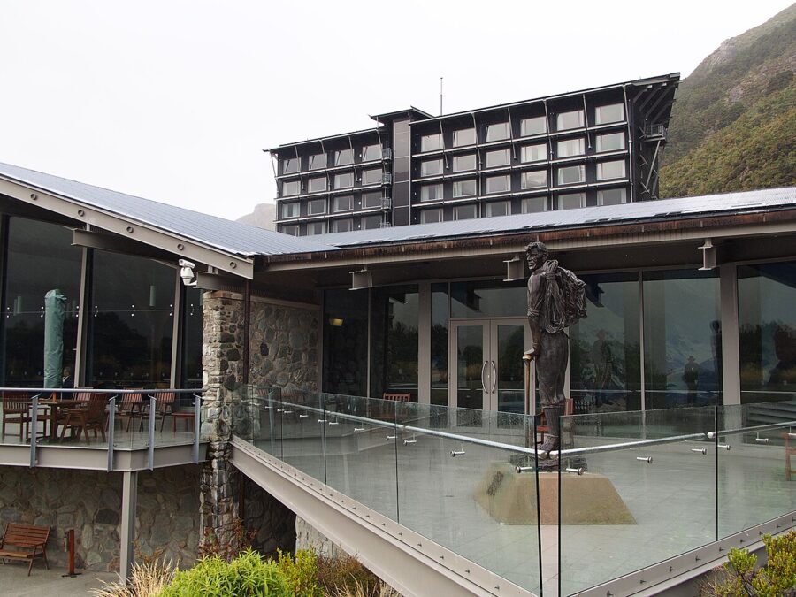
White Horse Hill Campground at the start of the Hooker Valley Track has 72 unpowered sites and must be booked, at NZ$20 (about US$12) per adult per night as of November 2026. No spaces are kept for walk-ins, and phone or visitor centre bookings carry a NZ$10 (about US$6) fee. There are toilets, treated water and a cooking shelter but no power or showers, and from June to August only pit toilets and no running water.
Rules: drones, fires and an ancestor
Recreational drones are not allowed anywhere in the national park, and commercial drone use needs a DOC permit. Outside the park, DOC requires a permit for any drone flight on public conservation land, recreational ones included, so check who manages the ground at Lake Pukaki before you fly there. There is a permanent fire ban in the park, fireworks included, and no dogs or other pets.
There is no entry fee for the park as of November 2026, but one is coming for some visitors. The Government is preparing an access charge for international visitors at four sites, Aoraki/Mount Cook among them, while New Zealanders and residents stay free. The Conservation Amendment Bill that would allow it had its first reading in May 2026 and was still before Parliament in November, so check DOC’s website before you travel.
To Ngāi Tahu, the iwi of most of the South Island, Aoraki is the most sacred of ancestors. In one account Aoraki and his brothers were stranded on their canoe when the south wind froze them into stone, forming the Southern Alps, Kā Tiritiri o te Moana. The mountain has Tōpuni status, a public mark of Ngāi Tahu authority over it, and since 1998 its official name has been Aoraki/Mount Cook, joining the Māori name to the one Captain J.L. Stokes gave it in 1851.
Ngāi Tahu hold that climbing onto what is effectively the head of an ancestor is not appropriate. People have climbed it anyway since Tom Fyfe, Jack Clarke and George Graham first reached the summit in 1894. It is lower than Everest by more than 5,000 meters, but it is a technical glaciated climb in fast-changing weather, and no walking track goes near the top.
For walkers, respect is simpler: keep to the tracks, and carry out all rubbish and human waste, because the waters that flow from Aoraki are sacred to the iwi.
So plan the visit backward from the light. Drive in the afternoon before, sleep in the park, and be on the Hooker Valley Track before sunrise with the car park still half empty. Then stop at Peter’s Lookout on the way out, as the sun gets low over the western shore and the lake goes still.