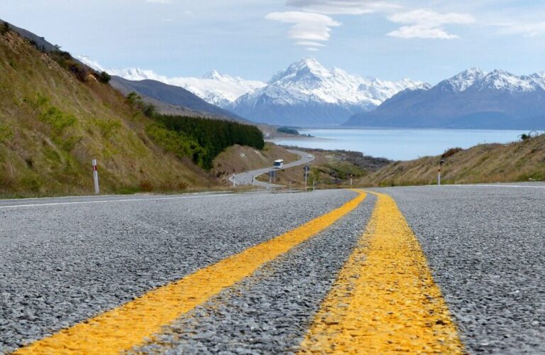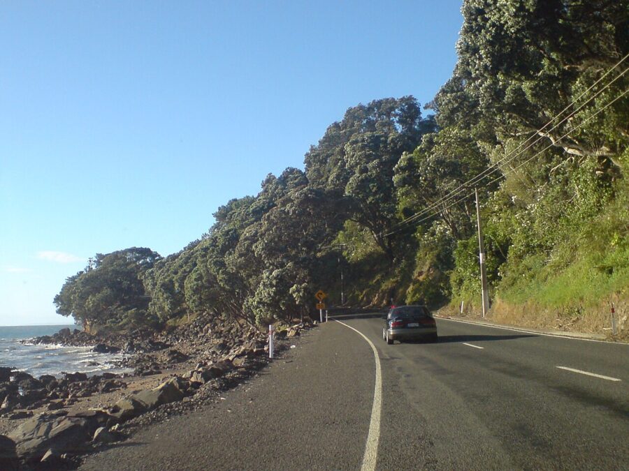
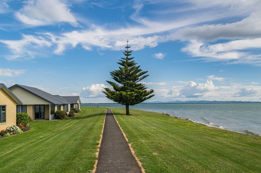
The Thames Coast Road faces west. That one fact decides how this drive looks: leave Thames in the morning and the hills behind you keep the shoreline in shade, but come back up it after lunch and the Firth of Thames turns silver on your left, the pohutukawa throw long shadows across State Highway 25, and every bay between Tararu and Kereta lights up in turn.
On paper it is a short drive, about 55 km (34 miles) from Thames to Coromandel Town and an hour with no stops. Nobody does it with no stops. The road hugs the shore for most of its length, climbs over the hill at Kereta, crosses the saddle above Manaia Harbour and drops into a gold-rush town on a harbor full of islands and mussel lines.
Contents8 parts
The route in numbers
Thames sits at the base of the peninsula where the Waihou River meets the Firth of Thames, about 115 km (71 miles) and an hour and a half from Auckland. It is part of the Coromandel: the main town of the Thames-Coromandel District, and the place to fill the tank and the fridge before heading north.
| Leg | Distance | Driving time, no stops | Road |
|---|---|---|---|
| Auckland to Thames | about 115 km (71 mi) | about 1 hr 30 min | SH1, SH2, SH25 |
| Thames to Te Puru | about 12 km (7 mi) | about 15 min | SH25, coastal |
| Thames to Tapu | about 19 km (12 mi) | about 25 min | SH25, coastal |
| Thames to Coromandel Town | about 55 km (34 mi) | about 1 hr | SH25, coastal then over the Manaia saddle |
| Coromandel Town to Whitianga | about 46 km (29 mi) | about 50 min | SH25, sealed |
| Coromandel Town to SH25 by the 309 Road | about 22 km (14 mi) | slower than it looks | mostly gravel |
The full loop, up this coast to Coromandel Town, across to Whitianga, down to Tairua and back over SH25A to Kopu, is a little under 190 km (118 miles) on the NZ Transport Agency’s loop map. It can be driven in a day. I would give it three: one for this coast, one for Mercury Bay, one for weather and tides.
Those are driving times, not planning times. The road is narrow and winding, the limit drops through every settlement, and campervans and cyclists share the bends. Plan on half a day from Thames to Coromandel Town with the stops below.
Road status after the storms
Cyclones Hale and Gabrielle in the summer of 2022 and 2023 cut roads all over the peninsula and closed SH25A between Kopu and Hikuai for most of a year. Then 2026 brought three more events, and the Thames Coast Road was caught in one of them.
- January 2026. A storm and a state of emergency closed sections of SH25 on the east side, including Whangapoua Hill between Coromandel Town and Kuaotunu. The district council reported the Thames Coast road to Coromandel Town largely unaffected.
- 27 March 2026. Slips closed SH25 between Coromandel Town and Kuaotunu again. On 28 March NZTA said it would reopen that afternoon with a 50 km/h limit past the Whangapoua Hill slip.
- 12 April 2026, Cyclone Vaianu. Subsidence closed SH25 on the Thames Coast Road at Kereta Hill, near the Kereta Hill lookout, and traffic north of it had to go around by SH25A. NZTA reopened it on 17 April to a single lane under stop/go control with a 30 km/h limit.
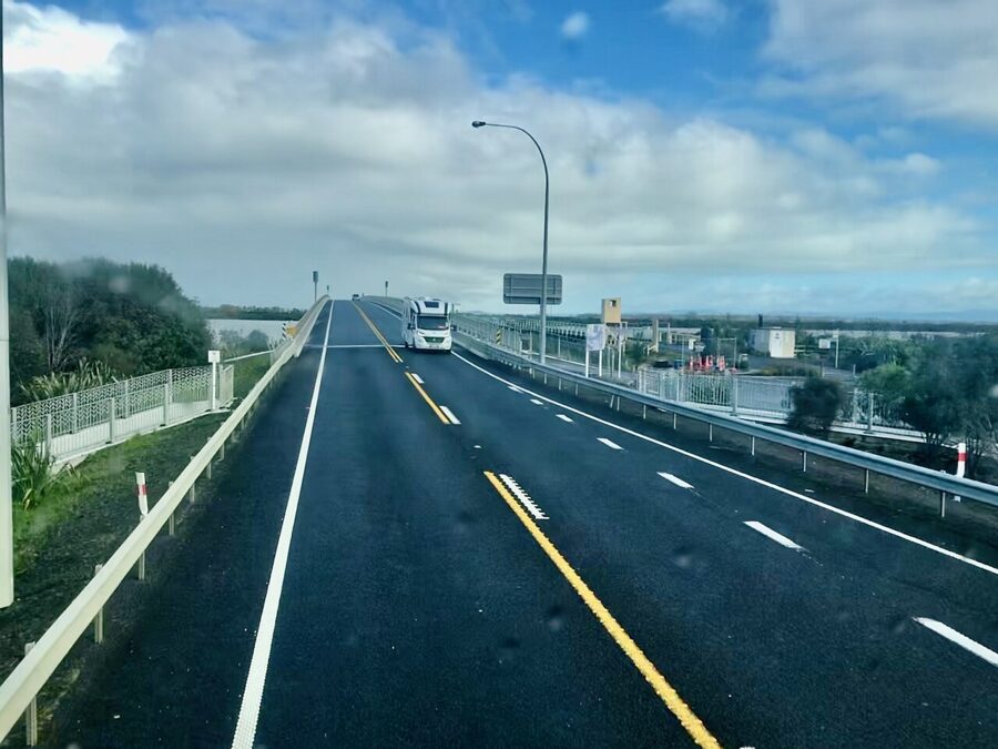
As of late November 2026 the coast road is open end to end, but expect to stop. NZTA’s planned maintenance for the week of 23 November lists stop/go sites at Te Puru, at Kereta and at the Tiki Road intersection in Coromandel Town, all at 30 km/h. On the Auckland side, roadworks on SH2 near the SH27 intersection at Mangatarata can mean closures and a signed detour, so check the NZ Transport Agency Journey Planner before you set off.
Check the NZTA Journey Planner (journeys.nzta.govt.nz) on the morning you drive, and the district council’s Road and Highway Conditions page for local roads like the 309. Whether Kereta Hill has had its permanent repair is the kind of thing that changes month to month, and the Journey Planner shows it first.
Thames before you go
Thames grew out of a gold rush. The goldfield opened in 1867, the settlements of Shortland and Grahamstown sprang up on the flat between the hills and the firth, and for a few years Thames was one of the biggest towns in the country. What survives is a long main street of timber verandahs and old mining machinery in odd corners.
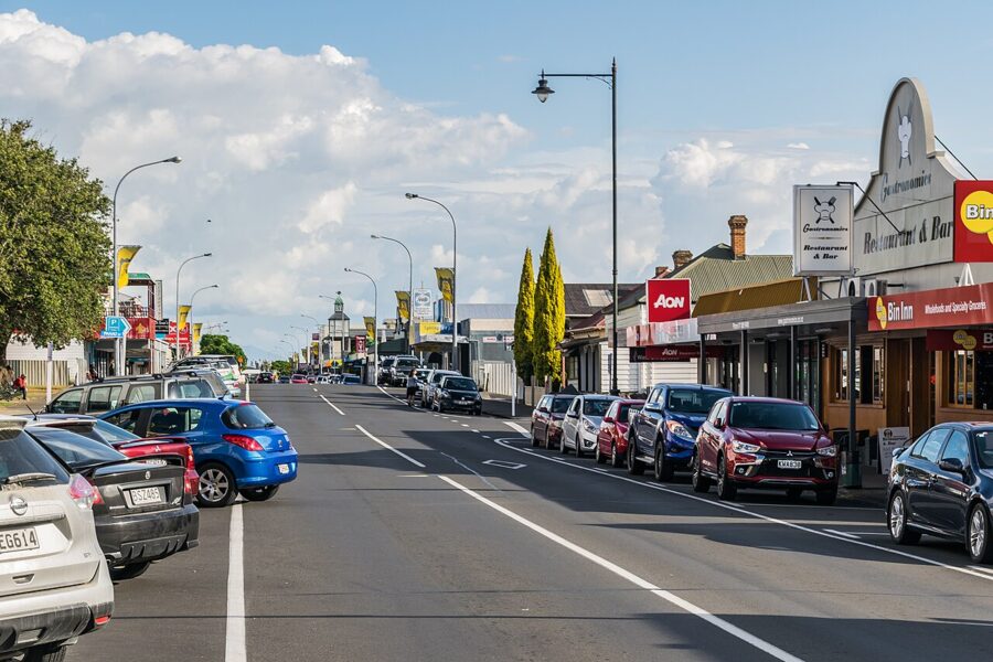
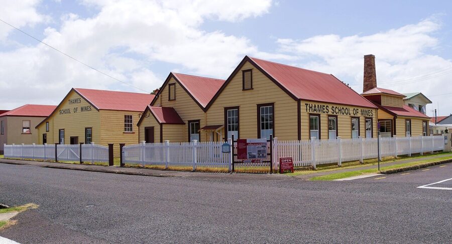
The building I would make time for is the Thames School of Mines, which trained miners and assayers from 1886 and still holds its labs, lecture room and mineral collection. Heritage New Zealand lists it as open Wednesday to Sunday, 10am to 4pm, by guided tour only, as of November 2026. The rooms are dim on gray days, worth knowing if you want the display cases.
Thames is the last supermarket and proper fuel stop before Coromandel Town. If you are carrying a camera bag, carry lunch too.
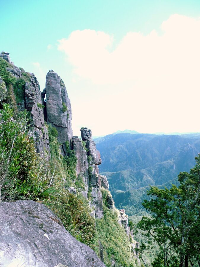
Behind the town, Kauaeranga Valley Road runs inland to the Department of Conservation (DOC) visitor center and the Pinnacles track, a full day of climbing; the Pinnacles Hut has to be booked through DOC. With two days in Thames, give one to it.
The coast road, stop by stop
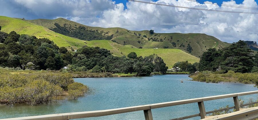
North of Thames, SH25 becomes a ledge: bush climbing into the Coromandel Range on one side, seawall, rock shelf and firth on the other. The settlements are small, each built around a stream mouth and a strip of grass reserve, and those reserves are your stopping places.
Tararu, Thornton Bay and Ngarimu Bay
The first few kilometers stay close to town. After Tararu, Thornton Bay and Ngarimu Bay have roadside reserves with room to park off the highway.
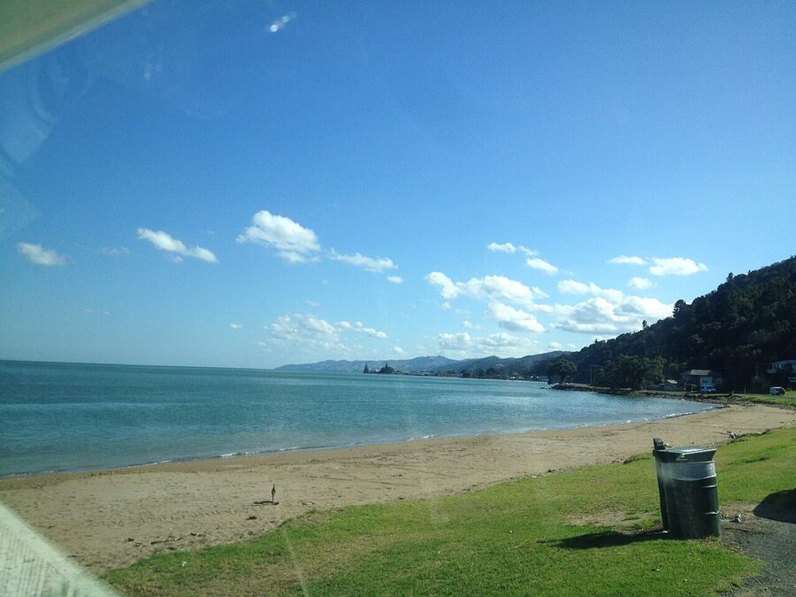
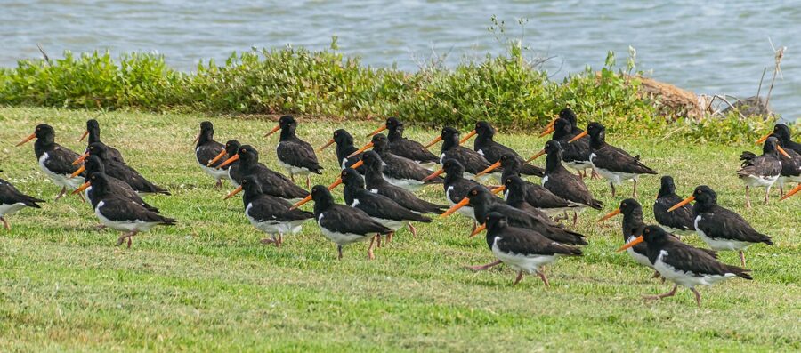
This is also the stretch for birds. The Firth of Thames is a Ramsar wetland of international importance, and its southern shore is one of the country’s main feeding grounds for migrating shorebirds, including bar-tailed godwits that arrive from Alaska each spring. Around Thames you are more likely to see South Island pied oystercatchers working the tideline. A 300 mm lens is enough from the shore; a 100 mm lens is not.
Te Puru and Waiomu
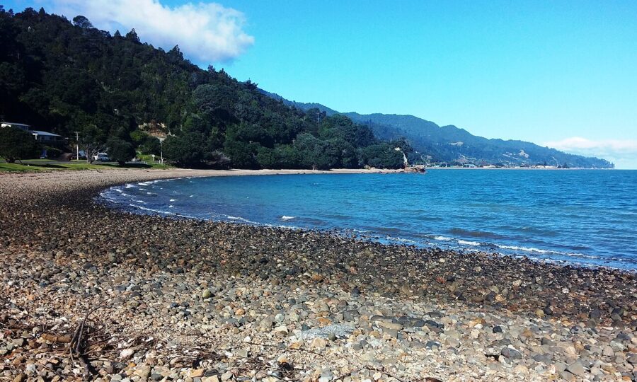
Te Puru, about 12 km (7 miles) north of Thames, has a holiday park and a stream mouth. Waiomu, a little further on, has a stony beach, a reserve and a beach café. The shore here is rock and shell rather than sand, and the rocks carry oysters, so wear shoes to the waterline.
If you want one bush walk on this coast, it starts here. DOC’s Waiomu Kauri Grove Walk leaves from the end of the sealed Waiomu Valley Road and takes about two hours return, with stream crossings that will wet your feet. About 25 minutes in, a side track goes to the old Monowai goldmine battery site, and a final ten-minute climb reaches a stand of mature kauri.
Tapu, and the road over the hills
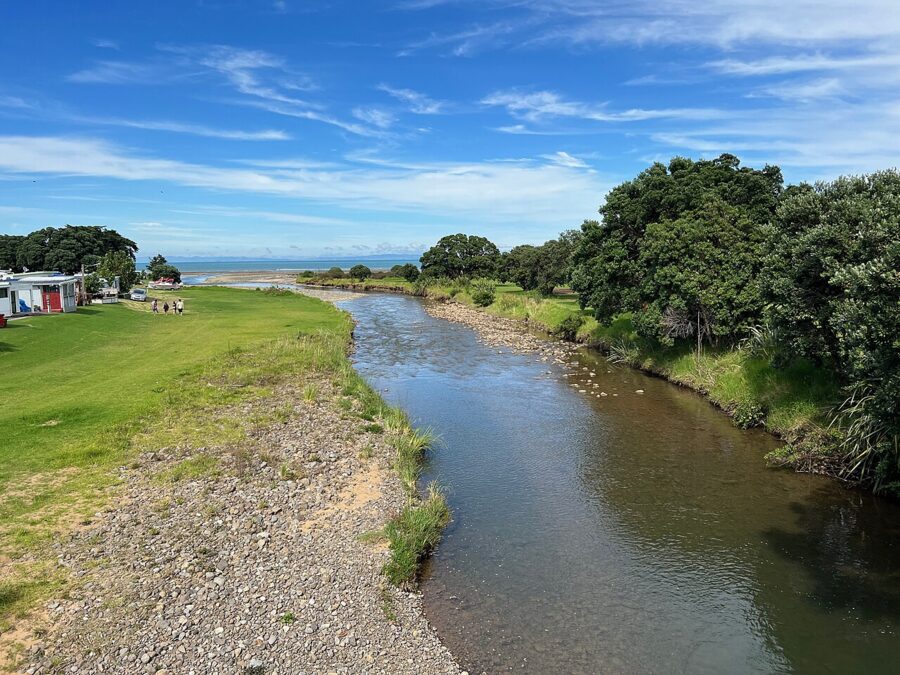
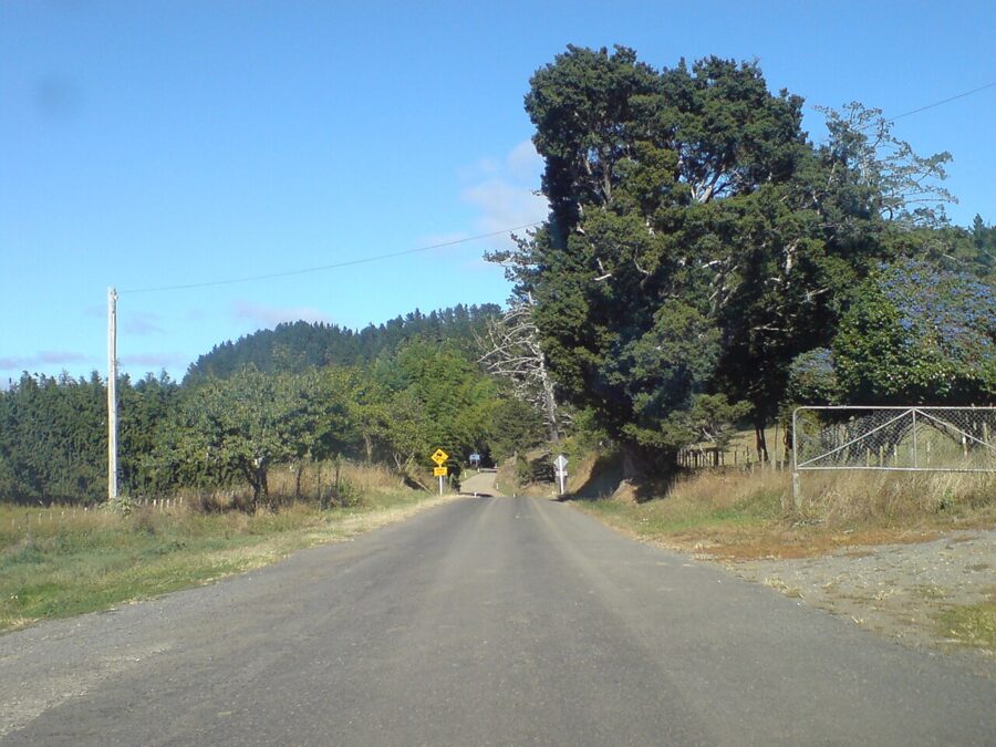
Tapu, about 19 km (12 miles) north of Thames, sits at the mouth of the Tapu River, with a second holiday park and the start of the Tapu-Coroglen Road, the gravel crossing to the east coast. Its western end is worth driving even if you come back the same way.
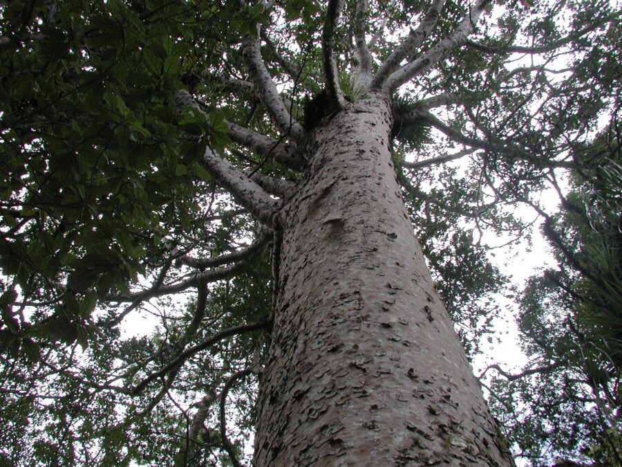
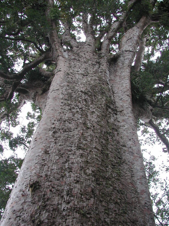
About 8.5 km (5 miles) up the Tapu-Coroglen Road is the Square Kauri. DOC describes a short, steep track of 187 steps to a tree estimated at 1,200 years old, the 15th largest kauri on the peninsula, with a viewing area facing Maumaupaki, also known as Camels Back. Closer to Tapu on the same road, Rapaura Watergardens is a private garden of ponds and bush; check its own listing for hours and entry.
Te Mata and Waikawau
North of Tapu the road runs right along the rock shelf, with pohutukawa overhead and the firth a few meters below the road edge. Te Mata is a cluster of houses in a valley; Waikawau, a little further, has a river mouth and a boat ramp.
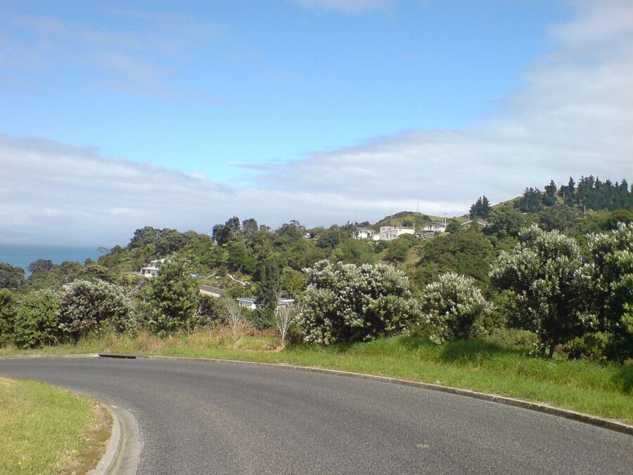
This is pohutukawa coast. The trees flower crimson from about mid-December into early January, which is why New Zealanders call them the Christmas tree, and in a good year the road from Thames to Kereta is lined in red. It is also the busiest time of year, so drive north early and save the stops for the way back.
Kereta and the hill
At Kereta the road finally leaves the shore and climbs. This is the section that subsided in April 2026, so you may still meet stop/go lights or a single lane. Take it slowly; the reward is at the top.
The Manaia Saddle
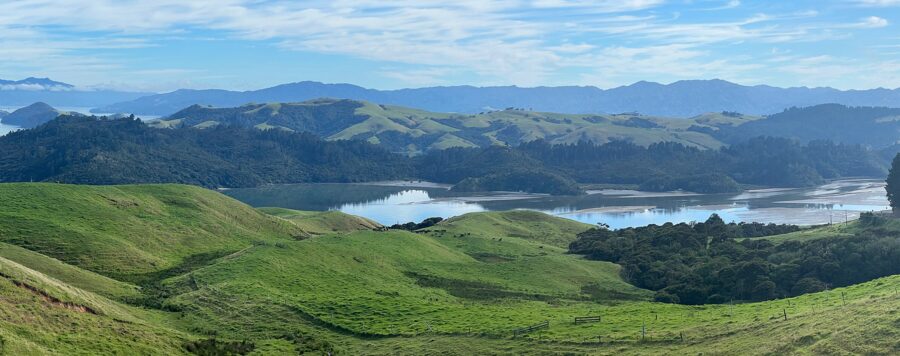
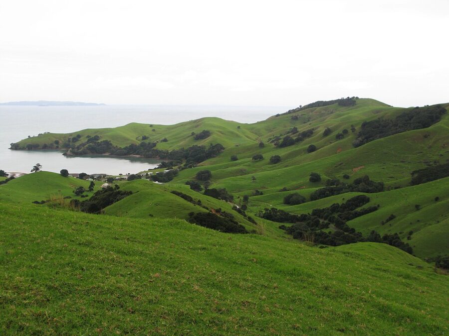
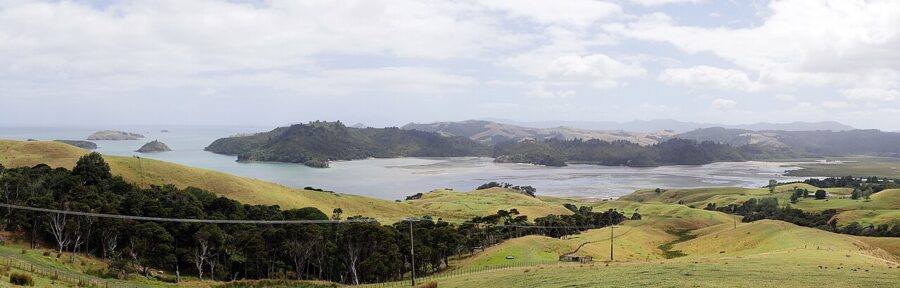
From the saddle above Manaia there is a pull-off on the highway. It is easy to miss coming from the north, where the road bends sharply into it, so watch for it early if you drive back to Thames.
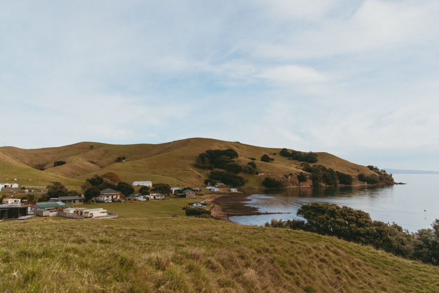
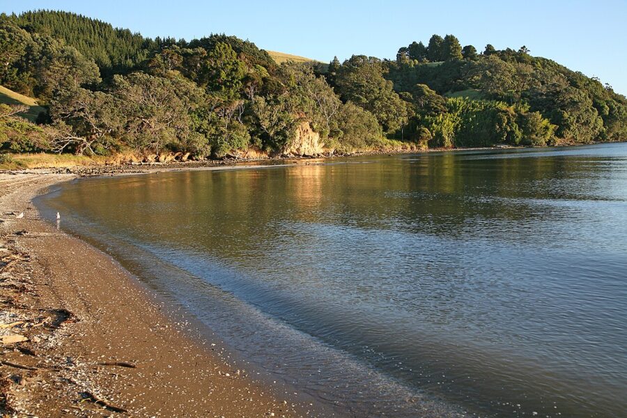
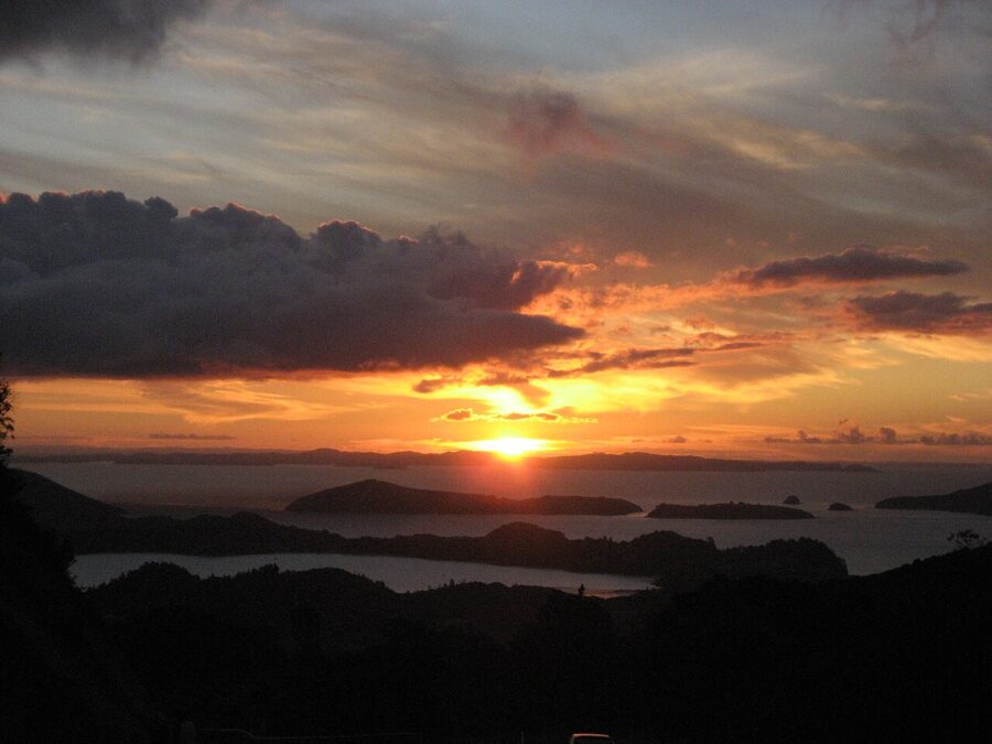
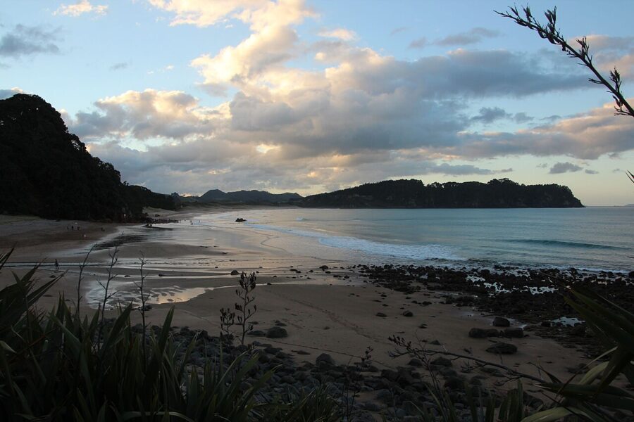
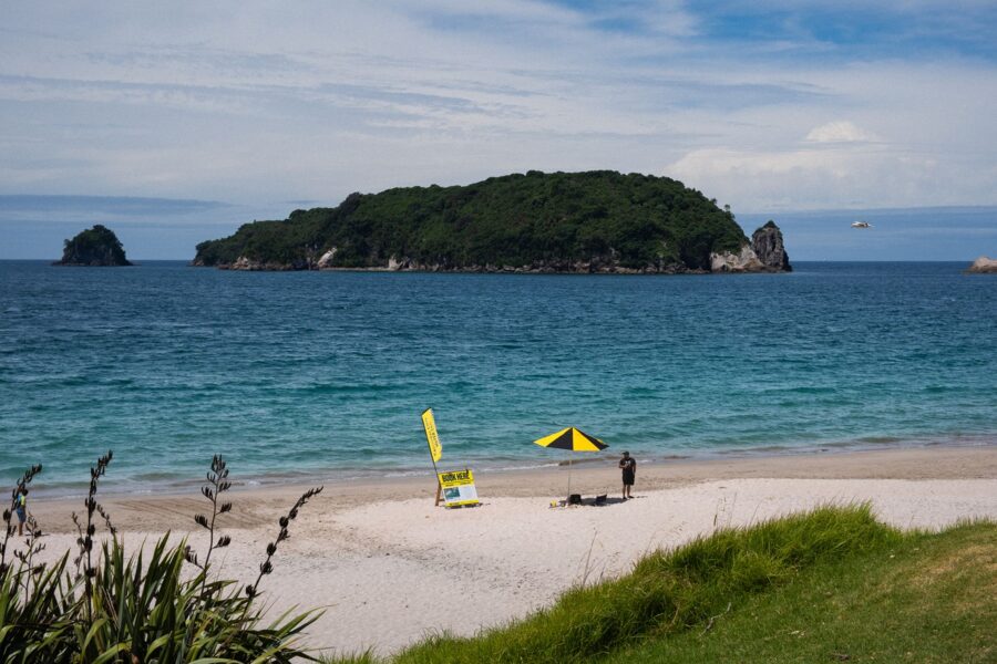
The saddle has two views. East, over Manaia Harbour to the range, is front-lit from mid-afternoon and backlit at sunrise; mid-morning, as in the photograph at the start, gives soft light and often still water. West, down to Kirita Bay and the islands in the firth, is the sunset side.
Coromandel Town
Gold made this town too, and earlier than Thames: Charles Ring reported gold at Driving Creek, just north of here, in 1852. The rush did not last, and the town was left with a main street of 19th-century timber shops, a harbor full of mussel and oyster farms, and a pace that suits a night’s stay better than a lunch stop.
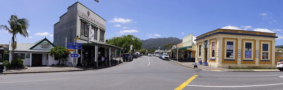
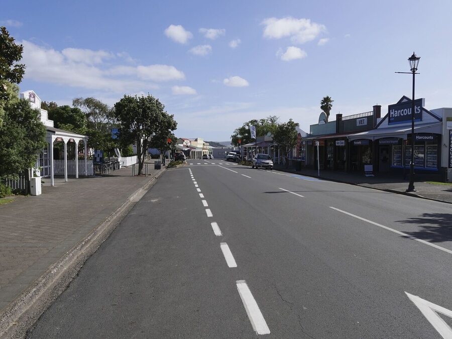
Kapanga Road is the main street, and the buildings are the subject: verandahs, painted weatherboards and shop signs. The School of Mines and Historical Museum, a separate collection from the one in Thames, is on Rings Road; its hours are seasonal, so check before you go.
Driving Creek and the stamper battery
North of town on the road to Colville, the potter Barry Brickell spent decades building a narrow-gauge railway up the hillside behind his studio, with tunnels, spirals, reversing points and a double-deck viaduct. Driving Creek runs it as a railway tour of about an hour and 15 minutes; the operator lists it as open every day from 9am to 4:30pm except Christmas Day, as of November 2026, and recommends booking ahead on weekends and holidays.
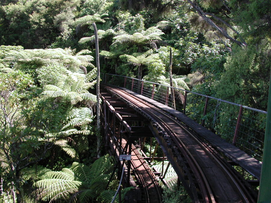
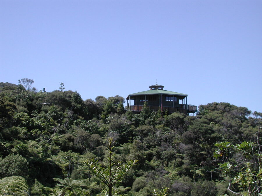
At the top is the Eyefull Tower, a lookout over the bush, the harbor and the islands, and the one place on this trip where you look down on the whole harbor. Go in the clear light of morning, before haze builds over the water.
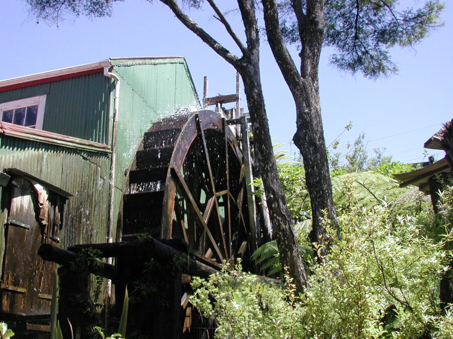
On the same road, the Coromandel Gold Stamper Battery keeps an old battery and its water wheel, a reminder of how ore was crushed before the gold could be recovered. Check its opening times before you go.
The harbor at the end of the day
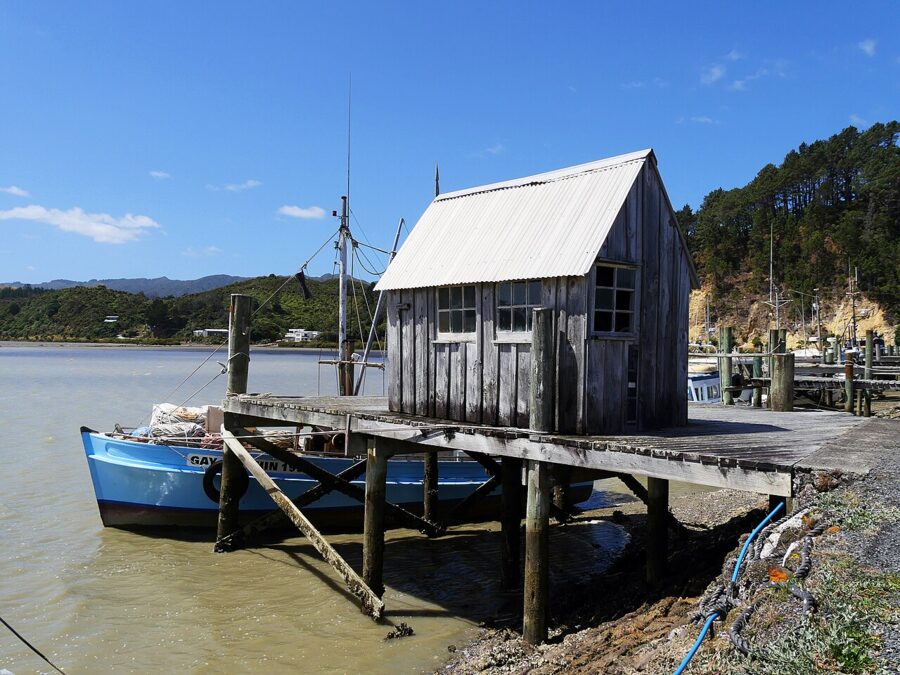
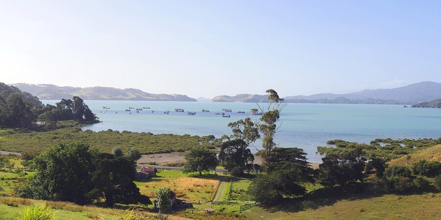
Coromandel Harbour faces west like the Thames coast, so the end of the drive and the end of the day line up. For sunset I would choose between the wharf south of town, for boats and sheds, and Long Bay just west of town, for sand and a still bay. The lookout on DOC’s Kauri Block Track above town is the morning view.
Light on the Firth of Thames, season by season
On this drive, direction matters more than season. The Thames coast and Coromandel Harbour both face west, so the best hours are the last two before sunset and the worst are mid-morning, when the range shades the shore. The east coast faces the other way, which makes Cathedral Cove and Hot Water Beach dawn subjects.
Summer (December to February). Pohutukawa in flower, long evenings and the most traffic of the year. Sunsets swing furthest southwest, over the Hunua Ranges across the firth. Book early for Christmas and New Year.
Autumn (March to May). My pick. The crowds are gone, the water is still warm enough to stand in, and the air is clearer after the summer haze. Two of the 2026 storms hit in late March and April, so watch the forecast.
Winter (June to August). Low sun gives side light even at midday, and storms bring the most dramatic skies over the firth. Short days and wet gravel roads are the trade-off.
Spring (September to November). Godwits return to the firth, the bush is at its greenest, and the paddocks above Kirita Bay are at their most vivid. Carry a jacket even on a sunny morning.
The tide matters as much as the hour. The firth is shallow, and at low tide the shore near Thames turns to wide flats. For water against the rocks and reflections in the estuaries, aim for mid to high tide; for feeding birds and sand patterns, low tide. A Thames tide table covers the whole coast road.
Beyond Coromandel Town
From Coromandel Town there are two ways east to Mercury Bay. SH25 is sealed and runs over Whangapoua Hill and past Kuaotunu to Whitianga, about 46 km (29 miles). The 309 Road is shorter, about 22 km (14 miles), mostly gravel and much slower, and the more interesting of the two.
The 309 Road
Leave Coromandel Town south on Tiki Road and turn left onto the 309 after about 3.7 km. Nobody agrees on the name: one story says there are 309 bends, another that coaches once took 309 minutes to cross. Expect narrow gravel and blind corners, and the 12.6 m vehicle ban applies here too.
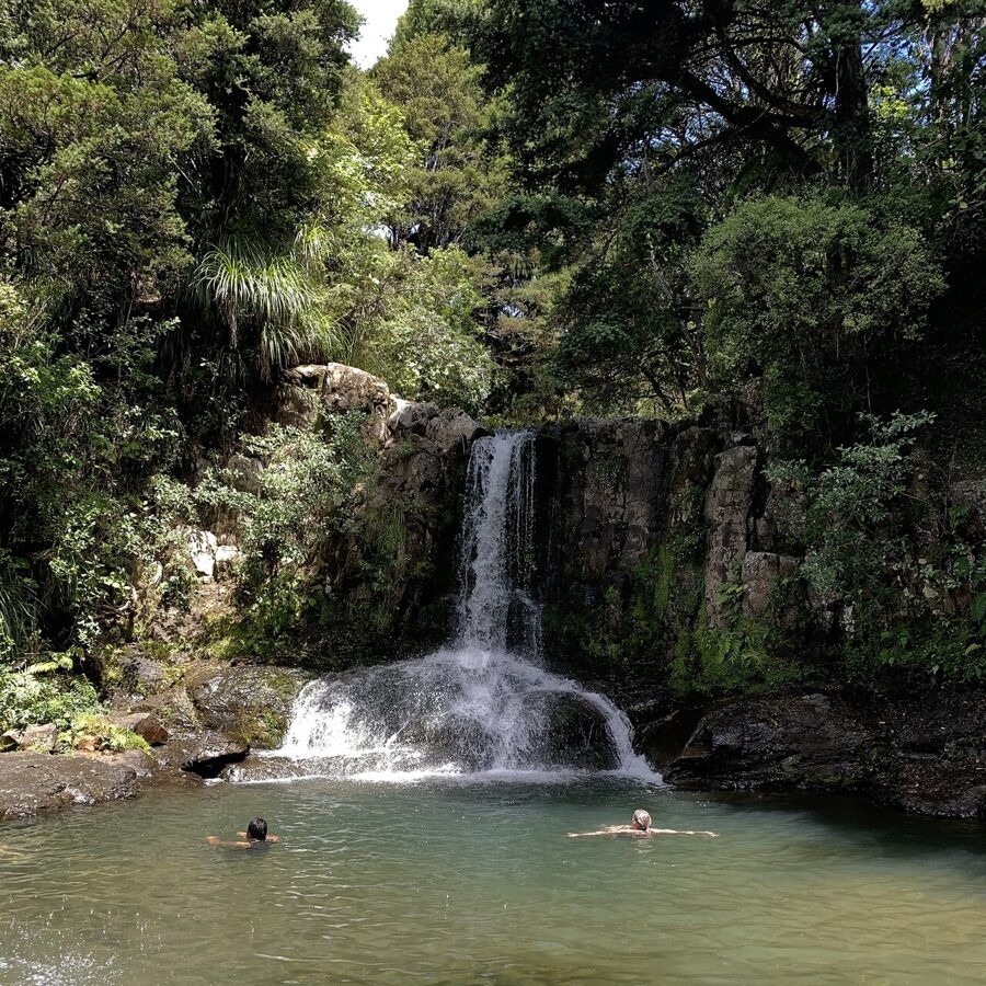
About 7 km in, Waiau Falls drops into a swimming hole in bush beside the road. The falls sit in a shady gully, so they suit a bright overcast day or late afternoon, once the sun is off the water. Bring a tripod, and go on a weekday; the pool is popular in summer.
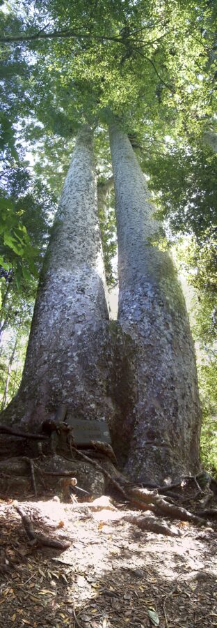
About 1 km further on is DOC’s Kauri Grove Lookout Walk, which DOC calls the most accessible mature kauri stand on the peninsula, including the Siamese kauri, two trunks forking just above the ground. Parking is limited; DOC sends overflow to the Waiau Falls car park about 600 m away and warns that the walk between is on the gravel road with blind corners, so keep to the outside edge and keep children close.
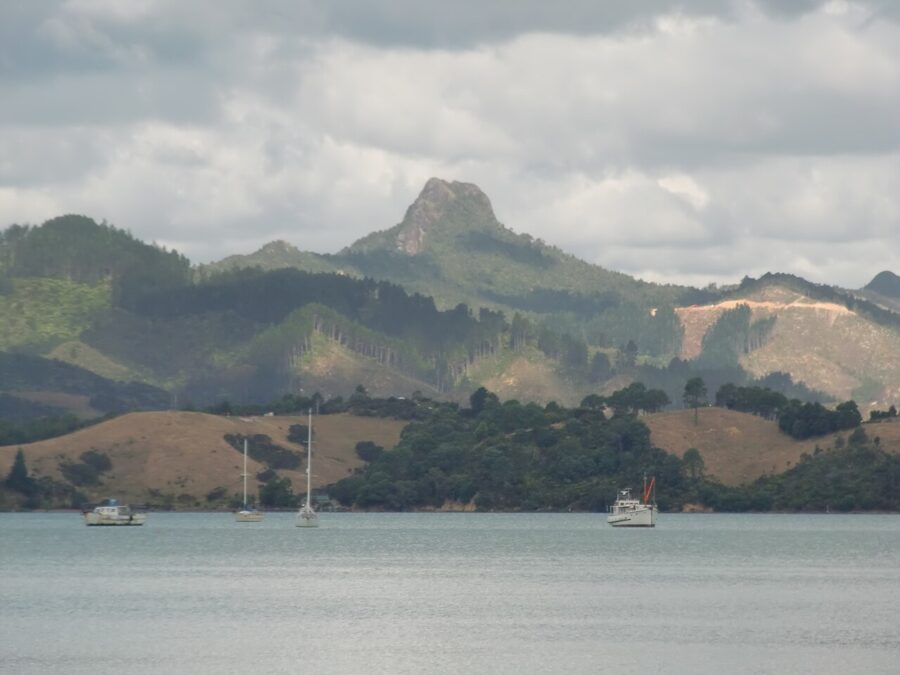
Castle Rock, the volcanic plug above the harbor and the 309 valley, is the other landmark on this side of town. A steep track climbs it from a side road off the 309, and the summit looks over both coasts. From across the harbor it is a late-afternoon subject.
Cathedral Cove
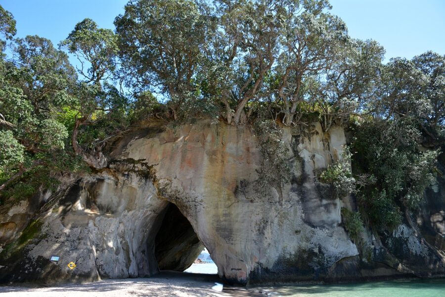
Mautohe Cathedral Cove, near Hahei on the far side of Mercury Bay, is the image most people have of the Coromandel: a sea-cut arch through a white headland, a beach on each side and Te Hoho Rock offshore. DOC restored walking access in December 2024 after the cyclone damage, and as of November 2026 the main track is open, though it can close at short notice. It closes, and the shuttles stop, whenever NIWA issues an orange or red weather warning for Hahei.
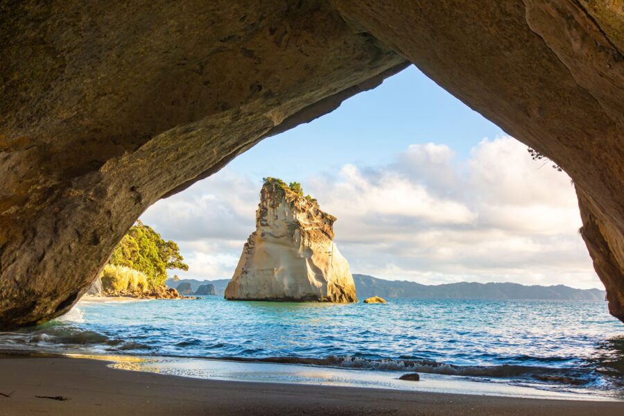
Getting there has changed. The car park at the top of Grange Road, where the track starts, is drop-off and pick-up only, and there is no parking on Grange Road. Park at the council’s Hahei Visitor Car Park at the village entrance and take the park-and-ride shuttle, or walk up Grange Road, about 2 km and 30 minutes, uphill with little shade. The shuttle operator lists daily service and a return adult fare of NZ$8 (about US$5) as of November 2026; there is also paid parking at the Cathedral Cove Gateway Trail on Lees Road.
The walk takes about an hour and a half return on a sealed track with steep sections and steps. The path from Hahei Beach to the Grange Road entrance has been closed by slips; in October 2026 DOC and the Hahei residents’ association settled on a reroute, with building due to start in mid-November and local reports hoping for an opening by Christmas. DOC has said it will not repair the Gemstone Bay track a third time.
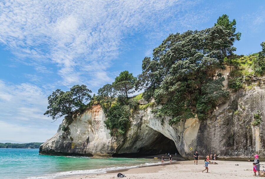
DOC’s other rules are short. Drones need a permit. High tide can cut the beach off from the track, and in rough seas waves surge through the arch, so check tide and swell before you walk down. The beaches are unpatrolled and have rips.
One more thing to watch: the Conservation Amendment Bill, introduced in May 2026, would let DOC charge international visitors at Cathedral Cove and three other sites. As of November 2026 it has not passed and no charge applies; DOC’s Cathedral Cove page is where a fee would be announced.
Hot Water Beach
A few kilometers south of Hahei, geothermal water rises through the sand at Hot Water Beach, and for about two hours either side of low tide you can dig a pool in front of the rocks and sit in it. Bring a spade and test the water first: in places it comes up hot enough to scald.
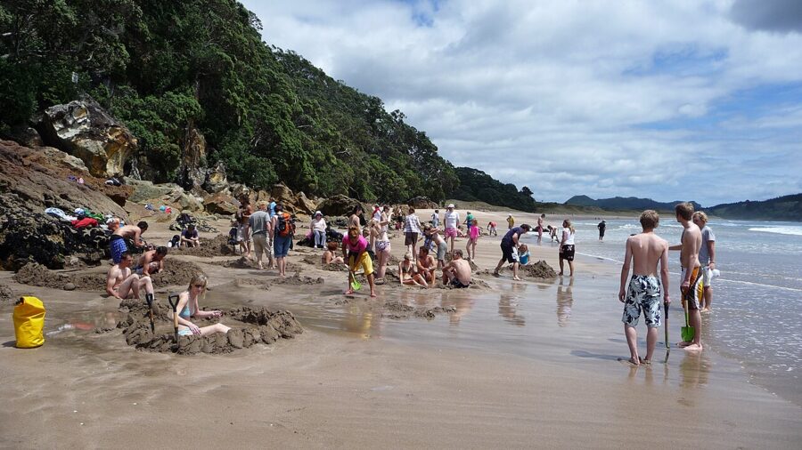
The beach has strong rips, and surf lifeguards patrol it in the summer season; swim only between the flags. Parking is paid. The council’s 2026/27 fees are NZ$6 an hour or NZ$35 a day (about US$3.50 and US$20) in the main car park, and NZ$4 an hour or NZ$25 a day (about US$2.30 and US$15) at the Taiwawe car park.
Where to stay
Where you sleep decides your light. Stay in Thames and you can drive north in the afternoon with the sun on the water. Stay in Coromandel Town and you get the harbor at sunset and an early start for the east coast.
- Thames. Motels and B&Bs, the most choice and the best value outside summer. Good for an afternoon drive north and a day in the Kauaeranga Valley.
- The coast road. Holiday parks at Te Puru and Tapu put you on the firth for sunset. Small and popular; book ahead for summer.
- Coromandel Town. Motels, baches, the Coromandel Town TOP 10 Holiday Park in town and the Coromandel Shelly Beach TOP 10 Holiday Park on the beachfront to the north. The best base for the harbor and the 309 Road.
- Mercury Bay. Whitianga, Hahei and the Hot Water Beach TOP 10 Holiday Park if your main subjects are Cathedral Cove at dawn and the beach at low tide.
Freedom camping is allowed only at sites the district council permits; check its freedom camping pages before parking a campervan for the night. Between Christmas and the end of January everything books out, so reserve early or come in March.
The drive slots into a longer North Island loop. South of Thames, the usual next stops are Hobbiton near Matamata and the geothermal parks around Rotorua, where the Champagne Pool at Wai-O-Tapu is the region’s other great color study.
Leave Thames about three hours before sunset, stop wherever the reserves give you room, and be on the Manaia Saddle or the Coromandel wharf for the last half hour. The firth will have done the rest on the way.